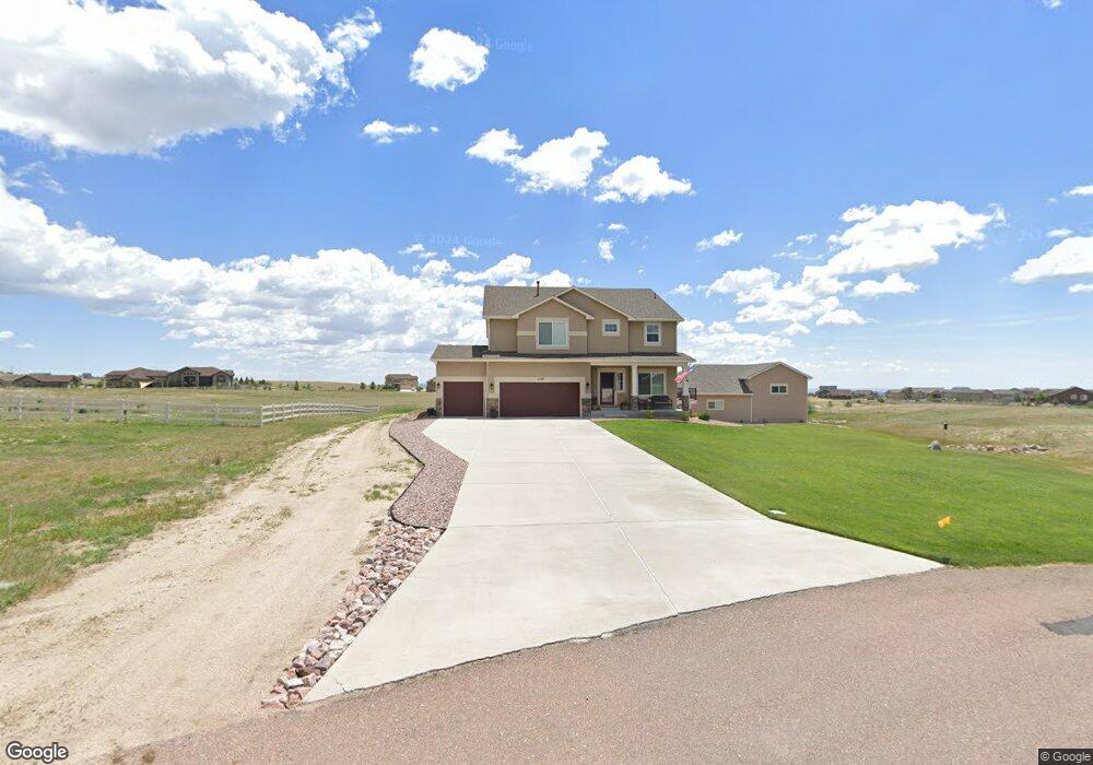
11567 Denali Trail Peyton, CO 80831
Estimated Value: $955,000 - $1,071,000
5
Beds
6
Baths
3,406
Sq Ft
$294/Sq Ft
Est. Value
About This Home
This home is located at 11567 Denali Trail, Peyton, CO 80831 and is currently estimated at $1,001,380, approximately $294 per square foot. 11567 Denali Trail is a home with nearby schools including Meridian Ranch International School, Falcon Middle School, and Falcon High School.
Ownership History
Date
Name
Owned For
Owner Type
Purchase Details
Closed on
Jun 12, 2015
Sold by
Reunion Homes Inc
Bought by
Abney Heather and Abney Michael B
Current Estimated Value
Home Financials for this Owner
Home Financials are based on the most recent Mortgage that was taken out on this home.
Original Mortgage
$430,761
Outstanding Balance
$333,039
Interest Rate
3.7%
Mortgage Type
VA
Estimated Equity
$668,341
Purchase Details
Closed on
May 14, 2015
Sold by
Rh Mesa Ridge Llc
Bought by
Reunion Homes Inc
Home Financials for this Owner
Home Financials are based on the most recent Mortgage that was taken out on this home.
Original Mortgage
$430,761
Outstanding Balance
$333,039
Interest Rate
3.7%
Mortgage Type
VA
Estimated Equity
$668,341
Purchase Details
Closed on
Dec 18, 2014
Sold by
Antlers Ridge Holdings Llc
Bought by
Rh Mesa Ridge Llc
Create a Home Valuation Report for This Property
The Home Valuation Report is an in-depth analysis detailing your home's value as well as a comparison with similar homes in the area
Home Values in the Area
Average Home Value in this Area
Purchase History
| Date | Buyer | Sale Price | Title Company |
|---|---|---|---|
| Abney Heather | $417,300 | Empire Title Co Springs Llc | |
| Reunion Homes Inc | -- | Empire Title Co Springs Llc | |
| Rh Mesa Ridge Llc | $62,000 | Land Title Guarantee Company |
Source: Public Records
Mortgage History
| Date | Status | Borrower | Loan Amount |
|---|---|---|---|
| Open | Abney Heather | $430,761 |
Source: Public Records
Tax History Compared to Growth
Tax History
| Year | Tax Paid | Tax Assessment Tax Assessment Total Assessment is a certain percentage of the fair market value that is determined by local assessors to be the total taxable value of land and additions on the property. | Land | Improvement |
|---|---|---|---|---|
| 2025 | $4,408 | $66,820 | -- | -- |
| 2024 | $4,290 | $65,410 | $8,340 | $57,070 |
| 2023 | $4,290 | $65,410 | $8,340 | $57,070 |
| 2022 | $2,992 | $43,090 | $6,410 | $36,680 |
| 2021 | $2,551 | $36,350 | $6,600 | $29,750 |
| 2020 | $2,563 | $36,350 | $5,900 | $30,450 |
| 2019 | $2,540 | $36,350 | $5,900 | $30,450 |
| 2018 | $2,237 | $31,470 | $5,510 | $25,960 |
| 2017 | $2,049 | $31,470 | $5,510 | $25,960 |
| 2016 | $2,148 | $32,560 | $5,670 | $26,890 |
| 2015 | $1,364 | $20,650 | $20,650 | $0 |
| 2014 | $987 | $14,670 | $14,670 | $0 |
Source: Public Records
Map
Nearby Homes
- 11504 Blackcomb Trail
- 12071 Smokes Bluffs Rd
- 12190 Smoke Bluffs Rd
- 12150 Fox Brush Dr
- 11133 Lobo Peak Dr
- 11134 Lobo Peak Dr
- 11824 Black Hills Dr
- 11825 Black Hills Dr
- 12695 Black Hills Dr
- The Peak Plan at Latigo
- The Brooklyn Plan at Latigo
- The Grand Royal Plan at Latigo
- 12010 S Conestoga Trail
- 12020 S Conestoga Trail
- 12692 Clark Peak Ct
- 11960 Conestoga Trail S
- 12804 Clark Peak Ct
- 10965 Long Summer Ct
- 10932 Huron Peak Place
- 12708 Sunrise Ridge Dr
- 11507 Denali Trail
- 11627 Denali Trail
- 11564 Blackcomb Trail
- 11686 Denali Trail
- 12251 Smoke Bluffs Rd
- 11506 Denali Trail
- 11626 Denali Trail
- 11624 Blackcomb Trail
- 11498 Lobo Peak Dr
- 12071 Smoke Bluffs Rd
- 12165 Antlers Ridge Dr
- 11505 Blackcomb Trail
- 11565 Blackcomb Trail
- 12250 Smoke Bluffs Rd
- 12225 Antlers Ridge Dr
- 11471 Lobo Peak Dr
- 12310 Smoke Bluffs Rd
- 11625 Blackcomb Trail
- 12130 Smoke Bluffs Rd
- 12011 Smoke Bluffs Rd