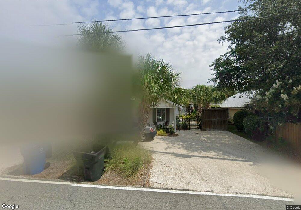
1157 Mallery St Saint Simons Island, GA 31522
Estimated Value: $562,993 - $764,000
3
Beds
3
Baths
1,320
Sq Ft
$518/Sq Ft
Est. Value
About This Home
This home is located at 1157 Mallery St, Saint Simons Island, GA 31522 and is currently estimated at $683,998, approximately $518 per square foot. 1157 Mallery St is a home located in Glynn County with nearby schools including St. Simons Elementary School, Glynn Middle School, and Glynn Academy.
Ownership History
Date
Name
Owned For
Owner Type
Purchase Details
Closed on
Feb 6, 2023
Sold by
Mercer Patricia Lynn
Bought by
Lynn M May Rev Liv Tr
Current Estimated Value
Purchase Details
Closed on
Jun 21, 2013
Sold by
Scholze Jimmy Thorne
Bought by
Mercer Patricia Lynn
Home Financials for this Owner
Home Financials are based on the most recent Mortgage that was taken out on this home.
Original Mortgage
$204,000
Interest Rate
3.59%
Mortgage Type
New Conventional
Create a Home Valuation Report for This Property
The Home Valuation Report is an in-depth analysis detailing your home's value as well as a comparison with similar homes in the area
Home Values in the Area
Average Home Value in this Area
Purchase History
| Date | Buyer | Sale Price | Title Company |
|---|---|---|---|
| Lynn M May Rev Liv Tr | -- | -- | |
| Mercer Patricia Lynn | $255,000 | -- |
Source: Public Records
Mortgage History
| Date | Status | Borrower | Loan Amount |
|---|---|---|---|
| Previous Owner | Mercer Patricia Lynn | $204,000 |
Source: Public Records
Tax History Compared to Growth
Tax History
| Year | Tax Paid | Tax Assessment Tax Assessment Total Assessment is a certain percentage of the fair market value that is determined by local assessors to be the total taxable value of land and additions on the property. | Land | Improvement |
|---|---|---|---|---|
| 2025 | $5,374 | $214,280 | $104,080 | $110,200 |
| 2024 | $3,808 | $151,840 | $41,640 | $110,200 |
| 2023 | $2,093 | $153,240 | $41,640 | $111,600 |
| 2022 | $2,524 | $153,240 | $41,640 | $111,600 |
| 2021 | $2,599 | $104,760 | $41,640 | $63,120 |
| 2020 | $2,622 | $104,760 | $41,640 | $63,120 |
| 2019 | $2,622 | $104,760 | $41,640 | $63,120 |
| 2018 | $2,564 | $104,760 | $41,640 | $63,120 |
| 2017 | $2,564 | $98,480 | $41,640 | $56,840 |
| 2016 | $2,378 | $98,480 | $41,640 | $56,840 |
| 2015 | $2,387 | $98,480 | $41,640 | $56,840 |
| 2014 | $2,387 | $98,480 | $41,640 | $56,840 |
Source: Public Records
Map
Nearby Homes
- 134 Ibis Cove
- 105 Thompson Cove
- 162 Toluca Ln
- 200 Salt Air Dr Unit 152
- 200 Salt Air Dr Unit 154
- 200 Salt Air Dr Unit 139
- 108 Rosa Dorsey Ln
- 214 Island Dr
- 1153 Ocean Blvd
- 1104 Sherman Ave
- 104 Courtyard Villas Unit C7
- 106 Sandcastle Way
- 405 Everett St
- 919 Mallery St
- 1145 Park Ln
- 850 Mallery St Unit 6N
- 850 Mallery St Unit 8K
- 850 Mallery St Unit 6A
- 850 Mallery St Unit 4W
- 850 Mallery St Unit S 3
- 1157 Mallery St
- 1153 Mallery St
- 1161 Mallery St
- 1161 Mallery St
- 1149 Mallery St
- 1149 Mallery St
- 1165 Mallery St
- 1158 Mallery St
- 1145 Mallery St
- 1162 Mallery St
- 671 Wilson Cir Unit E
- 671 Wilson Cir Unit D
- 671 Wilson Cir
- 671 Wilson Cir Unit A
- 1169 Mallery St
- 459 Mos
- 1150 Mallery St
- 673 Arnold Rd
- 1141 Mallery St
- 675 Arnold Rd