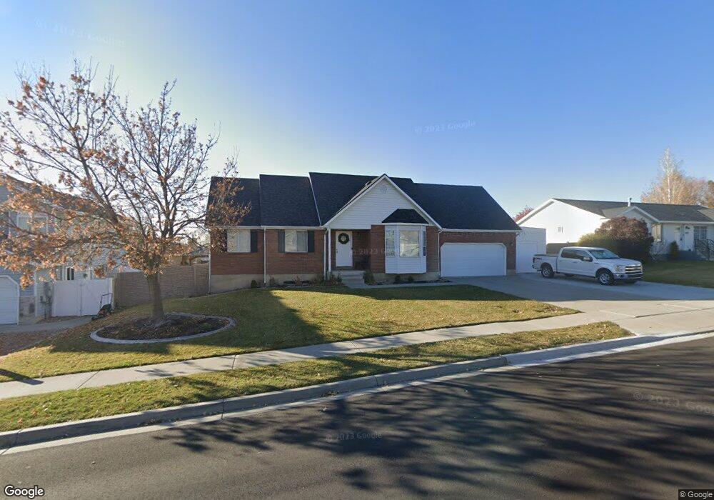
1157 N 210 W American Fork, UT 84003
Estimated Value: $518,000 - $610,000
4
Beds
3
Baths
2,448
Sq Ft
$232/Sq Ft
Est. Value
About This Home
This home is located at 1157 N 210 W, American Fork, UT 84003 and is currently estimated at $567,948, approximately $232 per square foot. 1157 N 210 W is a home located in Utah County with nearby schools including Legacy Elementary School, American Fork Junior High School, and American Fork High School.
Ownership History
Date
Name
Owned For
Owner Type
Purchase Details
Closed on
Dec 16, 2021
Sold by
Steele Mitchell C
Bought by
Steele Mitchell C and Steele Mckenzie J
Current Estimated Value
Home Financials for this Owner
Home Financials are based on the most recent Mortgage that was taken out on this home.
Original Mortgage
$359,200
Outstanding Balance
$330,281
Interest Rate
3.09%
Mortgage Type
New Conventional
Estimated Equity
$237,667
Purchase Details
Closed on
Dec 13, 2021
Sold by
Steele Mitchell C
Bought by
Steele Mitchell C
Home Financials for this Owner
Home Financials are based on the most recent Mortgage that was taken out on this home.
Original Mortgage
$359,200
Outstanding Balance
$330,281
Interest Rate
3.09%
Mortgage Type
New Conventional
Estimated Equity
$237,667
Purchase Details
Closed on
May 13, 2020
Sold by
Steele Mitchell C
Bought by
Steele Mitchell C and Steele Mckenzie J
Home Financials for this Owner
Home Financials are based on the most recent Mortgage that was taken out on this home.
Original Mortgage
$298,000
Interest Rate
3.3%
Mortgage Type
New Conventional
Purchase Details
Closed on
May 16, 2019
Sold by
Steele Mitchell C and Maughan Peter
Bought by
Steele Mitchell C and Maughan Peter
Home Financials for this Owner
Home Financials are based on the most recent Mortgage that was taken out on this home.
Original Mortgage
$292,500
Interest Rate
4%
Mortgage Type
New Conventional
Purchase Details
Closed on
May 15, 2019
Sold by
Laws Roger D and Laws Tracy G
Bought by
Steele Michell C and Maughan Peter
Home Financials for this Owner
Home Financials are based on the most recent Mortgage that was taken out on this home.
Original Mortgage
$292,500
Interest Rate
4%
Mortgage Type
New Conventional
Purchase Details
Closed on
Apr 24, 2006
Sold by
Laws Roger D
Bought by
Laws Roger D and Laws Tracy G
Home Financials for this Owner
Home Financials are based on the most recent Mortgage that was taken out on this home.
Original Mortgage
$188,700
Interest Rate
6.29%
Mortgage Type
Fannie Mae Freddie Mac
Purchase Details
Closed on
Jun 18, 2003
Sold by
Andrus David B and Andrus Yvonne M
Bought by
Ford Andrew
Create a Home Valuation Report for This Property
The Home Valuation Report is an in-depth analysis detailing your home's value as well as a comparison with similar homes in the area
Home Values in the Area
Average Home Value in this Area
Purchase History
| Date | Buyer | Sale Price | Title Company |
|---|---|---|---|
| Steele Mitchell C | -- | Vanguard Title | |
| Steele Mitchell C | -- | Vanguard Title | |
| Steele Mitchell C | -- | Vanguard Title Ins Agcy Llc | |
| Steele Mitchell C | -- | Vanguard Title Ins Agcy Llc | |
| Steele Mitchell C | -- | Republic Title | |
| Steele Michell C | -- | Utah First Title Insurance A | |
| Laws Roger D | -- | First American Title Agency | |
| Ford Andrew | -- | Backman Stewart Title Servi |
Source: Public Records
Mortgage History
| Date | Status | Borrower | Loan Amount |
|---|---|---|---|
| Open | Steele Mitchell C | $359,200 | |
| Previous Owner | Steele Mitchell C | $298,000 | |
| Previous Owner | Steele Mitchell C | $292,500 | |
| Previous Owner | Laws Roger D | $188,700 |
Source: Public Records
Tax History Compared to Growth
Tax History
| Year | Tax Paid | Tax Assessment Tax Assessment Total Assessment is a certain percentage of the fair market value that is determined by local assessors to be the total taxable value of land and additions on the property. | Land | Improvement |
|---|---|---|---|---|
| 2025 | $2,267 | $286,935 | $221,400 | $300,300 |
| 2024 | $2,267 | $251,845 | $0 | $0 |
| 2023 | $2,105 | $247,940 | $0 | $0 |
| 2022 | $2,281 | $265,210 | $0 | $0 |
| 2021 | $1,951 | $354,200 | $158,900 | $195,300 |
| 2020 | $1,823 | $321,100 | $141,900 | $179,200 |
| 2019 | $1,704 | $310,400 | $131,200 | $179,200 |
| 2018 | $1,607 | $279,900 | $124,100 | $155,800 |
| 2017 | $1,514 | $142,340 | $0 | $0 |
| 2016 | $1,478 | $129,085 | $0 | $0 |
| 2015 | $1,439 | $119,240 | $0 | $0 |
| 2014 | $1,393 | $113,905 | $0 | $0 |
Source: Public Records
Map
Nearby Homes
- 344 W 1080 N
- 179 W 1290 N
- 425 W 1120 N
- 984 N 300 W
- 287 W 1360 N
- 356 W 1300 N
- 471 W 1040 N
- 3889 W 950 Cir N Unit 366
- 1071 Timpview Dr
- 987 N 410 W
- 914 N 400 W Unit A
- 35 W 1350 N
- 1438 N 400 W
- 10238 N 6530 W Unit 15
- 1051 N 390 E Unit 103
- 6079 W Whisper Ln Unit 404
- 1220 E 700 N
- 1039 N 390 E Unit 102
- 11338 N Annes Way Unit 8
- 6111 W Whisper Ln Unit 402