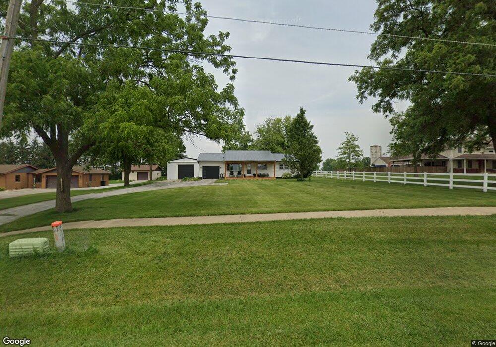
11571 E State Route 1 17 Grant Park, IL 60940
Estimated Value: $171,000 - $262,000
--
Bed
--
Bath
--
Sq Ft
0.48
Acres
About This Home
This home is located at 11571 E State Route 1 17, Grant Park, IL 60940 and is currently estimated at $223,798. 11571 E State Route 1 17 is a home located in Kankakee County with nearby schools including Grant Park Elementary School and Grant Park High School.
Ownership History
Date
Name
Owned For
Owner Type
Purchase Details
Closed on
May 29, 2009
Sold by
B & C Group
Bought by
Roberts Rebecca A
Current Estimated Value
Home Financials for this Owner
Home Financials are based on the most recent Mortgage that was taken out on this home.
Original Mortgage
$153,000
Outstanding Balance
$97,084
Interest Rate
4.85%
Mortgage Type
New Conventional
Estimated Equity
$126,714
Create a Home Valuation Report for This Property
The Home Valuation Report is an in-depth analysis detailing your home's value as well as a comparison with similar homes in the area
Home Values in the Area
Average Home Value in this Area
Purchase History
| Date | Buyer | Sale Price | Title Company |
|---|---|---|---|
| Roberts Rebecca A | $153,000 | Homestar Title |
Source: Public Records
Mortgage History
| Date | Status | Borrower | Loan Amount |
|---|---|---|---|
| Open | Roberts Rebecca A | $153,000 |
Source: Public Records
Tax History Compared to Growth
Tax History
| Year | Tax Paid | Tax Assessment Tax Assessment Total Assessment is a certain percentage of the fair market value that is determined by local assessors to be the total taxable value of land and additions on the property. | Land | Improvement |
|---|---|---|---|---|
| 2024 | $4,324 | $62,918 | $12,500 | $50,418 |
| 2023 | $3,693 | $56,683 | $11,261 | $45,422 |
| 2022 | $3,505 | $52,484 | $10,427 | $42,057 |
| 2021 | $3,380 | $50,709 | $10,074 | $40,635 |
| 2020 | $3,320 | $48,759 | $9,687 | $39,072 |
| 2019 | $3,333 | $48,656 | $10,537 | $38,119 |
| 2018 | $3,600 | $47,124 | $10,205 | $36,919 |
| 2017 | $3,637 | $46,657 | $10,104 | $36,553 |
| 2016 | $3,522 | $45,079 | $9,762 | $35,317 |
| 2015 | $3,386 | $42,475 | $9,342 | $33,133 |
| 2014 | $3,251 | $41,238 | $9,070 | $32,168 |
| 2013 | -- | $41,973 | $9,232 | $32,741 |
Source: Public Records
Map
Nearby Homes
- 11338 E 9000 Rd N
- 15626 Dr
- 15594 Dr
- 15583 Dr
- 15615 Dr
- 15566 Deer Path - Lot 4 Dr
- 15527 Deer Path - Lot 10 Dr
- 320 E Taylor St
- 12393 Illinois 1
- 10766 E 7000 Rd N
- SEC of Rt. 1 9000 N
- 10868 E Le Claire St
- 5342 N Vincennes Trail
- 5532 N 13000e Rd
- 6125 Tulip Ln
- 967 Brown Dr
- 946 Louise Dr
- 3571 N State Route 1 17
- Section 18 E Deerson St
- 428 W 6th St
- 11563 E State Route 1 17
- 11623 E State Route 1 17
- 11537 E State Route 1 17
- 11517 E State Route 1 17
- 11485 Il-1
- 11485 E State Route 1 17
- 11485 Illinois 1
- 309 S Griffin St
- 307 S Griffin St
- 7634 Dixie Hwy
- 305 S Griffin St
- 303 S Griffin St
- 11481 E State Route 1 17
- 420 Dixie Hwy
- 312 S Griffin St
- 310 S Griffin St
- 306 S Griffin St
- 217 S Griffin St
- 300 S Griffin St