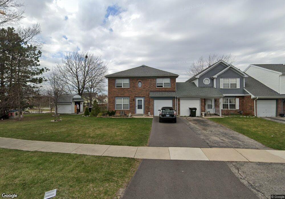
1158 Robin Dr Carol Stream, IL 60188
Estimated Value: $324,000 - $386,000
3
Beds
2
Baths
1,720
Sq Ft
$207/Sq Ft
Est. Value
About This Home
This home is located at 1158 Robin Dr, Carol Stream, IL 60188 and is currently estimated at $355,563, approximately $206 per square foot. 1158 Robin Dr is a home located in DuPage County with nearby schools including Spring Trail Elementary School, Eastview Middle School, and Bartlett High School.
Ownership History
Date
Name
Owned For
Owner Type
Purchase Details
Closed on
Sep 25, 2002
Sold by
Vasquez Paul R and Vasquez Christa L
Bought by
Dzananovic Osman and Dzananovic Hajrija
Current Estimated Value
Home Financials for this Owner
Home Financials are based on the most recent Mortgage that was taken out on this home.
Original Mortgage
$175,750
Outstanding Balance
$74,919
Interest Rate
6.39%
Mortgage Type
Purchase Money Mortgage
Estimated Equity
$280,644
Purchase Details
Closed on
Jan 2, 2001
Sold by
Firstar Bank Na
Bought by
Vasquez Paul R and Vasquez Chirista L
Create a Home Valuation Report for This Property
The Home Valuation Report is an in-depth analysis detailing your home's value as well as a comparison with similar homes in the area
Home Values in the Area
Average Home Value in this Area
Purchase History
| Date | Buyer | Sale Price | Title Company |
|---|---|---|---|
| Dzananovic Osman | $185,000 | Fox Title Company | |
| Vasquez Paul R | -- | -- |
Source: Public Records
Mortgage History
| Date | Status | Borrower | Loan Amount |
|---|---|---|---|
| Open | Dzananovic Osman | $175,750 |
Source: Public Records
Tax History
| Year | Tax Paid | Tax Assessment Tax Assessment Total Assessment is a certain percentage of the fair market value that is determined by local assessors to be the total taxable value of land and additions on the property. | Land | Improvement |
|---|---|---|---|---|
| 2024 | $6,767 | $96,266 | $17,657 | $78,609 |
| 2023 | $6,213 | $87,340 | $16,020 | $71,320 |
| 2022 | $5,933 | $77,640 | $13,600 | $64,040 |
| 2021 | $5,727 | $73,700 | $12,910 | $60,790 |
| 2020 | $5,558 | $71,490 | $12,520 | $58,970 |
| 2019 | $5,474 | $68,940 | $12,070 | $56,870 |
| 2018 | $5,208 | $65,970 | $11,550 | $54,420 |
| 2017 | $4,754 | $59,470 | $11,090 | $48,380 |
| 2016 | $4,663 | $56,800 | $10,590 | $46,210 |
| 2015 | $4,690 | $53,760 | $10,020 | $43,740 |
| 2014 | $4,132 | $49,990 | $9,770 | $40,220 |
| 2013 | $4,927 | $51,180 | $10,000 | $41,180 |
Source: Public Records
Map
Nearby Homes
- 1215 Robin Dr
- 1239 Spring Valley Dr
- 1328 Big Horn Trail
- 1297 Woodlake Dr Unit 1
- 1279 Bison Trail
- 1266 Seabury Cir
- 1308 Coldspring Rd Unit 7
- 1811 Rizzi Ln
- 848 Birchbark Trail
- 403 Cromwell Cir Unit 2
- 422 Cromwell Cir Unit 2
- 264 Norway Ct
- 2198 Wildwood Ln
- 1874 Windward Ln
- 880 Hampton Dr
- 3N010 Woodview Dr
- 3945 County Farm Rd
- 28W472 Cape Ave
- 3758 Merrimac Ln W
- 2325 Bayside Dr
- 1160 Robin Dr Unit 54
- 1162 Robin Dr
- 1164 Robin Dr
- 1166 Robin Dr
- 1145 Pheasant Trail
- 1168 Robin Dr
- 1157 Robin Dr
- 1159 Robin Dr
- 1155 Robin Dr
- 1147 Robin Dr
- 1161 Robin Dr
- 1145 Robin Dr
- 1098 Spring Valley Dr
- 1165 Robin Dr
- 1165 Robin Dr Unit 1165
- 1176 Robin Dr
- 1143 Robin Dr
- 1139 Robin Dr
- 1137 Pheasant Trail
- 1171 Robin Dr
Your Personal Tour Guide
Ask me questions while you tour the home.