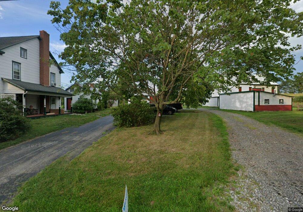
1158 White Hall Rd Littlestown, PA 17340
Estimated Value: $509,469 - $585,000
3
Beds
2
Baths
2,506
Sq Ft
$218/Sq Ft
Est. Value
About This Home
This home is located at 1158 White Hall Rd, Littlestown, PA 17340 and is currently estimated at $545,367, approximately $217 per square foot. 1158 White Hall Rd is a home located in Adams County with nearby schools including Rolling Acres El School, Maple Avenue Middle School, and Littlestown Senior High School.
Ownership History
Date
Name
Owned For
Owner Type
Purchase Details
Closed on
Nov 22, 2021
Sold by
Sanders James S
Bought by
Wenger Glenn and Wenger Kristin
Current Estimated Value
Home Financials for this Owner
Home Financials are based on the most recent Mortgage that was taken out on this home.
Original Mortgage
$287,700
Outstanding Balance
$245,228
Interest Rate
3.05%
Mortgage Type
New Conventional
Estimated Equity
$300,139
Purchase Details
Closed on
Nov 6, 2000
Bought by
Sanders James S
Create a Home Valuation Report for This Property
The Home Valuation Report is an in-depth analysis detailing your home's value as well as a comparison with similar homes in the area
Purchase History
| Date | Buyer | Sale Price | Title Company |
|---|---|---|---|
| Wenger Glenn | $420,000 | None Available | |
| Sanders James S | $48,500 | -- |
Source: Public Records
Mortgage History
| Date | Status | Borrower | Loan Amount |
|---|---|---|---|
| Open | Wenger Glenn | $287,700 |
Source: Public Records
Tax History Compared to Growth
Tax History
| Year | Tax Paid | Tax Assessment Tax Assessment Total Assessment is a certain percentage of the fair market value that is determined by local assessors to be the total taxable value of land and additions on the property. | Land | Improvement |
|---|---|---|---|---|
| 2025 | $2,279 | $117,600 | $11,200 | $106,400 |
| 2024 | $2,181 | $117,600 | $11,200 | $106,400 |
| 2023 | $5,490 | $116,500 | $10,100 | $106,400 |
| 2022 | $5,480 | $118,100 | $10,100 | $108,000 |
| 2021 | $5,290 | $118,100 | $10,100 | $108,000 |
| 2020 | $5,215 | $118,100 | $10,100 | $108,000 |
| 2019 | $5,106 | $118,100 | $10,100 | $108,000 |
| 2018 | $4,998 | $118,100 | $10,100 | $108,000 |
| 2017 | $1,887 | $118,100 | $10,100 | $108,000 |
| 2016 | -- | $118,100 | $10,100 | $108,000 |
| 2015 | -- | $117,200 | $9,200 | $108,000 |
| 2014 | -- | $116,400 | $8,400 | $108,000 |
Source: Public Records
Map
Nearby Homes
- 464 Locust Ln
- 0 Littlestown Rd
- 0 Locust Dr Unit PAAD2015910
- 20c Locust Dr
- 7 Cedarfield Dr Unit 2
- 162 Newark St
- 21 Johnamac N Unit 384
- 440 N Queen St
- 52 N Gala Unit 394
- 620 Saint Johns Rd
- 4900 Hanover Rd
- 28 Bonniefield Cir Unit 25
- 161 Stoners Cir
- 1 Hickory Ln
- 13 Fieldcrest Dr Unit 154
- 125 Homestead Dr
- 43 Ashfield Dr Unit 14
- 106 E King St
- 22 Rita Marie Ave
- 30 Locust St
- 1099 White Hall Rd
- 1224 White Hall Rd
- 173 School House Rd
- 1261 White Hall Rd Unit 2
- L-2 White Hall Rd
- 1021 White Hall Rd
- 1270 White Hall Rd
- 162 School House Rd
- 991 White Hall Rd
- 5 Honda Rd
- 1303 White Hall Rd
- 980 White Hall Rd Unit A
- 950 Bulk Plant Rd Unit 2
- 40 Honda Rd
- 1370 White Hall Rd
- 920 Bulk Plant Rd Unit 2
- 930 Bulk Plant Rd Unit 3
- 515 Locust Ln
- 381 Flatbush Rd
- 893 White Hall Rd