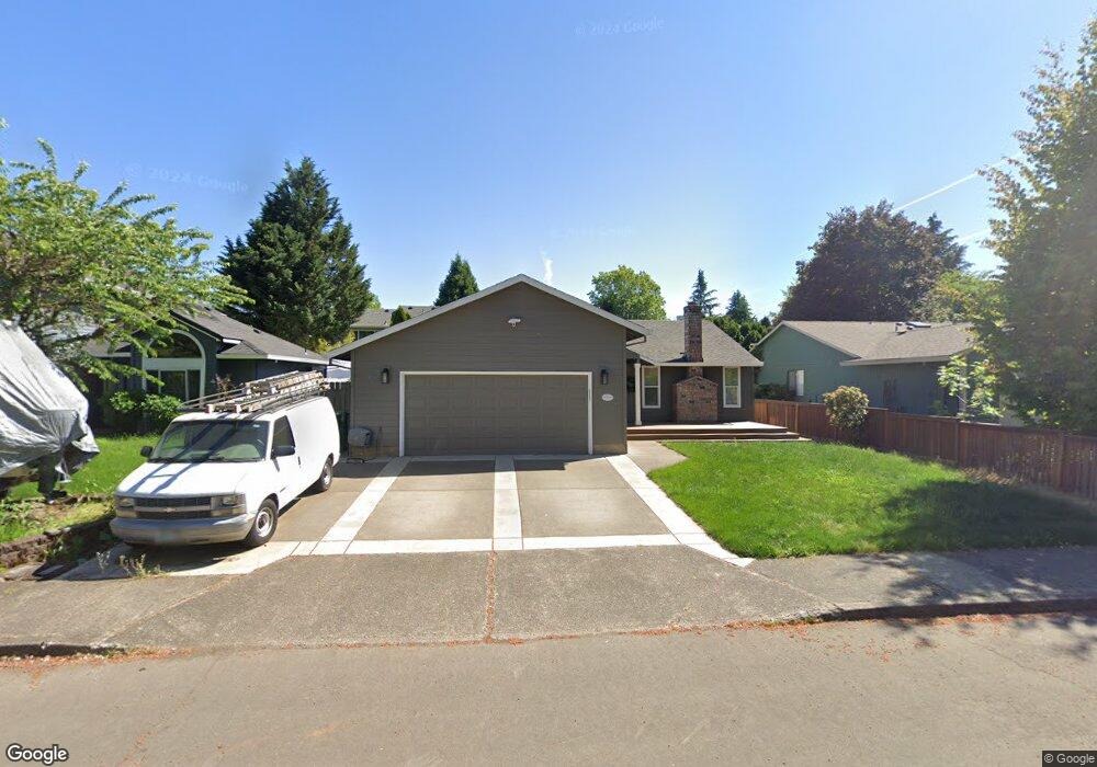
11580 SW Sheffield Cir Portland, OR 97223
Scholls-Summerlake NeighborhoodEstimated Value: $519,000 - $577,000
3
Beds
2
Baths
1,330
Sq Ft
$405/Sq Ft
Est. Value
About This Home
This home is located at 11580 SW Sheffield Cir, Portland, OR 97223 and is currently estimated at $538,360, approximately $404 per square foot. 11580 SW Sheffield Cir is a home located in Washington County with nearby schools including Hiteon Elementary School, Conestoga Middle School, and Southridge High School.
Ownership History
Date
Name
Owned For
Owner Type
Purchase Details
Closed on
Apr 21, 2003
Sold by
Naylor Steven P and Naylor Tracey L
Bought by
Naylor Steven P and Naylor Tracey L
Current Estimated Value
Home Financials for this Owner
Home Financials are based on the most recent Mortgage that was taken out on this home.
Original Mortgage
$140,500
Outstanding Balance
$55,912
Interest Rate
4.75%
Estimated Equity
$482,448
Purchase Details
Closed on
Jul 31, 1998
Sold by
Ling William and Ling Norma B
Bought by
Naylor Steven P and Mendoza Tracey L
Home Financials for this Owner
Home Financials are based on the most recent Mortgage that was taken out on this home.
Original Mortgage
$141,000
Interest Rate
6.9%
Mortgage Type
Seller Take Back
Create a Home Valuation Report for This Property
The Home Valuation Report is an in-depth analysis detailing your home's value as well as a comparison with similar homes in the area
Home Values in the Area
Average Home Value in this Area
Purchase History
| Date | Buyer | Sale Price | Title Company |
|---|---|---|---|
| Naylor Steven P | -- | Ticor Title Insurance Compan | |
| Naylor Steven P | $151,500 | Ticor Title Insurance |
Source: Public Records
Mortgage History
| Date | Status | Borrower | Loan Amount |
|---|---|---|---|
| Open | Naylor Steven P | $140,500 | |
| Closed | Naylor Steven P | $141,000 |
Source: Public Records
Tax History Compared to Growth
Tax History
| Year | Tax Paid | Tax Assessment Tax Assessment Total Assessment is a certain percentage of the fair market value that is determined by local assessors to be the total taxable value of land and additions on the property. | Land | Improvement |
|---|---|---|---|---|
| 2025 | $4,488 | $256,740 | -- | -- |
| 2024 | $4,330 | $249,270 | -- | -- |
| 2023 | $4,330 | $242,010 | $0 | $0 |
| 2022 | $4,223 | $242,010 | $0 | $0 |
| 2021 | $4,069 | $228,130 | $0 | $0 |
| 2020 | $3,945 | $221,490 | $0 | $0 |
| 2019 | $3,751 | $215,040 | $0 | $0 |
| 2018 | $3,628 | $208,780 | $0 | $0 |
| 2017 | $3,502 | $202,700 | $0 | $0 |
| 2016 | $3,380 | $196,800 | $0 | $0 |
| 2015 | $3,255 | $191,070 | $0 | $0 |
| 2014 | $3,173 | $185,510 | $0 | $0 |
Source: Public Records
Map
Nearby Homes
- 13165 SW Shore Dr
- 11325 SW Eucalyptus Place
- 13527 SW Ashbury Ln
- 13326 SW Shore Dr
- 11601 SW 129th Place
- 11769 SW 129th Place
- 11756 SW 129th Place
- 11877 SW Morning Hill Dr
- 11044 SW Sage Terrace
- 11002 SW Sage Terrace
- 11494 SW Lakeview Terrace
- 10993 SW Sage Terrace
- 10910 SW Huntington Ave
- 13850 SW Scholls Ferry Rd Unit 102
- 10820 SW Huntington Ave
- 0 SW Scholls Ferry Rd
- 10830 SW Briarwood Place
- 14120 SW Barrows Rd Unit 3-3
- 14064 SW Walnut Creek Way
- 14217 SW Barrows Rd Unit 14217
- 11578 SW Sheffield Cir
- 11586 SW Sheffield Cir
- 13310 SW Brittany Dr
- 13330 SW Brittany Dr
- 11588 SW Sheffield Cir
- 11576 SW Sheffield Cir
- 13290 SW Brittany Dr
- 13350 SW Brittany Dr
- 11581 SW Sheffield Cir
- 11579 SW Sheffield Cir
- 11583 SW Sheffield Cir
- 11590 SW Sheffield Cir
- 11574 SW Sheffield Cir
- 11585 SW Sheffield Cir
- 11566 SW Sheffield Cir
- 13370 SW Brittany Dr
- 11600 SW Sheffield Cir
- 11587 SW Sheffield Cir
- 11577 SW Sheffield Cir
- 13335 SW Brittany Dr