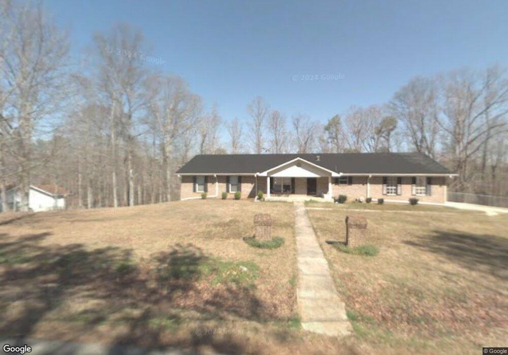
11582 Independence Cir Duncanville, AL 35456
Estimated Value: $323,958 - $438,000
--
Bed
1
Bath
4,356
Sq Ft
$84/Sq Ft
Est. Value
About This Home
This home is located at 11582 Independence Cir, Duncanville, AL 35456 and is currently estimated at $364,240, approximately $83 per square foot. 11582 Independence Cir is a home located in Tuscaloosa County with nearby schools including Maxwell Elementary School, Duncanville Middle School, and Hillcrest High School.
Ownership History
Date
Name
Owned For
Owner Type
Purchase Details
Closed on
Apr 13, 2006
Sold by
Perkins Farris
Bought by
Day Charles and Day Robin
Current Estimated Value
Home Financials for this Owner
Home Financials are based on the most recent Mortgage that was taken out on this home.
Original Mortgage
$144,000
Outstanding Balance
$82,513
Interest Rate
6.31%
Mortgage Type
Purchase Money Mortgage
Estimated Equity
$281,727
Create a Home Valuation Report for This Property
The Home Valuation Report is an in-depth analysis detailing your home's value as well as a comparison with similar homes in the area
Home Values in the Area
Average Home Value in this Area
Purchase History
| Date | Buyer | Sale Price | Title Company |
|---|---|---|---|
| Day Charles | $180,000 | -- |
Source: Public Records
Mortgage History
| Date | Status | Borrower | Loan Amount |
|---|---|---|---|
| Open | Day Charles | $144,000 |
Source: Public Records
Tax History Compared to Growth
Tax History
| Year | Tax Paid | Tax Assessment Tax Assessment Total Assessment is a certain percentage of the fair market value that is determined by local assessors to be the total taxable value of land and additions on the property. | Land | Improvement |
|---|---|---|---|---|
| 2024 | $844 | $65,980 | $5,360 | $60,620 |
| 2023 | $844 | $65,980 | $5,360 | $60,620 |
| 2022 | $844 | $65,980 | $5,360 | $60,620 |
| 2021 | $844 | $65,980 | $5,360 | $60,620 |
| 2020 | $762 | $29,970 | $2,680 | $27,290 |
| 2019 | $762 | $29,970 | $2,680 | $27,290 |
| 2018 | $762 | $29,970 | $2,680 | $27,290 |
| 2017 | $734 | $0 | $0 | $0 |
| 2016 | $766 | $0 | $0 | $0 |
| 2015 | $545 | $0 | $0 | $0 |
| 2014 | -- | $21,910 | $1,080 | $20,830 |
Source: Public Records
Map
Nearby Homes
- 0000 Daffron Rd
- 0 Daffron Rd Unit 1
- 7321 Bradley Rd
- 5941 73rd Place E
- 7440 Huntland Ln
- 7426 Huntland Ln
- 7410 Huntland Ln
- 13039 Raintree Cir
- 7424 Wuthering Heights Ln
- 3425 Argonne Rd
- 3665 Ward Boyd Dr
- 6300 Golden Acres Dr
- 6551 Ash Hill Dr
- 7000 Wrigley Way
- 5005 Easton Dr
- 6663 Cooperstown Cir
- 3610 Ward Boyd Dr
- 6713 Cooperstown Cir
- 6710 Covington Villas Dr
- 6539 Helen Julia Ln
- 11558 Independence Cir
- 11581 Independence Cir
- 11591 Independence Cir
- 11591 Colonial Dr
- 11600 Independence Cir
- 11573 Independence Cir
- 11530 Independence Cir
- 11561 Colonial Dr
- 12733 Pilgrim Cir
- 11531 Independence Cir
- 11588 Colonial Dr
- 12710 Pilgrim Cir
- 12694 Jefferson Dr
- 0 Colonial Dr
- 11578 Colonial Dr
- 11514 Colonial Dr
- 12730 Pilgrim Cir
- 11481 Colonial Dr
- 11552 Colonial Dr
- 11536 Colonial Dr