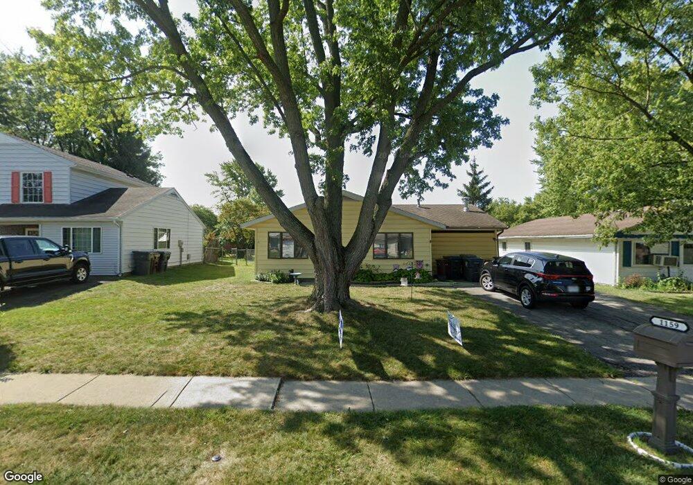
1159 Bikini Dr Lima, OH 45801
Northside Lima NeighborhoodEstimated Value: $146,000 - $175,000
3
Beds
1
Bath
1,473
Sq Ft
$108/Sq Ft
Est. Value
About This Home
This home is located at 1159 Bikini Dr, Lima, OH 45801 and is currently estimated at $159,043, approximately $107 per square foot. 1159 Bikini Dr is a home located in Allen County with nearby schools including Elida Elementary School, Elida Middle School, and Elida High School.
Ownership History
Date
Name
Owned For
Owner Type
Purchase Details
Closed on
Jul 18, 2007
Sold by
Ford Cynthia
Bought by
Vision 2 Investment Llc
Current Estimated Value
Purchase Details
Closed on
Jul 31, 2002
Sold by
Stuttler Ronald L
Bought by
Jackson Tyre and Ford Cynthia
Home Financials for this Owner
Home Financials are based on the most recent Mortgage that was taken out on this home.
Original Mortgage
$54,240
Interest Rate
6.7%
Mortgage Type
New Conventional
Purchase Details
Closed on
May 3, 1996
Sold by
Hurst Eddie
Bought by
Stuttler Ronald and Stuttler Donna
Home Financials for this Owner
Home Financials are based on the most recent Mortgage that was taken out on this home.
Original Mortgage
$56,250
Interest Rate
7.86%
Mortgage Type
New Conventional
Purchase Details
Closed on
Jan 1, 1982
Bought by
Hurst Kathleen A
Create a Home Valuation Report for This Property
The Home Valuation Report is an in-depth analysis detailing your home's value as well as a comparison with similar homes in the area
Home Values in the Area
Average Home Value in this Area
Purchase History
| Date | Buyer | Sale Price | Title Company |
|---|---|---|---|
| Vision 2 Investment Llc | $45,000 | None Available | |
| Jackson Tyre | $67,800 | -- | |
| Stuttler Ronald | $58,000 | -- | |
| Hurst Kathleen A | -- | -- |
Source: Public Records
Mortgage History
| Date | Status | Borrower | Loan Amount |
|---|---|---|---|
| Previous Owner | Jackson Tyre | $54,240 | |
| Previous Owner | Stuttler Ronald | $56,250 |
Source: Public Records
Tax History Compared to Growth
Tax History
| Year | Tax Paid | Tax Assessment Tax Assessment Total Assessment is a certain percentage of the fair market value that is determined by local assessors to be the total taxable value of land and additions on the property. | Land | Improvement |
|---|---|---|---|---|
| 2024 | $1,644 | $39,690 | $5,040 | $34,650 |
| 2023 | $1,270 | $27,380 | $3,470 | $23,910 |
| 2022 | $1,289 | $27,380 | $3,470 | $23,910 |
| 2021 | $1,296 | $27,380 | $3,470 | $23,910 |
| 2020 | $1,206 | $23,940 | $3,290 | $20,650 |
| 2019 | $1,206 | $23,940 | $3,290 | $20,650 |
| 2018 | $1,220 | $23,940 | $3,290 | $20,650 |
| 2017 | $1,154 | $23,940 | $3,290 | $20,650 |
| 2016 | $1,152 | $23,940 | $3,290 | $20,650 |
| 2015 | $1,157 | $23,940 | $3,290 | $20,650 |
| 2014 | $1,052 | $20,970 | $3,290 | $17,680 |
| 2013 | $1,021 | $20,970 | $3,290 | $17,680 |
Source: Public Records
Map
Nearby Homes
- 1580 W Robb Ave
- 1710 Camp Ave
- 0 Sherman Ave
- 2129 Reinell Ave
- 1744 Homeward Ave
- 00 Homeward Ave
- 2104 Virginia Ave
- 1776 Virginia Ave
- 1730 Homeward Ave
- 2371 Mandolin Dr
- 610 W Robb Ave
- 2268 N Glenwood Ave
- 1919 Jared Place
- 1116 Belvidere Ave
- 608 W O'Connor Ave
- 676 Cortlandt Ave
- 765 Ewing Ave
- 1113 Crestwood Dr
- 102 Charwood Dr
- 1848 Edgewood Dr