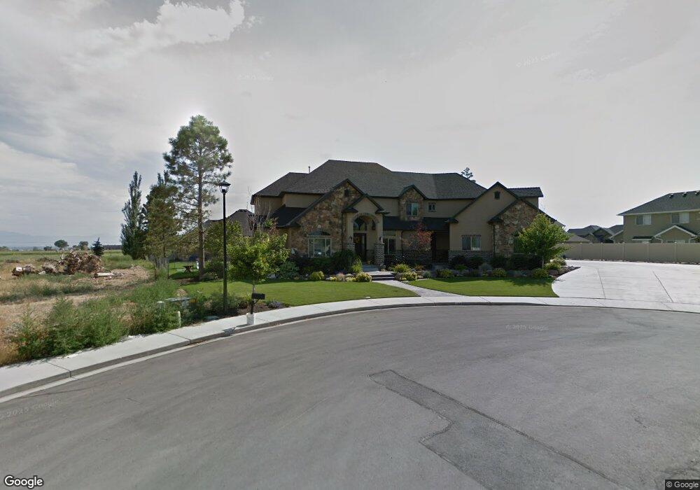
1159 N 1150 E Unit 2 American Fork, UT 84003
Estimated Value: $1,085,000 - $1,681,326
5
Beds
4
Baths
4,650
Sq Ft
$318/Sq Ft
Est. Value
About This Home
This home is located at 1159 N 1150 E Unit 2, American Fork, UT 84003 and is currently estimated at $1,476,775, approximately $317 per square foot. 1159 N 1150 E Unit 2 is a home located in Utah County with nearby schools including Deerfield Elementary School, Mountain Ridge Junior High School, and American Fork High School.
Ownership History
Date
Name
Owned For
Owner Type
Purchase Details
Closed on
Nov 12, 2020
Sold by
Anderson Terry
Bought by
Anderson Laurie and The Anderson Family Irrevocabl
Current Estimated Value
Purchase Details
Closed on
Oct 1, 2020
Sold by
Anderson Terry E and Anderson Laurie W
Bought by
Anderson Terry
Purchase Details
Closed on
Dec 12, 2018
Sold by
Anderson Terry E and Anderson Laurie W
Bought by
Anderson Terry E and Anderson Laurie W
Purchase Details
Closed on
May 17, 2016
Sold by
Anderson Terry E and Anderson Laurie W
Bought by
Anderson Terry E and Anderson Laurie W
Home Financials for this Owner
Home Financials are based on the most recent Mortgage that was taken out on this home.
Original Mortgage
$100,000
Outstanding Balance
$79,736
Interest Rate
3.71%
Mortgage Type
Commercial
Estimated Equity
$1,397,039
Purchase Details
Closed on
Oct 6, 2014
Sold by
Anderson Terry and Anderson Laurie
Bought by
The Anderson Family Irrevocable Trust and Anderson Laurie W
Purchase Details
Closed on
Sep 6, 2013
Sold by
Anderson Terry E and Anderson Laurie W
Bought by
Anderson Terry E and Anderson Laurie W
Home Financials for this Owner
Home Financials are based on the most recent Mortgage that was taken out on this home.
Original Mortgage
$394,300
Outstanding Balance
$100,667
Interest Rate
4.36%
Mortgage Type
New Conventional
Estimated Equity
$1,376,108
Purchase Details
Closed on
Mar 22, 2010
Sold by
Central Bank
Bought by
Anderson Terry E and Anderson Laurie W
Home Financials for this Owner
Home Financials are based on the most recent Mortgage that was taken out on this home.
Original Mortgage
$405,000
Interest Rate
4.88%
Mortgage Type
New Conventional
Purchase Details
Closed on
Jun 24, 2009
Sold by
Buckner John
Bought by
Central Bank
Purchase Details
Closed on
May 31, 2007
Sold by
Southam Paul and Southam David L
Bought by
Buckner John
Home Financials for this Owner
Home Financials are based on the most recent Mortgage that was taken out on this home.
Original Mortgage
$717,422
Interest Rate
6.16%
Mortgage Type
Construction
Create a Home Valuation Report for This Property
The Home Valuation Report is an in-depth analysis detailing your home's value as well as a comparison with similar homes in the area
Home Values in the Area
Average Home Value in this Area
Purchase History
| Date | Buyer | Sale Price | Title Company |
|---|---|---|---|
| Anderson Laurie | -- | None Available | |
| Anderson Terry | -- | None Available | |
| Anderson Terry E | -- | Meridian Title Co | |
| Anderson Terry E | -- | Meridian Title | |
| Anderson Terry E | -- | Meridian Title Co | |
| Anderson Terry E | -- | Meridian Title Co | |
| The Anderson Family Irrevocable Trust | -- | Accommodation | |
| Anderson Terry E | -- | Utah First Title Insurance A | |
| Anderson Terry E | -- | Bartlett Title Insurance Ag | |
| Central Bank | $600,000 | Pro Title & Escrow Inc | |
| Buckner John | -- | Inwest Title Services Inc |
Source: Public Records
Mortgage History
| Date | Status | Borrower | Loan Amount |
|---|---|---|---|
| Open | Anderson Terry E | $100,000 | |
| Closed | Anderson Terry E | $100,000 | |
| Open | Anderson Terry E | $394,300 | |
| Closed | Anderson Terry E | $405,000 | |
| Previous Owner | Buckner John | $717,422 |
Source: Public Records
Tax History
| Year | Tax Paid | Tax Assessment Tax Assessment Total Assessment is a certain percentage of the fair market value that is determined by local assessors to be the total taxable value of land and additions on the property. | Land | Improvement |
|---|---|---|---|---|
| 2025 | $5,688 | $752,235 | -- | -- |
| 2024 | $5,688 | $631,950 | $0 | $0 |
| 2023 | $5,637 | $664,070 | $0 | $0 |
| 2022 | $5,788 | $672,815 | $0 | $0 |
| 2021 | $5,059 | $918,600 | $189,800 | $728,800 |
| 2020 | $4,939 | $869,800 | $175,700 | $694,100 |
| 2019 | $4,211 | $767,100 | $163,500 | $603,600 |
| 2018 | $3,906 | $680,200 | $155,300 | $524,900 |
| 2017 | $3,889 | $365,585 | $0 | $0 |
| 2016 | $3,980 | $347,600 | $0 | $0 |
| 2015 | $4,194 | $347,600 | $0 | $0 |
| 2014 | $4,225 | $345,400 | $0 | $0 |
Source: Public Records
Map
Nearby Homes
- 1125 N 1270 E
- 1058 N 930 E Unit 64
- 1089 N 950 E
- 1077 N 950 E
- 1045 N 930 E Unit 58
- 3518 N 1450 W
- 9587 N 4500 W
- 4675 W Ferguson Way
- 9752 N Dorchester Dr
- 4552 W Windsor Cir
- 4531 W Cambridge Dr
- 1121 E 580 N
- 4979 W Willowbank Dr
- 9506 N 4000 W
- 5032 W Northwood Ln
- 4968 W Evergreen Ln
- 5061 W Evergreen Ln
- 462 N 950 E Unit 5
- 5034 W Green Ash Ln
- 5042 W Green Ash Ln
- 1159 N 1150 E
- 1132 N 1100 E
- 1118 N 1100 E
- 1131 E 1100 N Unit 3
- 1131 E 1100 N
- 1158 N 1150 E
- 1158 N 1150 E Unit 1
- 1167 N 1150 E
- 1154 N 1100 E
- 1115 E 1100 N
- 1153 E 1100 N
- 1153 E 1100 N Unit 4
- 1100 E 1100 N
- 1164 N 1100 E
- 1175 N 1150 E
- 1133 N 1190 E
- 1137 N 1100 E
- 1113 N 1100 E
- 1111 N 1190 E
- 1159 N 1100 E
Your Personal Tour Guide
Ask me questions while you tour the home.