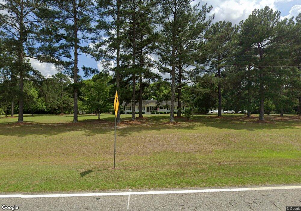
1159 Red Rock Rd Sylvester, GA 31791
Estimated Value: $214,615 - $329,000
--
Bed
1
Bath
2,216
Sq Ft
$124/Sq Ft
Est. Value
About This Home
This home is located at 1159 Red Rock Rd, Sylvester, GA 31791 and is currently estimated at $275,154, approximately $124 per square foot. 1159 Red Rock Rd is a home located in Worth County with nearby schools including Worth County Primary School, Worth County Elementary School, and Worth County Middle School.
Ownership History
Date
Name
Owned For
Owner Type
Purchase Details
Closed on
Aug 3, 2018
Sold by
Daughtry Mance H
Bought by
Brooks Billy T
Current Estimated Value
Home Financials for this Owner
Home Financials are based on the most recent Mortgage that was taken out on this home.
Original Mortgage
$129,200
Outstanding Balance
$112,205
Interest Rate
4.5%
Mortgage Type
New Conventional
Estimated Equity
$162,949
Purchase Details
Closed on
Jul 2, 1985
Bought by
Daughtry Mance H
Create a Home Valuation Report for This Property
The Home Valuation Report is an in-depth analysis detailing your home's value as well as a comparison with similar homes in the area
Home Values in the Area
Average Home Value in this Area
Purchase History
| Date | Buyer | Sale Price | Title Company |
|---|---|---|---|
| Brooks Billy T | $161,500 | -- | |
| Daughtry Mance H | $63,800 | -- |
Source: Public Records
Mortgage History
| Date | Status | Borrower | Loan Amount |
|---|---|---|---|
| Open | Brooks Billy T | $129,200 |
Source: Public Records
Tax History Compared to Growth
Tax History
| Year | Tax Paid | Tax Assessment Tax Assessment Total Assessment is a certain percentage of the fair market value that is determined by local assessors to be the total taxable value of land and additions on the property. | Land | Improvement |
|---|---|---|---|---|
| 2024 | $1,670 | $51,197 | $8,275 | $42,922 |
| 2023 | $1,670 | $51,197 | $8,275 | $42,922 |
| 2022 | $1,671 | $51,197 | $8,275 | $42,922 |
| 2021 | $1,704 | $51,197 | $8,275 | $42,922 |
| 2020 | $1,707 | $51,197 | $8,275 | $42,922 |
| 2019 | $1,707 | $51,197 | $8,275 | $42,922 |
| 2018 | $1,467 | $51,197 | $8,275 | $42,922 |
| 2017 | $1,467 | $51,197 | $8,275 | $42,922 |
| 2016 | $1,411 | $51,197 | $8,275 | $42,922 |
| 2015 | $1,413 | $51,197 | $8,275 | $42,922 |
| 2014 | $1,413 | $51,197 | $8,275 | $42,922 |
| 2013 | -- | $50,381 | $7,459 | $42,922 |
| 2012 | -- | $50,381 | $7,459 | $42,922 |
Source: Public Records
Map
Nearby Homes
- 222 Pebble Hill Cir
- 213 Aspen Ln
- 128 Airport Rd
- 106 Shady Ln
- 0 N County Line Rd
- 115 Wynn Dr
- 0 Blue Springs Rd Unit 138600
- 0 Blue Springs Rd
- 0 Blue Springs Rd Unit 138601
- 1447 Pearson Rd
- 144 James Dr
- 101 Dogwood Ln
- 2730 S County Line Rd
- 414 Pine Glen Dr
- 5108 Cypress Ave
- 115 Northlake Dr
- 109 Huntington Ct
- 107 Gardner Rd
- 103 N Ayers St
- 101 Elm St
- LOT 456 Red Rock Rd
- 1161 Red Rock Rd
- 1167 Red Rock Rd
- 1145 Red Rock Rd
- 1175 Red Rock Rd
- 1185 Red Rock Rd
- 1069 Red Rock Rd
- 1314 Red Rock Rd
- 1304 Red Rock Rd
- 1330 Red Rock Rd
- 226 Pebble Hill Cir
- 1336 Red Rock Rd
- 230 Pebble Hill Cir
- 1340 Red Rock Rd
- 218 Pebble Hill Cir
- 1026 Red Rock Rd
- 143 Pebble Ln
- 117 Pebble Ln
- 210 Pebble Hill Cir
- 119 Pebble Ln