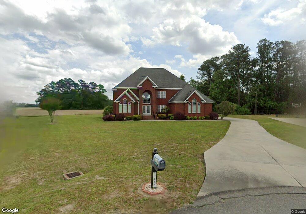
116 Abbey Frank St La Grange, NC 28551
Estimated Value: $312,000 - $446,000
3
Beds
3
Baths
3,483
Sq Ft
$115/Sq Ft
Est. Value
About This Home
This home is located at 116 Abbey Frank St, La Grange, NC 28551 and is currently estimated at $398,997, approximately $114 per square foot. 116 Abbey Frank St is a home located in Lenoir County with nearby schools including La Grange Elementary School, E.B. Frink Middle School, and North Lenoir High School.
Ownership History
Date
Name
Owned For
Owner Type
Purchase Details
Closed on
Feb 16, 2010
Sold by
May Jeffrey Alan and May Sara Heath
Bought by
Simms Chin Linda A
Current Estimated Value
Purchase Details
Closed on
Nov 1, 2005
Sold by
Sutton Developers Inc
Bought by
May Jeffrey Alan and May Sara Heath
Home Financials for this Owner
Home Financials are based on the most recent Mortgage that was taken out on this home.
Original Mortgage
$270,000
Interest Rate
5.71%
Mortgage Type
New Conventional
Purchase Details
Closed on
Aug 25, 2005
Sold by
Sutton Billy Morris and Sutton Shirley H
Bought by
Sutton Developers Inc
Create a Home Valuation Report for This Property
The Home Valuation Report is an in-depth analysis detailing your home's value as well as a comparison with similar homes in the area
Home Values in the Area
Average Home Value in this Area
Purchase History
| Date | Buyer | Sale Price | Title Company |
|---|---|---|---|
| Simms Chin Linda A | -- | -- | |
| May Jeffrey Alan | $272,000 | None Available | |
| Sutton Developers Inc | $40,000 | None Available |
Source: Public Records
Mortgage History
| Date | Status | Borrower | Loan Amount |
|---|---|---|---|
| Previous Owner | May Jeffrey Alan | $270,000 |
Source: Public Records
Tax History Compared to Growth
Tax History
| Year | Tax Paid | Tax Assessment Tax Assessment Total Assessment is a certain percentage of the fair market value that is determined by local assessors to be the total taxable value of land and additions on the property. | Land | Improvement |
|---|---|---|---|---|
| 2025 | $4,553 | $453,754 | $25,410 | $428,344 |
| 2024 | $3,712 | $269,549 | $24,000 | $245,549 |
| 2023 | $3,712 | $269,549 | $24,000 | $245,549 |
| 2022 | $3,712 | $269,549 | $24,000 | $245,549 |
| 2021 | $3,712 | $269,549 | $24,000 | $245,549 |
| 2020 | $3,712 | $269,549 | $24,000 | $245,549 |
| 2019 | $3,712 | $269,549 | $24,000 | $245,549 |
| 2018 | $3,671 | $269,549 | $24,000 | $245,549 |
| 2017 | $3,685 | $269,549 | $24,000 | $245,549 |
| 2014 | $4,198 | $326,668 | $24,000 | $302,668 |
| 2013 | -- | $326,668 | $24,000 | $302,668 |
| 2011 | -- | $326,668 | $24,000 | $302,668 |
Source: Public Records
Map
Nearby Homes
- 3619 S Caswell St
- 6272 Highway 70 E
- 805 Madison Ann Dr
- 4725 Packhouse Rd
- 210 Wood St
- 201 Wood St
- 202 Wood St
- 208 Wood St
- 217 Wood St
- 204 Wood St
- 205 Wood St
- 206 Wood St
- 614 S Caswell St
- Hayden Plan at Blair Ridge
- Freeport Plan at Blair Ridge
- Cali Plan at Blair Ridge
- Belhaven Plan at Blair Ridge
- 219 Wood St
- 101 Forest Dr
- 408 Lake Pines Dr
- 114 Abbey Farm St
- 114 Abbey Frank St
- 115 Abbey Frank St
- 112 Abbey Frank St
- 107 Abbey Frank St
- 110 Abbey Frank St
- 306 Madison Ann Dr
- 304 Madison Ann Dr
- 310 Madison Ann Dr
- 108 Abbey Frank St
- 302 Madison Ann Dr
- 400 Madison Ann Dr
- 3611 Nc Highway 903 N
- 300 Madison Ann Dr
- 106 Abbey Frank St
- 402 Madison Ann Dr
- 404 Madison Ann Dr
- 104 Abbey Frank St
- 307 Madison Ann Dr
- 309 Madison Ann Dr