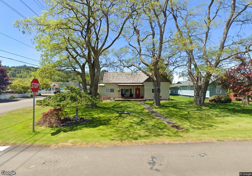
116 Adams St S South Bend, WA 98586
Estimated Value: $236,000 - $254,764
3
Beds
1
Bath
1,220
Sq Ft
$205/Sq Ft
Est. Value
About This Home
This home is located at 116 Adams St S, South Bend, WA 98586 and is currently estimated at $249,691, approximately $204 per square foot. 116 Adams St S is a home with nearby schools including Mike Morris Elementary School and South Bend High School.
Ownership History
Date
Name
Owned For
Owner Type
Purchase Details
Closed on
Aug 12, 2003
Sold by
Curtis Thomas and Curtis Tracy
Bought by
Curtis Thomas and Curtis Tracy
Current Estimated Value
Home Financials for this Owner
Home Financials are based on the most recent Mortgage that was taken out on this home.
Original Mortgage
$90,000
Interest Rate
5.67%
Mortgage Type
New Conventional
Create a Home Valuation Report for This Property
The Home Valuation Report is an in-depth analysis detailing your home's value as well as a comparison with similar homes in the area
Home Values in the Area
Average Home Value in this Area
Purchase History
| Date | Buyer | Sale Price | Title Company |
|---|---|---|---|
| Curtis Thomas | -- | None Available |
Source: Public Records
Mortgage History
| Date | Status | Borrower | Loan Amount |
|---|---|---|---|
| Previous Owner | Curtis Thomas | $90,000 |
Source: Public Records
Tax History Compared to Growth
Tax History
| Year | Tax Paid | Tax Assessment Tax Assessment Total Assessment is a certain percentage of the fair market value that is determined by local assessors to be the total taxable value of land and additions on the property. | Land | Improvement |
|---|---|---|---|---|
| 2025 | $1,783 | $230,200 | $40,500 | $189,700 |
| 2024 | $1,783 | $221,400 | $39,000 | $182,400 |
| 2023 | $1,541 | $173,500 | $33,000 | $140,500 |
| 2022 | $1,180 | $104,100 | $23,300 | $80,800 |
| 2021 | $1,173 | $97,300 | $21,800 | $75,500 |
| 2020 | $1,160 | $90,600 | $20,300 | $70,300 |
| 2019 | $930 | $77,200 | $17,300 | $59,900 |
| 2018 | $1,052 | $67,100 | $15,000 | $52,100 |
| 2017 | $939 | $67,100 | $15,000 | $52,100 |
| 2015 | $1,039 | $70,900 | $15,000 | $55,900 |
| 2014 | -- | $70,900 | $15,000 | $55,900 |
| 2012 | -- | $79,600 | $15,000 | $64,600 |
Source: Public Records
Map
Nearby Homes
- 106 First St E
- 111 First St
- 0 xx Kendrick St S
- 509 2nd St
- 304 Monroe St S
- 0 xx E Cowlitz St
- 420 Weir St S
- 0 x Quincy St N
- 209 Ferry St
- 0 Tract 2 Highway 101
- 806 California St
- 932 Minnesota St
- 818 Wyoming St
- 0 E Robert Bush Dr Unit NWM2276944
- 0 Rixon Rd Unit NWM2443833
- 1008 Virginia St
- 0 X Water St
- 1206 W 4th St
- 719 Main St
- 198 Raymond South Bend Rd