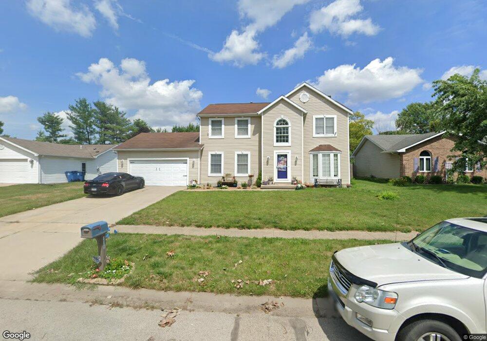
116 Appomattox Dr Springfield, IL 62711
Estimated Value: $241,085 - $316,000
Studio
--
Bath
--
Sq Ft
10,454
Sq Ft Lot
About This Home
This home is located at 116 Appomattox Dr, Springfield, IL 62711 and is currently estimated at $280,521. 116 Appomattox Dr is a home located in Sangamon County with nearby schools including Farmingdale Elementary School, Pleasant Plains Middle School, and Pleasant Plains High School.
Ownership History
Date
Name
Owned For
Owner Type
Purchase Details
Closed on
May 17, 2017
Sold by
Wagner Larry K and Wagner Kaye
Bought by
Glisson Tami M
Current Estimated Value
Home Financials for this Owner
Home Financials are based on the most recent Mortgage that was taken out on this home.
Original Mortgage
$144,000
Outstanding Balance
$118,019
Interest Rate
4.1%
Mortgage Type
New Conventional
Estimated Equity
$162,502
Purchase Details
Closed on
Apr 21, 2015
Purchase Details
Closed on
Aug 21, 2009
Create a Home Valuation Report for This Property
The Home Valuation Report is an in-depth analysis detailing your home's value as well as a comparison with similar homes in the area
Purchase History
| Date | Buyer | Sale Price | Title Company |
|---|---|---|---|
| Glisson Tami M | $180,000 | Zelle Title | |
| -- | -- | -- | |
| -- | $134,500 | -- |
Source: Public Records
Mortgage History
| Date | Status | Borrower | Loan Amount |
|---|---|---|---|
| Open | Glisson Tami M | $144,000 |
Source: Public Records
Tax History
| Year | Tax Paid | Tax Assessment Tax Assessment Total Assessment is a certain percentage of the fair market value that is determined by local assessors to be the total taxable value of land and additions on the property. | Land | Improvement |
|---|---|---|---|---|
| 2024 | $4,696 | $68,226 | $1,365 | $66,861 |
| 2023 | $4,438 | $62,318 | $1,247 | $61,071 |
| 2022 | $4,299 | $59,114 | $1,183 | $57,931 |
| 2021 | $4,159 | $56,901 | $1,139 | $55,762 |
| 2020 | $4,180 | $56,987 | $1,141 | $55,846 |
| 2019 | $3,608 | $50,232 | $1,137 | $49,095 |
| 2018 | $4,065 | $56,402 | $1,131 | $55,271 |
| 2017 | $4,164 | $55,672 | $1,116 | $54,556 |
| 2016 | $2,611 | $32,360 | $1,100 | $31,260 |
| 2015 | $2,100 | $31,973 | $1,087 | $30,886 |
| 2014 | $2,082 | $31,767 | $1,080 | $30,687 |
| 2013 | -- | $31,767 | $1,080 | $30,687 |
Source: Public Records
Map
Nearby Homes
- 3920 W Bluffs Rd
- 4144 Highbury
- 4090 Highbury
- 4671 Casey Dr
- 4661 Casey Dr
- 9 Oakwood Dr
- 4546 Thompson Rd
- 4800 Longfellow Dr
- 4335 Creek Dr
- 3613 Briana Dr
- 3612 Melissa Dr
- 3609 Melissa Dr
- 1115 Willowbrook Dr Unit 1
- 4610 Boone Dr
- 4611 Boone Dr
- 4627 Boone Dr
- 4619 Boone Dr
- 4614 Boone Dr
- 4622 Boone Dr
- 4618 Boone Dr
- 200 Appomattox Dr
- 112 Appomattox Dr
- 108 Appomattox Dr
- 87 Silver Rod Dr
- 117 Appomattox Dr
- 204 Appomattox Dr
- 73 Silver Rod Dr
- 113 Appomattox Dr
- 201 Appomattox Dr
- 109 Appomattox Dr
- 104 Appomattox Dr
- 97 Silver Rod Dr
- 208 Appomattox Dr
- 205 Appomattox Dr
- 37 Silver Rod Dr
- 105 Appomattox Dr
- 116 N Pittsburg Landing
- 112 N Pittsburg Landing
- 209 Appomattox Dr
- 200 N Pittsburg Landing
Your Personal Tour Guide
Ask me questions while you tour the home.