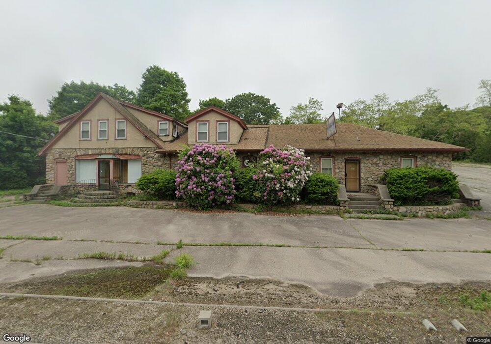
116 Ashaway Rd Westerly, RI 02891
Estimated Value: $641,730
Studio
--
Bath
4,292
Sq Ft
$150/Sq Ft
Est. Value
About This Home
This home is located at 116 Ashaway Rd, Westerly, RI 02891 and is currently estimated at $641,730, approximately $149 per square foot. 116 Ashaway Rd is a home located in Washington County with nearby schools including Westerly High School and St. Michael School.
Ownership History
Date
Name
Owned For
Owner Type
Purchase Details
Closed on
May 13, 2004
Sold by
Comforti Joseph
Bought by
Carella Joseph
Current Estimated Value
Purchase Details
Closed on
Dec 19, 2002
Sold by
Comfort Josephr
Bought by
Magliari Giuseppe and Magliari Rosaria
Create a Home Valuation Report for This Property
The Home Valuation Report is an in-depth analysis detailing your home's value as well as a comparison with similar homes in the area
Home Values in the Area
Average Home Value in this Area
Purchase History
| Date | Buyer | Sale Price | Title Company |
|---|---|---|---|
| Carella Joseph | $285,000 | -- | |
| Carella Joseph | $285,000 | -- | |
| Magliari Giuseppe | $55,000 | -- | |
| Magliari Giuseppe | $55,000 | -- |
Source: Public Records
Mortgage History
| Date | Status | Borrower | Loan Amount |
|---|---|---|---|
| Previous Owner | Magliari Giuseppe | $125,000 | |
| Previous Owner | Magliari Giuseppe | $125,000 |
Source: Public Records
Map
Nearby Homes
- 7 Schilke Dr
- 19 Nichols Ln
- 5 Marion St
- 12 Batterson Ave
- 6 Acorn Dr
- 2 Marichris Dr
- 0 Iroquois Ave
- 3 Joseph Ln
- 6 Beatrice St
- 21 Linden St
- 9 Perkins Ave
- 19 Apache Dr Unit F
- 19 Apache Dr Unit 19C
- 22 Colonial Dr
- 17 Apache Dr Unit G
- 40 Boombridge Rd
- 12 Apache Dr Unit A
- 28 Spruce St
- 55 Pleasant St
- 54 Boombridge Rd
- 0 Hopkinton Rd
- 120 Ashaway Rd
- 10 Old Hopkinton Rd
- 8 Old Hopkinton Rd
- 4 Milrose Ave
- 16 Old Hopkinton Rd
- 112 Ashaway Rd
- 12 Old Hopkinton Rd
- 5 Milrose Ave
- 18 Old Hopkinton Rd
- 14 Old Hopkinton Rd
- 115 Ashaway Rd
- 1 Boy Scout Dr
- 2 Boy Scout Dr
- 10 Milrose Ave
- 5 Bridgette Ln
- 11 Bridgette Ln
- 2 Forrestal Dr
- 3 Boy Scout Dr
- 4 Old Hopkinton Rd
Your Personal Tour Guide
Ask me questions while you tour the home.