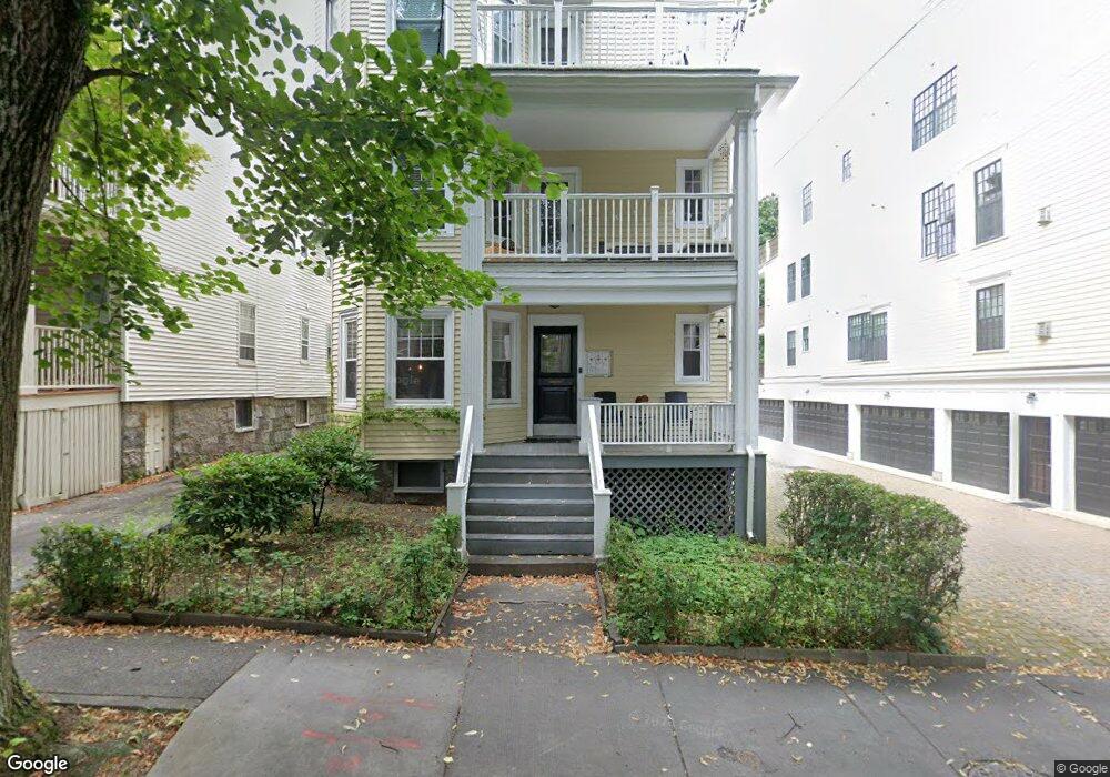
116 Browne St Brookline, MA 02446
Coolidge Corner NeighborhoodEstimated Value: $1,871,602 - $3,150,000
3
Beds
1
Bath
1,321
Sq Ft
$1,691/Sq Ft
Est. Value
About This Home
This home is located at 116 Browne St, Brookline, MA 02446 and is currently estimated at $2,234,401, approximately $1,691 per square foot. 116 Browne St is a home located in Norfolk County with nearby schools including Florida Ruffin Ridley, Brookline High School, and Match Charter Public School.
Ownership History
Date
Name
Owned For
Owner Type
Purchase Details
Closed on
Jan 30, 2009
Sold by
Mercer Esther L and Mercer William D R
Bought by
Stillman Ezra A
Current Estimated Value
Home Financials for this Owner
Home Financials are based on the most recent Mortgage that was taken out on this home.
Original Mortgage
$507,000
Outstanding Balance
$323,559
Interest Rate
5.28%
Mortgage Type
Purchase Money Mortgage
Estimated Equity
$1,910,842
Create a Home Valuation Report for This Property
The Home Valuation Report is an in-depth analysis detailing your home's value as well as a comparison with similar homes in the area
Home Values in the Area
Average Home Value in this Area
Purchase History
| Date | Buyer | Sale Price | Title Company |
|---|---|---|---|
| Stillman Ezra A | $845,000 | -- |
Source: Public Records
Mortgage History
| Date | Status | Borrower | Loan Amount |
|---|---|---|---|
| Open | Stillman Ezra A | $507,000 |
Source: Public Records
Tax History
| Year | Tax Paid | Tax Assessment Tax Assessment Total Assessment is a certain percentage of the fair market value that is determined by local assessors to be the total taxable value of land and additions on the property. | Land | Improvement |
|---|---|---|---|---|
| 2025 | $25,166 | $2,549,700 | $1,202,000 | $1,347,700 |
| 2024 | $25,156 | $2,574,800 | $1,155,700 | $1,419,100 |
| 2023 | $23,868 | $2,394,000 | $1,059,000 | $1,335,000 |
| 2022 | $23,232 | $2,279,900 | $1,008,500 | $1,271,400 |
| 2021 | $21,484 | $2,192,200 | $969,700 | $1,222,500 |
| 2020 | $20,146 | $2,131,900 | $881,600 | $1,250,300 |
| 2019 | $19,025 | $2,030,400 | $839,600 | $1,190,800 |
| 2018 | $17,835 | $1,885,300 | $699,600 | $1,185,700 |
| 2017 | $17,248 | $1,745,700 | $660,000 | $1,085,700 |
| 2016 | $14,116 | $1,354,700 | $616,900 | $737,800 |
| 2015 | $13,152 | $1,231,500 | $576,500 | $655,000 |
| 2014 | $12,696 | $1,114,700 | $480,400 | $634,300 |
Source: Public Records
Map
Nearby Homes
- 125 Crowninshield Rd Unit 125
- 99 Crowninshield Rd Unit 99
- 105 Babcock St
- 95 Stedman St Unit 1
- 95 Beals St Unit 2
- 79 Pleasant St Unit 4
- 63-65 Green St Unit 1
- 63-65 Green St Unit PH-3
- 36 Osborne Rd Unit 1
- 36 Osborne Rd
- 52 Babcock St Unit 5
- 52 Babcock St Unit 1
- 221 Saint Paul St
- 38 Stedman St Unit 38A
- 28 Winslow Rd
- 14 James St Unit 3
- 26 John St Unit 3
- 21 Green St Unit 3
- 16 Parkman St Unit 1
- 142 Fuller St Unit 4
- 116 Browne St
- 116 Browne St Unit 2
- 116 Browne St Unit 1
- 116 Browne St Unit 3
- 112 Browne St Unit 3
- 112 Browne St Unit 2
- 112 Browne St Unit 1
- 112 Browne St Unit 1 12
- 112 Browne St Unit 2,112
- 120 Browne St Unit 3
- 120 Browne St Unit 5
- 120 Browne St Unit 1
- 120 Browne St Unit 4
- 120 Browne St Unit 2
- 120 Browne St
- 110 Browne St Unit 1
- 110 Browne St Unit 3
- 110 Browne St Unit 2
- 35 Stetson St
- 35 Stetson St Unit 2B
Your Personal Tour Guide
Ask me questions while you tour the home.