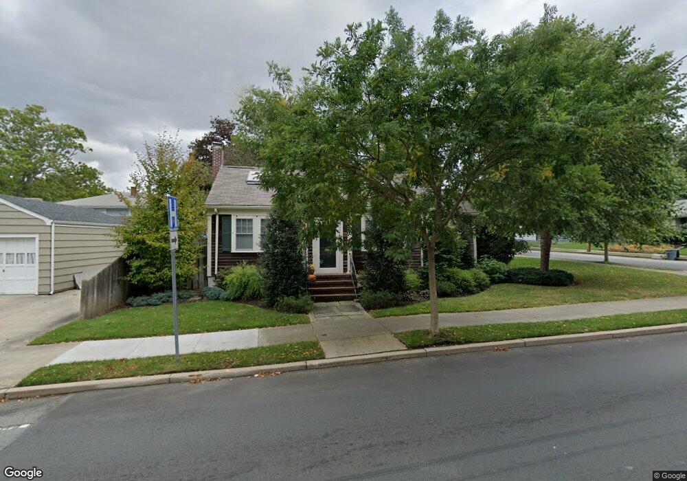
116 Brownell Ave New Bedford, MA 02740
Buttonwood Park NeighborhoodEstimated Value: $462,000 - $565,000
3
Beds
2
Baths
1,613
Sq Ft
$310/Sq Ft
Est. Value
About This Home
This home is located at 116 Brownell Ave, New Bedford, MA 02740 and is currently estimated at $499,718, approximately $309 per square foot. 116 Brownell Ave is a home located in Bristol County with nearby schools including Betsey B. Winslow Elementary School, Keith Middle School, and New Bedford High School.
Ownership History
Date
Name
Owned For
Owner Type
Purchase Details
Closed on
Nov 27, 1991
Sold by
Sullivan Michael S
Bought by
Amaral Rosa M
Current Estimated Value
Purchase Details
Closed on
Aug 11, 1987
Sold by
Ginsberg Michael A
Bought by
Sullivan Michael S
Create a Home Valuation Report for This Property
The Home Valuation Report is an in-depth analysis detailing your home's value as well as a comparison with similar homes in the area
Home Values in the Area
Average Home Value in this Area
Purchase History
| Date | Buyer | Sale Price | Title Company |
|---|---|---|---|
| Amaral Rosa M | $120,000 | -- | |
| Amaral Rosa M | $120,000 | -- | |
| Sullivan Michael S | $85,000 | -- |
Source: Public Records
Mortgage History
| Date | Status | Borrower | Loan Amount |
|---|---|---|---|
| Closed | Sullivan Michael S | $40,000 | |
| Closed | Sullivan Michael S | $25,000 | |
| Closed | Sullivan Michael S | $60,000 |
Source: Public Records
Tax History Compared to Growth
Tax History
| Year | Tax Paid | Tax Assessment Tax Assessment Total Assessment is a certain percentage of the fair market value that is determined by local assessors to be the total taxable value of land and additions on the property. | Land | Improvement |
|---|---|---|---|---|
| 2025 | $4,870 | $430,600 | $119,100 | $311,500 |
| 2024 | $4,969 | $414,100 | $113,500 | $300,600 |
| 2023 | $5,372 | $375,900 | $101,600 | $274,300 |
| 2022 | $4,940 | $317,900 | $96,800 | $221,100 |
| 2021 | $5,763 | $309,600 | $96,800 | $212,800 |
| 2020 | $5,604 | $296,000 | $100,500 | $195,500 |
| 2019 | $4,605 | $279,600 | $102,300 | $177,300 |
| 2018 | $4,831 | $255,300 | $102,300 | $153,000 |
| 2017 | $4,648 | $240,000 | $102,300 | $137,700 |
| 2016 | $3,720 | $225,600 | $96,800 | $128,800 |
| 2015 | $3,522 | $223,900 | $100,500 | $123,400 |
| 2014 | $3,379 | $222,900 | $102,300 | $120,600 |
Source: Public Records
Map
Nearby Homes
- 729 Allen St
- 0 Victoria St Unit 73457953
- 511 Bedford St
- 50 Gaywood St
- 330 Maple St
- 260 Maple St
- 25 Westwood Dr
- 124 Francis St
- 354-358 Arnold St
- 6 Walters Way
- 7 Winter St
- 245 Brownell St
- 35 Jenny Lind St
- 605 Union St
- 59 Longwood Ave
- 122 Armour St
- 295 Commonwealth Ave
- 317 Commonwealth Ave
- 119 Tremont St
- 32 Fulton St
- 440 Hawthorn St
- 239 Plymouth St
- 436 Hawthorn St
- 242 Plymouth St
- 430 Hawthorn St
- 231 Plymouth St
- 452 Hawthorn St
- 230 Plymouth St
- 107 Brownell Ave
- 0 Hawthorn St
- 96 Brownell Ave
- 341 Carroll St
- 222 Plymouth St
- 121 Burns St
- 460 Hawthorn St
- 301 Carroll St
- 82 Brownell Ave
- 208 Plymouth St
- 308 Carroll St
- 95 Burns St