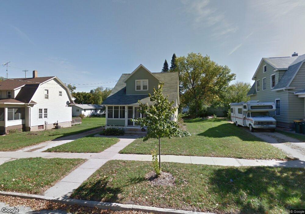
116 Council St Fort Atkinson, WI 53538
Estimated Value: $235,000 - $249,000
--
Bed
--
Bath
--
Sq Ft
7,187
Sq Ft Lot
About This Home
This home is located at 116 Council St, Fort Atkinson, WI 53538 and is currently estimated at $240,131. 116 Council St is a home located in Jefferson County with nearby schools including Barrie Elementary School, Fort Atkinson Middle School, and Fort Atkinson High School.
Ownership History
Date
Name
Owned For
Owner Type
Purchase Details
Closed on
Jan 1, 2014
Sold by
Lange Nicole Ann and Bastin Jeremy
Bought by
Willgrubs Nicholas
Current Estimated Value
Home Financials for this Owner
Home Financials are based on the most recent Mortgage that was taken out on this home.
Original Mortgage
$87,300
Interest Rate
3.99%
Mortgage Type
New Conventional
Purchase Details
Closed on
May 4, 2012
Sold by
Lange John Robert
Bought by
Lange Nicole Ann
Create a Home Valuation Report for This Property
The Home Valuation Report is an in-depth analysis detailing your home's value as well as a comparison with similar homes in the area
Home Values in the Area
Average Home Value in this Area
Purchase History
| Date | Buyer | Sale Price | Title Company |
|---|---|---|---|
| Willgrubs Nicholas | $97,000 | None Available | |
| Lange Nicole Ann | -- | None Available |
Source: Public Records
Mortgage History
| Date | Status | Borrower | Loan Amount |
|---|---|---|---|
| Previous Owner | Willgrubs Nicholas | $87,300 |
Source: Public Records
Tax History Compared to Growth
Tax History
| Year | Tax Paid | Tax Assessment Tax Assessment Total Assessment is a certain percentage of the fair market value that is determined by local assessors to be the total taxable value of land and additions on the property. | Land | Improvement |
|---|---|---|---|---|
| 2024 | $3,016 | $162,800 | $37,500 | $125,300 |
| 2023 | $2,667 | $162,800 | $37,500 | $125,300 |
| 2022 | $2,756 | $110,600 | $25,500 | $85,100 |
| 2021 | $2,425 | $110,600 | $25,500 | $85,100 |
| 2020 | $2,406 | $110,600 | $25,500 | $85,100 |
| 2019 | $2,293 | $110,600 | $25,500 | $85,100 |
| 2018 | $2,218 | $110,600 | $25,500 | $85,100 |
| 2017 | $2,196 | $110,600 | $25,500 | $85,100 |
| 2016 | $2,198 | $107,000 | $23,700 | $83,300 |
| 2015 | $2,324 | $107,000 | $23,700 | $83,300 |
| 2014 | $2,244 | $107,000 | $23,700 | $83,300 |
| 2013 | $2,303 | $107,000 | $23,700 | $83,300 |
Source: Public Records
Map
Nearby Homes
- 125 Monroe St
- 1120 Van Buren St
- 42 Wilson Ave
- 715 Madison Ave
- 336 Jones Ave
- 1220 Sherman Ave W
- 916 Madison Ave
- 1222 Sherman Ave W Unit P
- 605 Nelson St
- 1233 Sherman Ave W
- 609 Cloute St
- 311 N Main St
- 234 S Main St
- 619 Robert St
- 845 Messmer St
- 214 Hickory St
- 520 Edward St
- 233 S Water St E
- 426 Jefferson St
- 416 N 3rd St
- 120 Council St
- 112 Council St
- 108 Council St
- 715 Sherman Ave W
- 801 Sherman Ave W
- 117 Council St
- 113 Council St
- 716 Van Buren St
- 724 Van Buren St
- 720 Van Buren St
- 111 Council St
- 805 Sherman Ave W
- 711 Sherman Ave W
- 802 Van Buren St
- 710 Van Buren St
- 121 Jackson St
- 115 Jackson St Unit 117
- 115 Jackson St
- 722 Sherman Ave W
- 726 Sherman Ave W