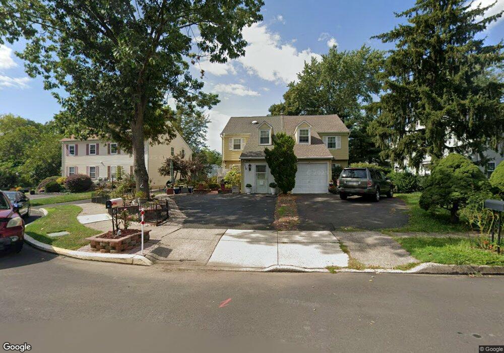
116 Deerpath Dr Lansdale, PA 19446
Estimated Value: $333,000 - $393,000
4
Beds
2
Baths
1,652
Sq Ft
$217/Sq Ft
Est. Value
About This Home
This home is located at 116 Deerpath Dr, Lansdale, PA 19446 and is currently estimated at $358,145, approximately $216 per square foot. 116 Deerpath Dr is a home located in Montgomery County with nearby schools including Bridle Path Elementary School, Penndale Middle School, and North Penn Senior High School.
Ownership History
Date
Name
Owned For
Owner Type
Purchase Details
Closed on
Sep 4, 2007
Sold by
Gallo Rudolph F
Bought by
Dorsey Maurice L
Current Estimated Value
Home Financials for this Owner
Home Financials are based on the most recent Mortgage that was taken out on this home.
Original Mortgage
$200,000
Outstanding Balance
$127,015
Interest Rate
6.63%
Estimated Equity
$231,130
Create a Home Valuation Report for This Property
The Home Valuation Report is an in-depth analysis detailing your home's value as well as a comparison with similar homes in the area
Home Values in the Area
Average Home Value in this Area
Purchase History
| Date | Buyer | Sale Price | Title Company |
|---|---|---|---|
| Dorsey Maurice L | $230,500 | None Available |
Source: Public Records
Mortgage History
| Date | Status | Borrower | Loan Amount |
|---|---|---|---|
| Open | Dorsey Maurice L | $200,000 |
Source: Public Records
Tax History Compared to Growth
Tax History
| Year | Tax Paid | Tax Assessment Tax Assessment Total Assessment is a certain percentage of the fair market value that is determined by local assessors to be the total taxable value of land and additions on the property. | Land | Improvement |
|---|---|---|---|---|
| 2025 | $4,278 | $114,660 | $42,310 | $72,350 |
| 2024 | $4,278 | $114,660 | $42,310 | $72,350 |
| 2023 | $4,082 | $114,660 | $42,310 | $72,350 |
| 2022 | $3,937 | $114,660 | $42,310 | $72,350 |
| 2021 | $3,702 | $114,660 | $42,310 | $72,350 |
| 2020 | $3,604 | $114,660 | $42,310 | $72,350 |
| 2019 | $3,537 | $114,660 | $42,310 | $72,350 |
| 2018 | $568 | $114,660 | $42,310 | $72,350 |
| 2017 | $3,386 | $114,660 | $42,310 | $72,350 |
| 2016 | $3,342 | $114,660 | $42,310 | $72,350 |
| 2015 | $3,190 | $114,660 | $42,310 | $72,350 |
| 2014 | $3,190 | $114,660 | $42,310 | $72,350 |
Source: Public Records
Map
Nearby Homes
- 417 Wynstone Ct
- 303 Wynstone Ct
- 83 Bethlehem Pike Unit 1213 FIRESTONE
- 83 Bethlehem Pike Unit 1106- MADISON PLAN
- 000 Lenape Dr
- 6 Lantern Ln
- 100 Victoria Dr
- 304 Victoria Dr
- 2943 E Walnut St Unit 59
- 110 Country Club Dr
- 405 Country Club Dr
- 2111 Hidden Meadow Dr
- 527 Lexington Ave
- 103 Dylan Dr Unit 45
- 1823 N Line St
- 534 Airy Ave
- 117 Brianna Ct
- 119 Brianna Ct Unit 10
- 111 Brianna Ct Unit 6
- 111 Brianna Ct
- 114 Deerpath Dr
- 118 Deerpath Dr
- 110 Deerpath Dr
- 120 Deerpath Dr
- 108 Deerpath Dr
- 290 Cricklewood Cir
- 292 Cricklewood Cir
- 288 Cricklewood Cir
- 294 Cricklewood Cir
- 286 Cricklewood Cir
- 296 Cricklewood Cir
- 124 Deerpath Dr
- 284 Cricklewood Cir
- 126 Deerpath Dr
- 298 Cricklewood Cir
- 102 Deerpath Dr Unit B
- 102 Deerpath Dr
- 102 Deerpath Dr Unit A
- 117 Deerpath Dr
- 115 Deerpath Dr