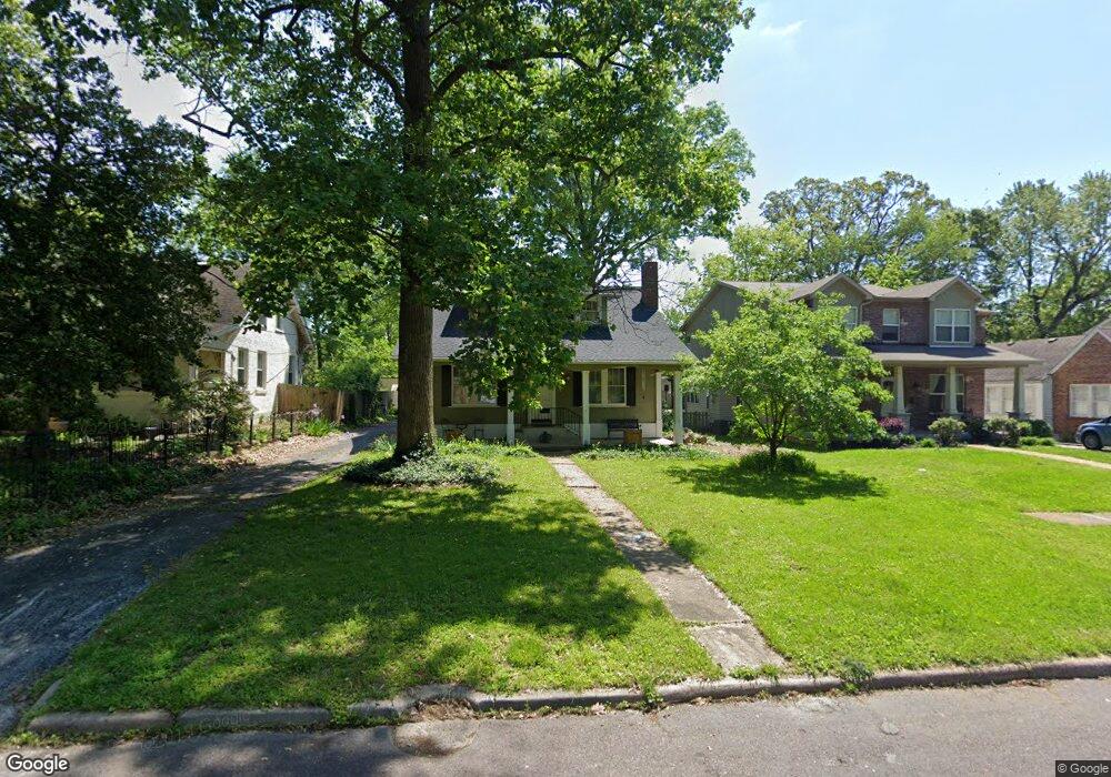
116 Dickson St Saint Louis, MO 63122
Estimated Value: $556,000 - $600,000
3
Beds
3
Baths
1,856
Sq Ft
$310/Sq Ft
Est. Value
About This Home
This home is located at 116 Dickson St, Saint Louis, MO 63122 and is currently estimated at $575,691, approximately $310 per square foot. 116 Dickson St is a home located in St. Louis County with nearby schools including F.P. Tillman Elementary School, Nipher Middle School, and Kirkwood Senior High School.
Ownership History
Date
Name
Owned For
Owner Type
Purchase Details
Closed on
Sep 24, 2012
Sold by
Whitehead Robert E and Whitehead Janet V
Bought by
Whitehead Robert E and Whitehead Janet S
Current Estimated Value
Home Financials for this Owner
Home Financials are based on the most recent Mortgage that was taken out on this home.
Original Mortgage
$163,000
Interest Rate
3.66%
Mortgage Type
New Conventional
Create a Home Valuation Report for This Property
The Home Valuation Report is an in-depth analysis detailing your home's value as well as a comparison with similar homes in the area
Home Values in the Area
Average Home Value in this Area
Purchase History
We collect this data history from publicly available records. To have your information removed, we recommend requesting removal directly through your county’s website.
| Date | Buyer | Sale Price | Title Company |
|---|---|---|---|
| Whitehead Robert E | -- | Freedom Title Llc St Louis |
Source: Public Records
Mortgage History
We collect this data history from publicly available records. To have your information removed, we recommend requesting removal directly through your county’s website.
| Date | Status | Borrower | Loan Amount |
|---|---|---|---|
| Closed | Whitehead Robert E | $163,000 |
Source: Public Records
Tax History
| Year | Tax Paid | Tax Assessment Tax Assessment Total Assessment is a certain percentage of the fair market value that is determined by local assessors to be the total taxable value of land and additions on the property. | Land | Improvement |
|---|---|---|---|---|
| 2025 | $5,793 | $105,870 | $92,060 | $13,810 |
| 2024 | $5,793 | $92,420 | $82,860 | $9,560 |
| 2023 | $5,702 | $92,420 | $82,860 | $9,560 |
| 2022 | $5,993 | $83,770 | $68,890 | $14,880 |
| 2021 | $5,419 | $83,770 | $68,890 | $14,880 |
| 2020 | $5,188 | $77,120 | $59,770 | $17,350 |
| 2019 | $5,242 | $77,120 | $59,770 | $17,350 |
| 2018 | $5,613 | $72,960 | $41,420 | $31,540 |
| 2017 | $5,606 | $72,960 | $41,420 | $31,540 |
| 2016 | $5,187 | $68,020 | $36,820 | $31,200 |
| 2015 | $5,180 | $68,020 | $36,820 | $31,200 |
| 2014 | $4,693 | $60,260 | $18,540 | $41,720 |
Source: Public Records
Map
Nearby Homes
- 702 E Monroe Ave
- 216 Park Ave
- 326 Luther Ln
- 721 Oakway Place
- 306 E Jefferson Ave
- 439 E Elliott Ave
- 236 Orrick Ln
- 214 Orrick Ln
- 132 E Monroe Ave Unit C-103
- 132 E Monroe Ave Unit 211
- 132 E Monroe Ave Unit E-106
- 132 E Monroe Ave Unit C-307
- 132 E Monroe Ave Unit 305
- 132 E Monroe Ave Unit 302
- 132 E Monroe Ave Unit 308
- 132 E Monroe Ave Unit 212
- 132 E Monroe Ave Unit A-102
- 132 E Monroe Ave Unit D-311
- 132 E Monroe Ave Unit 201
- 200 S Kirkwood Rd Unit 308
- 105 Handlan Ct
- 109 Handlan Ct
- 106 Dickson St
- 618TBB E Argonne Dr
- 110 Dickson St
- 112 Dickson St
- 632 E Argonne Dr
- 632 E Argonne Dr
- 102 Handlan Ct
- 113 Handlan Ct
- 106 Handlan Ct
- 110 Handlan Ct
- 610 E Argonne Dr
- 636TBB E Argonne Dr
- 636 E Argonne Dr
- 120 Dickson St
- 604 E Argonne Dr
- 109 Dickson St
- 101 Mitchell Place St
- 101 Mitchell St
Your Personal Tour Guide
Ask me questions while you tour the home.