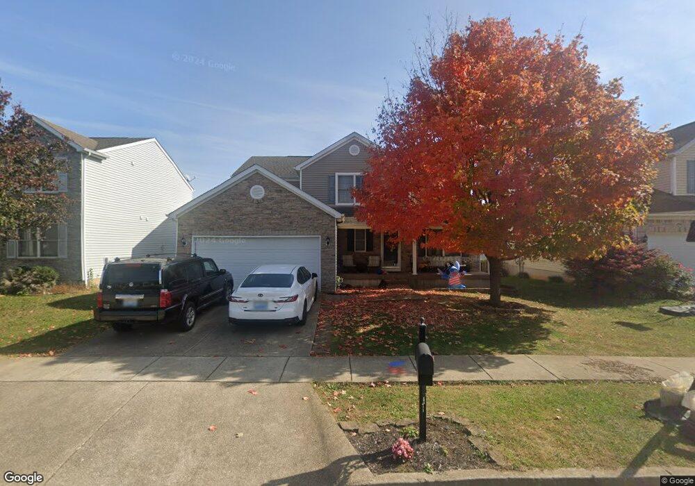
116 Dunn Cir Georgetown, KY 40324
Southeast Scott County NeighborhoodEstimated Value: $352,000 - $390,000
3
Beds
3
Baths
2,200
Sq Ft
$168/Sq Ft
Est. Value
About This Home
This home is located at 116 Dunn Cir, Georgetown, KY 40324 and is currently estimated at $369,087, approximately $167 per square foot. 116 Dunn Cir is a home located in Scott County with nearby schools including Eastern Elementary School, Scott County Middle School, and Scott County High School.
Ownership History
Date
Name
Owned For
Owner Type
Purchase Details
Closed on
Dec 30, 2005
Sold by
Dominion Homes Of Kentucky Ltd
Bought by
Fegley Matthew D and Fegley Andrea M
Current Estimated Value
Home Financials for this Owner
Home Financials are based on the most recent Mortgage that was taken out on this home.
Original Mortgage
$163,480
Outstanding Balance
$89,268
Interest Rate
6.18%
Mortgage Type
New Conventional
Estimated Equity
$279,819
Create a Home Valuation Report for This Property
The Home Valuation Report is an in-depth analysis detailing your home's value as well as a comparison with similar homes in the area
Home Values in the Area
Average Home Value in this Area
Purchase History
| Date | Buyer | Sale Price | Title Company |
|---|---|---|---|
| Fegley Matthew D | $204,350 | None Available |
Source: Public Records
Mortgage History
| Date | Status | Borrower | Loan Amount |
|---|---|---|---|
| Open | Fegley Matthew D | $163,480 |
Source: Public Records
Tax History
| Year | Tax Paid | Tax Assessment Tax Assessment Total Assessment is a certain percentage of the fair market value that is determined by local assessors to be the total taxable value of land and additions on the property. | Land | Improvement |
|---|---|---|---|---|
| 2025 | $2,824 | $317,100 | $0 | $0 |
| 2024 | $2,708 | $301,100 | $0 | $0 |
| 2023 | $2,596 | $286,300 | $48,000 | $238,300 |
| 2022 | $2,070 | $243,400 | $40,000 | $203,400 |
| 2021 | $2,144 | $227,600 | $40,000 | $187,600 |
| 2020 | $1,919 | $223,300 | $40,000 | $183,300 |
| 2019 | $1,879 | $215,300 | $0 | $0 |
| 2018 | $1,804 | $207,900 | $0 | $0 |
| 2017 | $1,739 | $199,480 | $0 | $0 |
| 2016 | $1,581 | $196,314 | $0 | $0 |
| 2015 | $1,544 | $193,000 | $0 | $0 |
| 2014 | $1,556 | $187,700 | $0 | $0 |
| 2011 | $120 | $193,000 | $0 | $0 |
Source: Public Records
Map
Nearby Homes
- 191 Johnstone Trail
- 204 Johnstone Trail
- 206 Johnstone Trail
- 208 Johnstone Trail
- 105 Jennifer Dr
- 122 Johnstone Trail
- 126 Thorndale Dr
- 124 Thorndale Dr
- 140 Dalton Rd
- 101 Rocky Creek Rd
- 3140 Paris Pike
- 136 Wilderness Cove Ln
- 116 Whitman Way Unit 7
- 111 Whitman Way
- 119 Limestone Ln
- 100 River Run Ct
- 139 Limestone Ln
- 118 Oxford Landing Dr
- 176 Oxford Landing Dr
- 120 Oxford Landing Dr
Your Personal Tour Guide
Ask me questions while you tour the home.