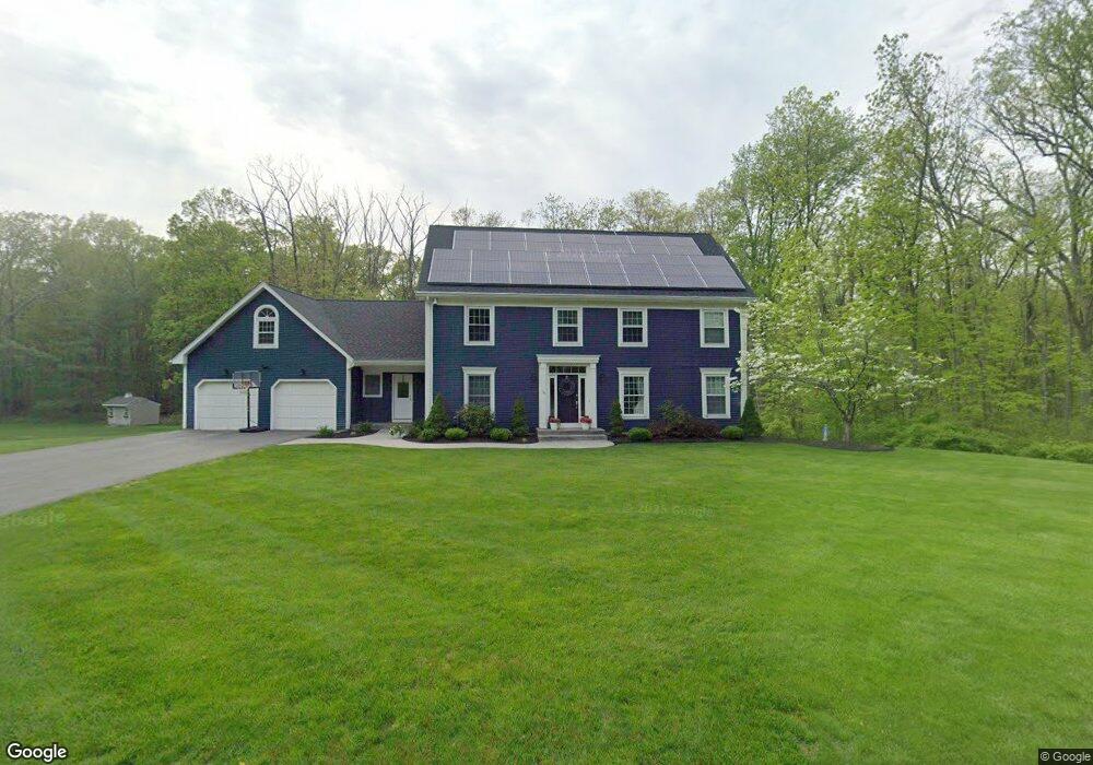
116 Forest Ridge Rd West Springfield, MA 01089
Estimated Value: $673,307 - $741,000
4
Beds
4
Baths
3,068
Sq Ft
$232/Sq Ft
Est. Value
About This Home
This home is located at 116 Forest Ridge Rd, West Springfield, MA 01089 and is currently estimated at $711,827, approximately $232 per square foot. 116 Forest Ridge Rd is a home located in Hampden County with nearby schools including West Springfield High School and St Thomas The Apostle School.
Ownership History
Date
Name
Owned For
Owner Type
Purchase Details
Closed on
Jul 12, 2018
Sold by
Shea Barbara B
Bought by
Hannoush Daniel N
Current Estimated Value
Purchase Details
Closed on
Dec 11, 2003
Sold by
Shea Barbara B
Bought by
Tr Barbara B Sheau and Shea Barbara B
Purchase Details
Closed on
Apr 16, 1991
Sold by
Sabella Edward V
Bought by
Shea Barbara B
Home Financials for this Owner
Home Financials are based on the most recent Mortgage that was taken out on this home.
Original Mortgage
$175,000
Interest Rate
9.32%
Mortgage Type
Purchase Money Mortgage
Purchase Details
Closed on
Mar 21, 1991
Sold by
Sabella Karen
Bought by
Sabella Edward
Home Financials for this Owner
Home Financials are based on the most recent Mortgage that was taken out on this home.
Original Mortgage
$175,000
Interest Rate
9.32%
Mortgage Type
Purchase Money Mortgage
Create a Home Valuation Report for This Property
The Home Valuation Report is an in-depth analysis detailing your home's value as well as a comparison with similar homes in the area
Home Values in the Area
Average Home Value in this Area
Purchase History
| Date | Buyer | Sale Price | Title Company |
|---|---|---|---|
| Hannoush Daniel N | $400,000 | -- | |
| Tr Barbara B Sheau | -- | -- | |
| Shea Barbara B | $315,000 | -- | |
| Sabella Edward | $1,000 | -- |
Source: Public Records
Mortgage History
| Date | Status | Borrower | Loan Amount |
|---|---|---|---|
| Previous Owner | Sabella Edward | $175,000 |
Source: Public Records
Tax History
| Year | Tax Paid | Tax Assessment Tax Assessment Total Assessment is a certain percentage of the fair market value that is determined by local assessors to be the total taxable value of land and additions on the property. | Land | Improvement |
|---|---|---|---|---|
| 2025 | $9,286 | $624,500 | $163,200 | $461,300 |
| 2024 | $8,397 | $567,000 | $163,200 | $403,800 |
| 2023 | $8,166 | $525,500 | $169,200 | $356,300 |
| 2022 | $7,650 | $485,400 | $154,200 | $331,200 |
| 2021 | $7,253 | $429,200 | $163,000 | $266,200 |
| 2020 | $7,195 | $423,500 | $163,000 | $260,500 |
| 2019 | $7,183 | $423,500 | $163,000 | $260,500 |
| 2018 | $7,611 | $446,400 | $163,000 | $283,400 |
| 2017 | $7,611 | $446,400 | $163,000 | $283,400 |
| 2016 | $7,640 | $449,700 | $157,300 | $292,400 |
| 2015 | $7,487 | $440,700 | $154,000 | $286,700 |
| 2014 | $1,822 | $440,700 | $154,000 | $286,700 |
Source: Public Records
Map
Nearby Homes
- 34 High Meadow Dr
- 0 Ahiska Rd Unit 73477754
- 750 Amostown Rd
- 67 Redden Rd
- 10 Beauregard Terrace
- 404 Brush Hill Ave
- 88 Verdugo St
- 117 Sibley Ave
- 240 Morton St
- 65 Verdugo St
- 61 Clarence St
- 242 Eastwood Dr
- 1996 Westfield St
- 62 Talcott Ave
- 36 Shady Brook
- 11 Annie's Way
- 361 Prospect Ave
- 65 Churchill Rd
- 2 Windpath E
- 103 Woodcliff Dr
- 132 Forest Ridge Rd
- 111 Forest Ridge Rd
- 100 Forest Ridge Rd
- 146 Forest Ridge Rd
- 85 Forest Ridge Rd
- 127 Forest Ridge Rd
- 86 Forest Ridge Rd
- 162 Forest Ridge Rd
- 145 Forest Ridge Rd
- 65 Forest Ridge Rd
- 70 Forest Ridge Rd
- 42 Timber Ridge Rd
- 49 Timber Ridge Rd
- 54 Forest Ridge Rd
- 45 Forest Ridge Rd
- 40 Forest Ridge Rd
- 39 Timber Ridge Rd
- 28 Timber Ridge Rd
- 27 Forest Ridge Rd
- 530 Bear Hole Rd
Your Personal Tour Guide
Ask me questions while you tour the home.