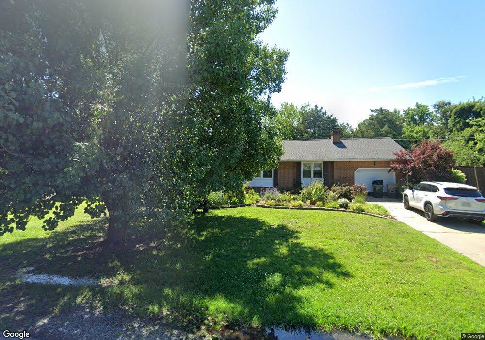
116 Forrest Rd Poquoson, VA 23662
Poquoson West NeighborhoodEstimated Value: $401,000 - $454,000
3
Beds
2
Baths
1,800
Sq Ft
$233/Sq Ft
Est. Value
About This Home
This home is located at 116 Forrest Rd, Poquoson, VA 23662 and is currently estimated at $418,751, approximately $232 per square foot. 116 Forrest Rd is a home located in Poquoson City with nearby schools including Summit Christian Academy - Upper School.
Ownership History
Date
Name
Owned For
Owner Type
Purchase Details
Closed on
Jul 5, 2007
Sold by
Liddle Thomas A
Bought by
Brewer Teddy I
Current Estimated Value
Home Financials for this Owner
Home Financials are based on the most recent Mortgage that was taken out on this home.
Original Mortgage
$32,000
Interest Rate
6.54%
Mortgage Type
Purchase Money Mortgage
Purchase Details
Closed on
Nov 4, 1999
Sold by
Mitchell Ronald A
Bought by
Liddle Thomas H
Home Financials for this Owner
Home Financials are based on the most recent Mortgage that was taken out on this home.
Original Mortgage
$144,050
Interest Rate
7.77%
Create a Home Valuation Report for This Property
The Home Valuation Report is an in-depth analysis detailing your home's value as well as a comparison with similar homes in the area
Home Values in the Area
Average Home Value in this Area
Purchase History
| Date | Buyer | Sale Price | Title Company |
|---|---|---|---|
| Brewer Teddy I | $320,000 | -- | |
| Liddle Thomas H | $139,900 | -- |
Source: Public Records
Mortgage History
| Date | Status | Borrower | Loan Amount |
|---|---|---|---|
| Closed | Brewer Teddy I | $32,000 | |
| Open | Brewer Teddy I | $272,000 | |
| Previous Owner | Liddle Thomas H | $144,050 |
Source: Public Records
Tax History Compared to Growth
Tax History
| Year | Tax Paid | Tax Assessment Tax Assessment Total Assessment is a certain percentage of the fair market value that is determined by local assessors to be the total taxable value of land and additions on the property. | Land | Improvement |
|---|---|---|---|---|
| 2025 | $3,715 | $325,900 | $120,400 | $205,500 |
| 2024 | $3,667 | $321,700 | $103,300 | $218,400 |
| 2023 | $3,571 | $321,700 | $103,300 | $218,400 |
| 2022 | $3,445 | $304,900 | $103,300 | $201,600 |
| 2021 | $3,445 | $304,900 | $103,300 | $201,600 |
| 2020 | -- | $286,300 | $103,300 | $183,000 |
| 2019 | -- | $286,300 | $103,300 | $183,000 |
| 2018 | -- | $273,200 | $103,300 | $169,900 |
| 2017 | -- | $258,300 | $103,300 | $155,000 |
| 2016 | -- | $258,300 | $103,300 | $155,000 |
| 2015 | -- | $245,900 | $103,300 | $142,600 |
| 2013 | -- | $245,900 | $103,300 | $142,600 |
Source: Public Records
Map
Nearby Homes
- 7 Quail Cove
- 3 Carmines Ct
- 7 Carmines Ct
- 8 White House Dr
- 105 Rens Rd Unit 74
- 105 Rens Rd Unit 2
- 21 Rens Rd
- 1020 Poquoson Ave Unit C
- 1020 Poquoson Ave
- 8.5AC Poquoson Ave
- 54 N Lawson Rd
- 9 Rhodelia Ln
- 106 Blue Crab Dr
- 52 N Lawson Rd
- 50 N Lawson Rd
- 1 Phillips Rd
- 7 Dove Point Trail
- 15+AC Browns Neck Rd
- 216 Little Florida Rd
- 24 Holly St