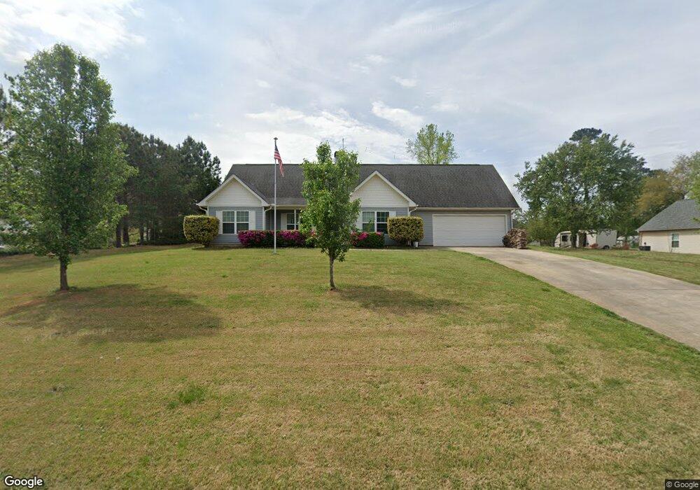
116 Forrest Ridge Dr McDonough, GA 30252
Estimated Value: $269,346 - $294,000
3
Beds
2
Baths
1,652
Sq Ft
$169/Sq Ft
Est. Value
About This Home
This home is located at 116 Forrest Ridge Dr, McDonough, GA 30252 and is currently estimated at $278,837, approximately $168 per square foot. 116 Forrest Ridge Dr is a home located in Henry County with nearby schools including Tussahaw Elementary School, McDonough Middle School, and New Creation Christian Academy.
Ownership History
Date
Name
Owned For
Owner Type
Purchase Details
Closed on
Apr 26, 2005
Sold by
Mw Kendall Construction Co Inc
Bought by
Bigham John L
Current Estimated Value
Home Financials for this Owner
Home Financials are based on the most recent Mortgage that was taken out on this home.
Original Mortgage
$132,905
Outstanding Balance
$69,517
Interest Rate
5.99%
Mortgage Type
New Conventional
Estimated Equity
$209,320
Purchase Details
Closed on
Feb 20, 2004
Sold by
Bunn Andrew C
Bought by
Mw Kendall Constr Co Inc
Home Financials for this Owner
Home Financials are based on the most recent Mortgage that was taken out on this home.
Original Mortgage
$101,175
Interest Rate
5.63%
Create a Home Valuation Report for This Property
The Home Valuation Report is an in-depth analysis detailing your home's value as well as a comparison with similar homes in the area
Home Values in the Area
Average Home Value in this Area
Purchase History
| Date | Buyer | Sale Price | Title Company |
|---|---|---|---|
| Bigham John L | $139,900 | -- | |
| Mw Kendall Constr Co Inc | $32,000 | -- |
Source: Public Records
Mortgage History
| Date | Status | Borrower | Loan Amount |
|---|---|---|---|
| Open | Bigham John L | $132,905 | |
| Previous Owner | Mw Kendall Constr Co Inc | $101,175 |
Source: Public Records
Tax History Compared to Growth
Tax History
| Year | Tax Paid | Tax Assessment Tax Assessment Total Assessment is a certain percentage of the fair market value that is determined by local assessors to be the total taxable value of land and additions on the property. | Land | Improvement |
|---|---|---|---|---|
| 2025 | $1,209 | $97,920 | $14,000 | $83,920 |
| 2024 | $1,209 | $106,600 | $14,000 | $92,600 |
| 2023 | $2,170 | $102,440 | $14,800 | $87,640 |
| 2022 | $2,376 | $89,800 | $14,800 | $75,000 |
| 2021 | $1,831 | $66,720 | $14,800 | $51,920 |
| 2020 | $2,090 | $61,080 | $12,000 | $49,080 |
| 2019 | $2,002 | $57,360 | $12,000 | $45,360 |
| 2018 | $1,980 | $56,440 | $10,800 | $45,640 |
| 2016 | $1,718 | $49,320 | $10,000 | $39,320 |
| 2015 | -- | $47,600 | $8,000 | $39,600 |
| 2014 | $1,600 | $44,920 | $8,000 | $36,920 |
Source: Public Records
Map
Nearby Homes
- 224 Osier Dr
- 175 Osier Dr
- 450 Noblewood Dr
- 446 Noblewood Dr
- 435 Noblewood Dr
- 420 Tavistock Ct
- 168 Osier Dr
- 150 Whitaker Rd
- 308 Stallings Dr
- 0 Nail Mill Rd
- 103 Royal Way
- 0 King Mill Rd Unit 10647914
- 0 King Mill Rd Unit 7684355
- 205 Calvery Way
- 628 Stevens Place
- 1171 King Mill Rd
- 150 Sterling Ave
- 6195 Winston Trace
- 9054 Dawes Crossing
- 80 Wise Rd
- 112 Forrest Ridge Dr
- 120 Forrest Ridge Dr
- 225 Courtlyn Way
- 225 Courtlyn Way Unit 1
- 108 Forrest Ridge Dr
- 124 Forrest Ridge Dr
- 200 Hastings Ct
- 301 Fletcher Ct
- 401 Tavistock Ct
- 500 Redchurch Dr
- 455 Noblewood Dr
- 419 Tavistock Ct
- 180 Osier Dr
- 400 Tavistock Ct
- 400 Guildhouse Dr
- 429 Bartlett Way
- 244 Osier Dr
- 267 Osier Dr
- 517 Redchurch Dr
- 416 Bartlett Way