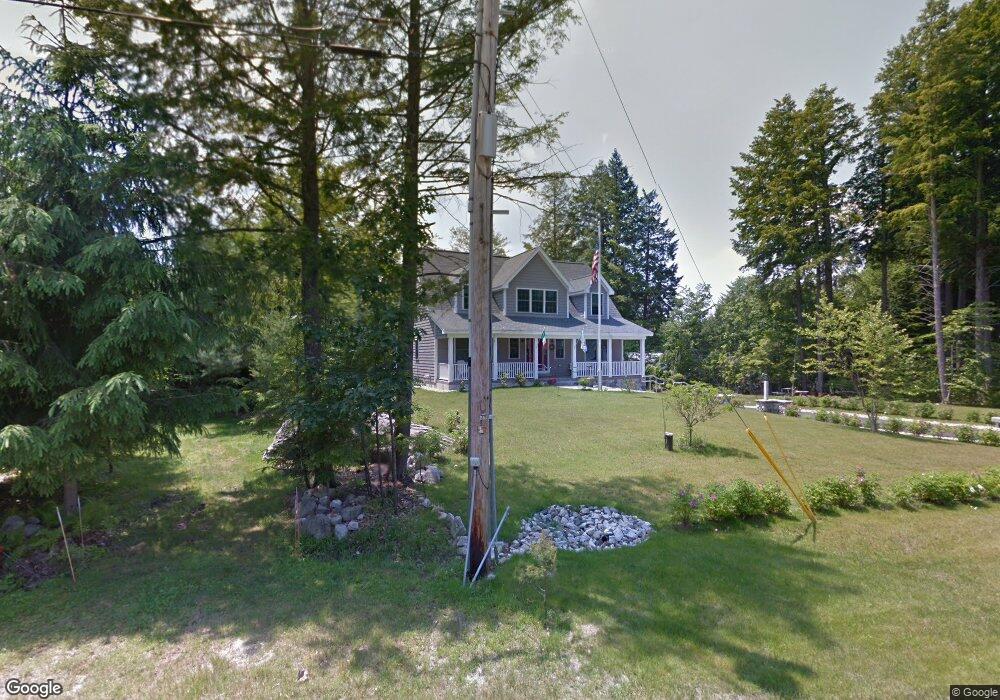
116 Hearthside Rd Standish, ME 04084
North Gorham NeighborhoodEstimated Value: $928,000 - $1,095,000
4
Beds
4
Baths
2,464
Sq Ft
$407/Sq Ft
Est. Value
About This Home
This home is located at 116 Hearthside Rd, Standish, ME 04084 and is currently estimated at $1,002,980, approximately $407 per square foot. 116 Hearthside Rd is a home located in Cumberland County with nearby schools including Bonny Eagle High School and Windham Christian Academy.
Ownership History
Date
Name
Owned For
Owner Type
Purchase Details
Closed on
Aug 28, 2019
Sold by
Natale Julie
Bought by
Lapomarda Pasquale
Current Estimated Value
Home Financials for this Owner
Home Financials are based on the most recent Mortgage that was taken out on this home.
Original Mortgage
$217,500
Outstanding Balance
$191,288
Interest Rate
3.8%
Mortgage Type
New Conventional
Estimated Equity
$811,692
Purchase Details
Closed on
Jan 12, 2018
Sold by
Lapomarda Pasquale Jr Est
Bought by
Pasquale Lapomarda T
Purchase Details
Closed on
Jul 28, 2015
Sold by
Lapomarda Gaye B Est
Bought by
Lapomarda Pasquale
Create a Home Valuation Report for This Property
The Home Valuation Report is an in-depth analysis detailing your home's value as well as a comparison with similar homes in the area
Home Values in the Area
Average Home Value in this Area
Purchase History
| Date | Buyer | Sale Price | Title Company |
|---|---|---|---|
| Lapomarda Pasquale | -- | -- | |
| Pasquale Lapomarda T | -- | -- | |
| Lapomarda Pasquale | -- | -- |
Source: Public Records
Mortgage History
| Date | Status | Borrower | Loan Amount |
|---|---|---|---|
| Open | Lapomarda Pasquale | $217,500 |
Source: Public Records
Tax History
| Year | Tax Paid | Tax Assessment Tax Assessment Total Assessment is a certain percentage of the fair market value that is determined by local assessors to be the total taxable value of land and additions on the property. | Land | Improvement |
|---|---|---|---|---|
| 2024 | $9,213 | $731,200 | $272,600 | $458,600 |
| 2023 | $7,854 | $567,100 | $206,700 | $360,400 |
| 2022 | $7,028 | $486,400 | $166,000 | $320,400 |
| 2021 | $6,854 | $456,900 | $151,600 | $305,300 |
| 2019 | $6,325 | $442,300 | $145,800 | $296,500 |
| 2018 | $5,313 | $431,400 | $134,900 | $296,500 |
| 2017 | $3,231 | $431,400 | $134,900 | $296,500 |
| 2016 | $5,531 | $431,400 | $134,900 | $296,500 |
| 2015 | $5,518 | $431,400 | $134,900 | $296,500 |
| 2014 | $5,242 | $431,400 | $134,900 | $296,500 |
| 2013 | -- | $431,400 | $134,900 | $296,500 |
Source: Public Records
Map
Nearby Homes
- 194 Hearthside Rd
- 72 Sand Beach Rd
- 103 Basin Rd
- 96 Mineral Spring Rd
- 34 Trails End Rd
- 6 Gilman Rd
- 32 Patriot Place
- 1042 Roosevelt Trail
- 34 Robin Ln
- 10 Abby Rd
- 75 Tandberg Trail
- 99 Enterprise Dr
- 5 Cardinal Ln
- 55 Page Rd
- 1 Matinicus Way Unit 1
- lot #8 Bedrock Terrace
- 1083 Roosevelt Trail
- 0 Turning Leaf Dr Unit 1640377
- 5 Sandbar Rd
- 32 Middle Jam Rd
- 110 Hearthside Rd
- 136 Hearthside Rd
- 124 Hearthside Rd
- 140 Hearthside Rd
- 113 Hearthside Rd
- 114 Hearthside Rd
- 119 Hearthside Rd
- 210 Hearthside Rd
- 199 Hearthside Rd
- 105 Hearthside Rd
- 144 Hearthside Rd
- 98 Hearthside Rd
- 135 Hearthside Rd
- 152 Hearthside Rd
- 129 Hearthside Rd
- 97 Hearthside Rd
- 198 Hearthside Rd
- 127 Hearthside Rd
- 206 Hearthside Rd
- 91 Hearthside Rd
Your Personal Tour Guide
Ask me questions while you tour the home.