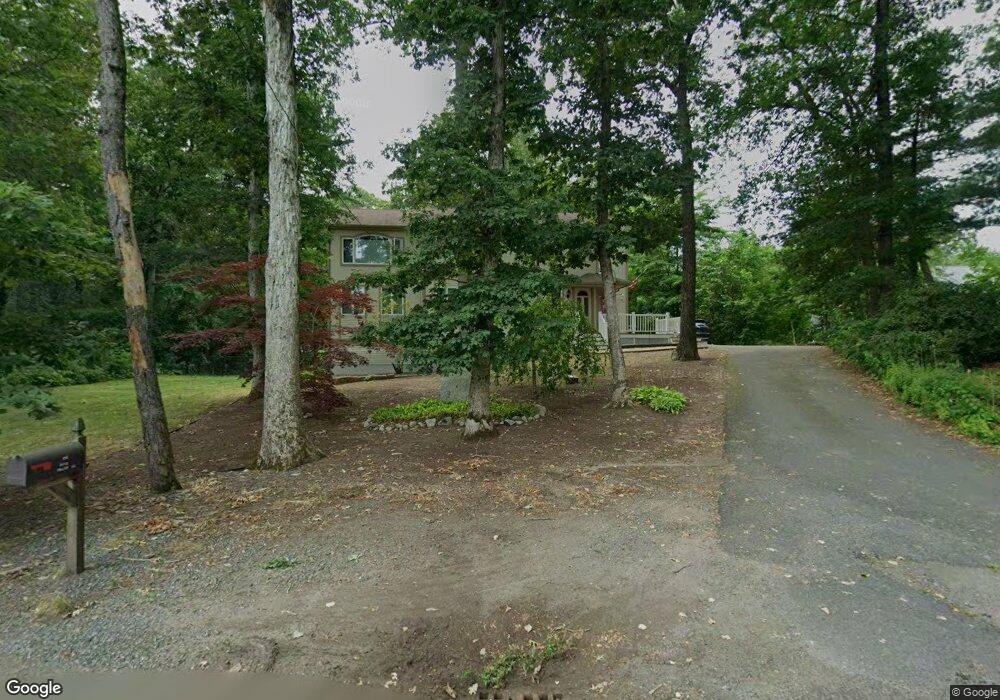
116 King Philip Rd Norton, MA 02766
Estimated Value: $607,000 - $708,000
4
Beds
3
Baths
2,370
Sq Ft
$286/Sq Ft
Est. Value
About This Home
This home is located at 116 King Philip Rd, Norton, MA 02766 and is currently estimated at $678,901, approximately $286 per square foot. 116 King Philip Rd is a home located in Bristol County with nearby schools including L.G. Nourse Elementary School, Henri A. Yelle Elementary School, and Norton Middle School.
Ownership History
Date
Name
Owned For
Owner Type
Purchase Details
Closed on
Jul 12, 2016
Sold by
Hargreaves Michael S
Bought by
Collier Pamela L
Current Estimated Value
Home Financials for this Owner
Home Financials are based on the most recent Mortgage that was taken out on this home.
Original Mortgage
$293,600
Outstanding Balance
$184,976
Interest Rate
3.64%
Mortgage Type
New Conventional
Estimated Equity
$493,925
Purchase Details
Closed on
Jun 16, 2009
Sold by
Fhlmc
Bought by
Collier Pamela L and Hargreaves Michael S
Home Financials for this Owner
Home Financials are based on the most recent Mortgage that was taken out on this home.
Original Mortgage
$289,987
Interest Rate
4.82%
Mortgage Type
Purchase Money Mortgage
Purchase Details
Closed on
Apr 14, 2009
Sold by
Casper Jon T and Taylor Bean
Bought by
Fhlmc
Purchase Details
Closed on
Feb 18, 1994
Sold by
Martin David N and Martin Joyce
Bought by
Lapointe Norma J
Create a Home Valuation Report for This Property
The Home Valuation Report is an in-depth analysis detailing your home's value as well as a comparison with similar homes in the area
Home Values in the Area
Average Home Value in this Area
Purchase History
| Date | Buyer | Sale Price | Title Company |
|---|---|---|---|
| Collier Pamela L | -- | -- | |
| Collier Pamela L | $300,000 | -- | |
| Fhlmc | $411,145 | -- | |
| Lapointe Norma J | $133,000 | -- |
Source: Public Records
Mortgage History
| Date | Status | Borrower | Loan Amount |
|---|---|---|---|
| Open | Collier Pamela L | $293,600 | |
| Previous Owner | Collier Pamela L | $289,987 | |
| Previous Owner | Lapointe Norma J | $192,553 | |
| Previous Owner | Lapointe Norma J | $15,000 |
Source: Public Records
Tax History Compared to Growth
Tax History
| Year | Tax Paid | Tax Assessment Tax Assessment Total Assessment is a certain percentage of the fair market value that is determined by local assessors to be the total taxable value of land and additions on the property. | Land | Improvement |
|---|---|---|---|---|
| 2025 | $77 | $590,800 | $169,600 | $421,200 |
| 2024 | $7,420 | $573,000 | $161,500 | $411,500 |
| 2023 | $7,095 | $546,200 | $152,400 | $393,800 |
| 2022 | $6,831 | $479,000 | $138,500 | $340,500 |
| 2021 | $6,623 | $443,600 | $146,600 | $297,000 |
| 2020 | $6,432 | $434,600 | $142,300 | $292,300 |
| 2019 | $6,233 | $418,300 | $136,900 | $281,400 |
| 2018 | $5,865 | $386,900 | $136,900 | $250,000 |
| 2017 | $5,877 | $382,400 | $136,900 | $245,500 |
| 2016 | $5,631 | $360,700 | $136,900 | $223,800 |
| 2015 | $5,471 | $355,500 | $134,200 | $221,300 |
| 2014 | $5,250 | $341,600 | $127,800 | $213,800 |
Source: Public Records
Map
Nearby Homes
- 127 King Philip Rd
- 30 Samoset St
- 145 Burt St Unit 1
- 4 Stanley Rd
- 132 S Washington St Unit 132
- 139 Burt St Unit 6
- 260 S Washington St
- 17 Lloyd Cir Unit 36
- 24 Lloyd Cir Unit 34
- 16 Lloyd Cir Unit 30
- 135 S Washington St
- Lot 3B Hill St
- O Leonard St
- 1 Carlton Dr
- 38 S Washington St
- 14 Downing Dr
- 195 E Main St
- 15 S Washington St
- 0 S Washington St Unit 73437419
- 152 Pine St Unit 23
- 112 King Philip Rd
- 118 King Philip Rd
- 115 King Philip Rd
- 117 King Philip Rd
- 113 King Philip Rd
- 123 King Philip Rd
- 111 King Philip Rd
- 114 King Philip Rd
- 109 King Philip Rd
- 127 King Philip Rd
- 129 King Philip Rd
- 107A King Philip Rd
- 107 King Philip Rd
- 110 King Philip Rd
- 105 King Philip Rd
- 131 King Philip Rd
- 103 King Philip Rd
- 106 King Philip Rd
- 106 King Philip Rd Unit 106
- 101 King Philip Rd