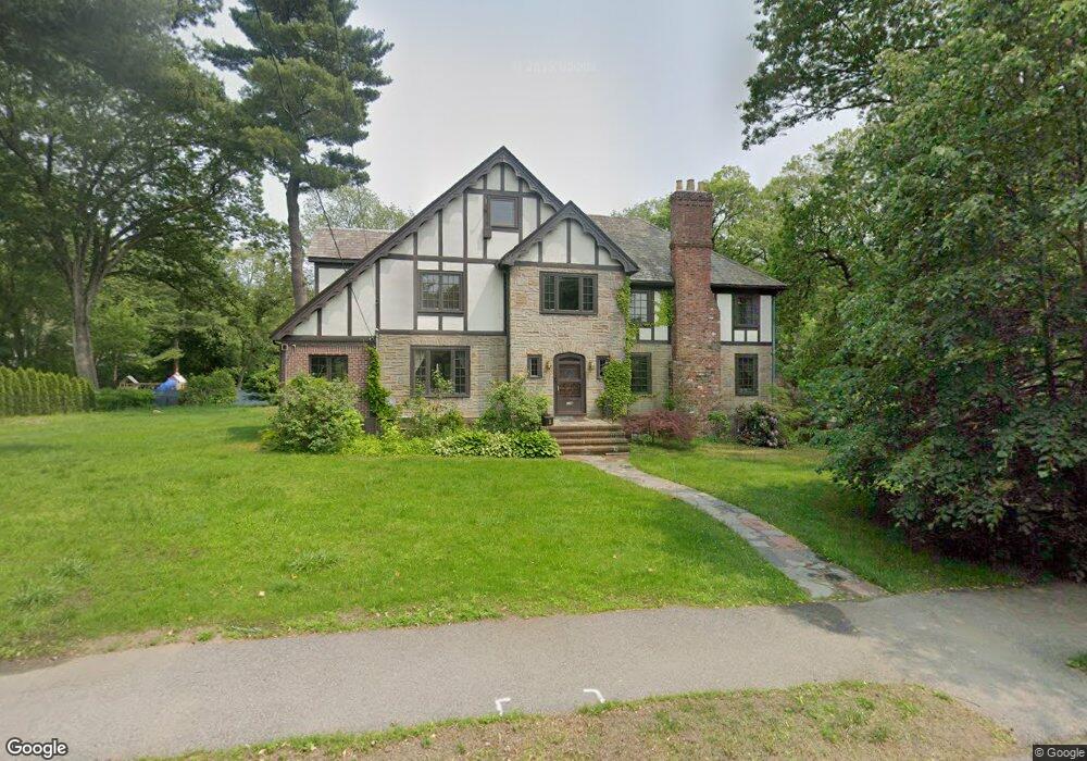
116 Lagrange St Chestnut Hill, MA 02467
South Brookline NeighborhoodEstimated Value: $2,415,391 - $2,740,000
5
Beds
5
Baths
3,733
Sq Ft
$674/Sq Ft
Est. Value
About This Home
This home is located at 116 Lagrange St, Chestnut Hill, MA 02467 and is currently estimated at $2,517,598, approximately $674 per square foot. 116 Lagrange St is a home located in Norfolk County with nearby schools including Baker School, Brookline High School, and Mount Alvernia Academy.
Ownership History
Date
Name
Owned For
Owner Type
Purchase Details
Closed on
Aug 15, 2008
Sold by
Thompson Meta E
Bought by
Hong Jung H and Hong Soon C
Current Estimated Value
Home Financials for this Owner
Home Financials are based on the most recent Mortgage that was taken out on this home.
Original Mortgage
$400,000
Outstanding Balance
$263,432
Interest Rate
6.4%
Mortgage Type
Purchase Money Mortgage
Estimated Equity
$2,254,166
Create a Home Valuation Report for This Property
The Home Valuation Report is an in-depth analysis detailing your home's value as well as a comparison with similar homes in the area
Home Values in the Area
Average Home Value in this Area
Purchase History
| Date | Buyer | Sale Price | Title Company |
|---|---|---|---|
| Hong Jung H | $983,000 | -- |
Source: Public Records
Mortgage History
| Date | Status | Borrower | Loan Amount |
|---|---|---|---|
| Open | Hong Jung H | $400,000 |
Source: Public Records
Tax History
| Year | Tax Paid | Tax Assessment Tax Assessment Total Assessment is a certain percentage of the fair market value that is determined by local assessors to be the total taxable value of land and additions on the property. | Land | Improvement |
|---|---|---|---|---|
| 2025 | $20,548 | $2,081,900 | $1,082,700 | $999,200 |
| 2024 | $19,612 | $2,007,400 | $1,041,000 | $966,400 |
| 2023 | $19,471 | $1,953,000 | $843,900 | $1,109,100 |
| 2022 | $18,954 | $1,860,100 | $803,800 | $1,056,300 |
| 2021 | $17,137 | $1,748,700 | $772,900 | $975,800 |
| 2020 | $15,755 | $1,667,200 | $702,600 | $964,600 |
| 2019 | $14,877 | $1,587,700 | $669,100 | $918,600 |
| 2018 | $13,853 | $1,464,400 | $652,900 | $811,500 |
| 2017 | $13,650 | $1,381,600 | $616,000 | $765,600 |
| 2016 | $13,454 | $1,291,200 | $575,700 | $715,500 |
| 2015 | $12,886 | $1,206,600 | $537,900 | $668,700 |
| 2014 | $12,556 | $1,102,400 | $494,300 | $608,100 |
Source: Public Records
Map
Nearby Homes
- 50-56 Broadlawn Park Unit 221
- 44 Broadlawn Park Unit 22
- 36 Westgate Rd Unit 1
- 42 Bryon Rd Unit 6
- 60 Bryon Rd Unit 1
- 58 Bryon Rd Unit 6
- 66 Brookline St
- 66 Bryon Rd Unit 2
- 70 Pond Brook Rd
- 60 Alberta Rd
- 72 Wallis Rd
- 16 Dorcar Rd
- 1125 W Roxbury Pkwy
- 17 Tirrell Crescent
- 36 Goodnough Rd
- 55 Bellingham Rd
- 931 Lagrange St
- 91 Grove St
- 923 Lagrange St
- 701 Vfw Pkwy
- 102 Princeton Rd
- 104 Lagrange St
- 70 Princeton Rd
- 130 Lagrange St
- 110 Princeton Rd
- 101 Princeton Rd
- 98 Lagrange St
- 79 Princeton Rd
- 101 Lagrange St
- 118 Princeton Rd
- 142 Lagrange St
- 111 Princeton Rd
- 135 Lagrange St
- 78 Lagrange St
- 60 Princeton Rd
- 37 Beverly Rd
- 145 Lagrange St
- 29 Beverly Rd
- 53 Beverly Rd
- 91 Lagrange St