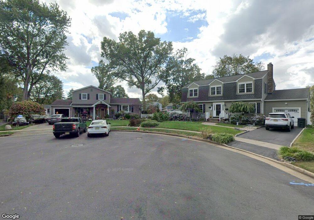
116 Linke Ct South Plainfield, NJ 07080
Estimated Value: $600,602 - $698,000
--
Bed
--
Bath
1,704
Sq Ft
$395/Sq Ft
Est. Value
About This Home
This home is located at 116 Linke Ct, South Plainfield, NJ 07080 and is currently estimated at $672,651, approximately $394 per square foot. 116 Linke Ct is a home located in Middlesex County with nearby schools including South Plainfield High School, The Queen City Academy Charter School, and Koinonia Academy.
Ownership History
Date
Name
Owned For
Owner Type
Purchase Details
Closed on
Nov 27, 2001
Sold by
Settles Mary
Bought by
Vargas Leonard and Vargas Judy
Current Estimated Value
Home Financials for this Owner
Home Financials are based on the most recent Mortgage that was taken out on this home.
Original Mortgage
$242,250
Outstanding Balance
$94,449
Interest Rate
6.54%
Estimated Equity
$578,202
Create a Home Valuation Report for This Property
The Home Valuation Report is an in-depth analysis detailing your home's value as well as a comparison with similar homes in the area
Home Values in the Area
Average Home Value in this Area
Purchase History
| Date | Buyer | Sale Price | Title Company |
|---|---|---|---|
| Vargas Leonard | $268,000 | -- |
Source: Public Records
Mortgage History
| Date | Status | Borrower | Loan Amount |
|---|---|---|---|
| Open | Vargas Leonard | $242,250 |
Source: Public Records
Tax History Compared to Growth
Tax History
| Year | Tax Paid | Tax Assessment Tax Assessment Total Assessment is a certain percentage of the fair market value that is determined by local assessors to be the total taxable value of land and additions on the property. | Land | Improvement |
|---|---|---|---|---|
| 2025 | $10,368 | $148,500 | $35,800 | $112,700 |
| 2024 | $9,917 | $148,500 | $35,800 | $112,700 |
| 2023 | $9,917 | $148,500 | $35,800 | $112,700 |
| 2022 | $9,794 | $148,500 | $35,800 | $112,700 |
| 2021 | $9,563 | $148,500 | $35,800 | $112,700 |
| 2020 | $9,424 | $148,500 | $35,800 | $112,700 |
| 2019 | $8,062 | $132,400 | $35,800 | $96,600 |
| 2018 | $7,854 | $132,400 | $35,800 | $96,600 |
| 2017 | $7,753 | $132,400 | $35,800 | $96,600 |
| 2016 | $7,675 | $132,400 | $35,800 | $96,600 |
| 2015 | $7,543 | $132,400 | $35,800 | $96,600 |
| 2014 | $7,326 | $132,400 | $35,800 | $96,600 |
Source: Public Records
Map
Nearby Homes
- 1726 Kenyon Ave
- 1712 Kenyon Ave
- 1400 Kenyon Ave
- 533 Edgar Ave
- 127 Remington Ave Unit 31
- 105 Firth St
- 1210 Field Ave
- 260 Merchants Ave
- 241 Van Fleet Ave
- 132 Parkside Rd
- 77 Parkside Rd Unit 89
- 1066 Allenwood Dr
- 1221 Grant Ave Unit 23
- 1210 Maltby Ave
- 551 Melrose Ave
- 917 Tompkins Ave
- 909 Sherman Ave
- 1905 Park Ave
- 814 Sherman Ave Unit 18
- 139 Palmer Ave
- 112 Linke Ct
- 120 Linke Ct
- 1718 Wickford Rd
- 1714 Wickford Rd
- 1722 Wickford Rd
- 108 Linke Ct
- 1710 Wickford Rd
- 1726 Wickford Rd
- 1736 Kenyon Ave
- 1717 Wickford Rd
- 104 Linke Ct
- 1706 Wickford Rd
- 1721 Wickford Rd
- 1730 Kenyon Ave
- 302 Bolliger Way
- 1740 Kenyon Ave
- 1730 Wickford Rd
- 306 Bolliger Way
- 1713 Wickford Rd
- 1722 Kenyon Ave