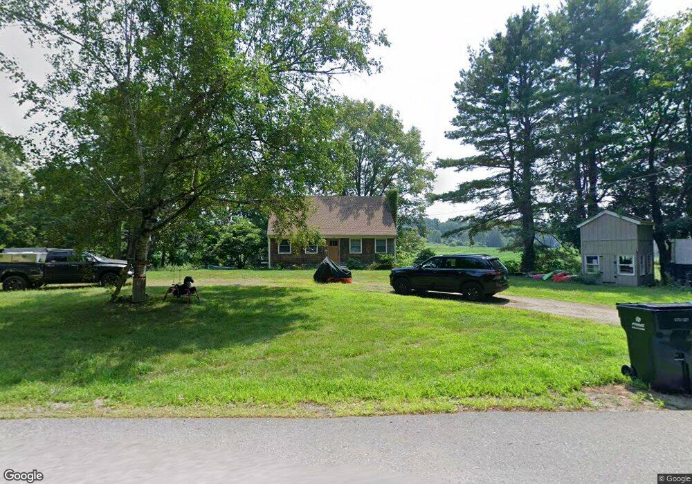
116 Littleton County Rd Harvard, MA 01451
Estimated Value: $502,000 - $792,000
3
Beds
3
Baths
1,469
Sq Ft
$437/Sq Ft
Est. Value
About This Home
This home is located at 116 Littleton County Rd, Harvard, MA 01451 and is currently estimated at $642,309, approximately $437 per square foot. 116 Littleton County Rd is a home located in Worcester County.
Ownership History
Date
Name
Owned For
Owner Type
Purchase Details
Closed on
Mar 14, 2014
Sold by
Carlson Robert W
Bought by
Carlson Robert W and Carlson Elizabeth L
Current Estimated Value
Purchase Details
Closed on
May 1, 1970
Bought by
Carlson Robert W and Carlson Elizabeth L
Create a Home Valuation Report for This Property
The Home Valuation Report is an in-depth analysis detailing your home's value as well as a comparison with similar homes in the area
Home Values in the Area
Average Home Value in this Area
Purchase History
| Date | Buyer | Sale Price | Title Company |
|---|---|---|---|
| Carlson Robert W | -- | -- | |
| Carlson Robert W | -- | -- |
Source: Public Records
Mortgage History
| Date | Status | Borrower | Loan Amount |
|---|---|---|---|
| Previous Owner | Carlson Robert W | $125,000 | |
| Previous Owner | Carlson Robert W | $100,000 |
Source: Public Records
Tax History Compared to Growth
Tax History
| Year | Tax Paid | Tax Assessment Tax Assessment Total Assessment is a certain percentage of the fair market value that is determined by local assessors to be the total taxable value of land and additions on the property. | Land | Improvement |
|---|---|---|---|---|
| 2025 | $7,512 | $480,000 | $269,000 | $211,000 |
| 2024 | $7,198 | $483,100 | $269,000 | $214,100 |
| 2023 | $7,386 | $444,700 | $249,100 | $195,600 |
| 2022 | $6,980 | $389,700 | $235,000 | $154,700 |
| 2021 | $0 | $373,100 | $235,000 | $138,100 |
| 2020 | $6,365 | $344,600 | $235,000 | $109,600 |
| 2019 | $5,963 | $342,300 | $235,000 | $107,300 |
| 2018 | $6,723 | $352,400 | $235,000 | $117,400 |
| 2017 | $5,622 | $310,600 | $195,000 | $115,600 |
| 2016 | $5,592 | $309,800 | $195,000 | $114,800 |
| 2015 | $5,663 | $318,300 | $191,000 | $127,300 |
| 2014 | $5,399 | $315,900 | $188,600 | $127,300 |
Source: Public Records
Map
Nearby Homes
- 220 Swanson Rd Unit 605
- 220 Swanson Rd Unit 606
- 220 Swanson Rd Unit 604
- 176 Swanson Rd Unit 309
- 166 Littleton Rd Unit 3
- 50 Spencer Rd Unit 36
- 42 Swanson Ct Unit 14A
- 58 Spencer Rd Unit 18K
- 53 Swanson Ct Unit 36C
- 24 Fairbanks St
- 11 Fairbanks St Unit 2
- 5 Fairbank St
- 332 Old Littleton Rd
- 87 Ayer Rd
- 310 Codman Hill Rd Unit 35D
- 139 Picnic St
- 1155 Burroughs Rd
- 18A S Shaker Rd
- 63 Leonard Rd Unit 63
- 45 S Shaker Rd
- 115 Littleton County Rd
- 111 Littleton County Rd
- 107 Littleton County Rd
- 39 Cleaves Hill Rd
- 37 Cleaves Hill Rd
- 86 Littleton County Rd
- 27 Cleaves Hill Rd
- 88 Littleton County Rd
- 20 Cleaves Hill Rd
- 16 Old Schoolhouse Rd
- 114 Littleton County Rd
- 146 Littleton County Rd
- 84 Littleton County Rd
- 20 Pinnacle Rd
- 28 Pinnacle Rd
- 9 Old Schoolhouse Rd
- 6 Old Schoolhouse Rd
- 32 Pinnacle Rd
- 184 Old Littleton Rd
- 21 Cleaves Hill Rd