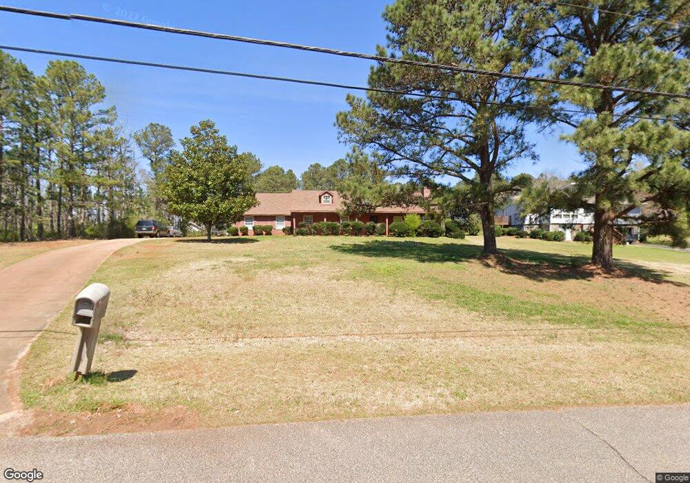
116 Meadowland Trail Lagrange, GA 30240
Estimated Value: $241,000 - $256,000
3
Beds
2
Baths
1,566
Sq Ft
$159/Sq Ft
Est. Value
About This Home
This home is located at 116 Meadowland Trail, Lagrange, GA 30240 and is currently estimated at $249,701, approximately $159 per square foot. 116 Meadowland Trail is a home located in Troup County with nearby schools including Franklin Forest Elementary School, Hillcrest Elementary School, and Hollis Hand Elementary School.
Ownership History
Date
Name
Owned For
Owner Type
Purchase Details
Closed on
Aug 18, 1986
Sold by
Chapelgate Properties Inc
Bought by
Leckrone Daniel A
Current Estimated Value
Purchase Details
Closed on
Mar 1, 1986
Sold by
Family Properties Inc
Bought by
Chapelgate Properties Inc
Purchase Details
Closed on
Jan 1, 1901
Bought by
Family Properties Inc
Create a Home Valuation Report for This Property
The Home Valuation Report is an in-depth analysis detailing your home's value as well as a comparison with similar homes in the area
Home Values in the Area
Average Home Value in this Area
Purchase History
| Date | Buyer | Sale Price | Title Company |
|---|---|---|---|
| Leckrone Daniel A | $71,500 | -- | |
| Chapelgate Properties Inc | $7,000 | -- | |
| Family Properties Inc | -- | -- |
Source: Public Records
Tax History Compared to Growth
Tax History
| Year | Tax Paid | Tax Assessment Tax Assessment Total Assessment is a certain percentage of the fair market value that is determined by local assessors to be the total taxable value of land and additions on the property. | Land | Improvement |
|---|---|---|---|---|
| 2024 | $1,845 | $67,640 | $14,000 | $53,640 |
| 2023 | $1,625 | $59,600 | $10,000 | $49,600 |
| 2022 | $1,590 | $56,960 | $10,000 | $46,960 |
| 2021 | $1,559 | $51,680 | $10,000 | $41,680 |
| 2020 | $1,559 | $51,680 | $10,000 | $41,680 |
| 2019 | $1,087 | $36,040 | $3,600 | $32,440 |
| 2018 | $998 | $33,080 | $3,600 | $29,480 |
| 2017 | $998 | $33,080 | $3,600 | $29,480 |
| 2016 | $1,002 | $33,238 | $3,600 | $29,638 |
| 2015 | $1,004 | $33,238 | $3,600 | $29,638 |
| 2014 | $959 | $31,678 | $3,600 | $28,078 |
| 2013 | -- | $32,684 | $3,600 | $29,084 |
Source: Public Records
Map
Nearby Homes
- 127 Oakmont Dr
- 91 Richmond Dr
- 127 Ashling Dr
- 104 Hidden Branches Ln
- 89 Chase Rd
- 1784 New Franklin Rd
- LOT 106 River Oaks Dr
- 105 Ridgeview Dr
- 118 Moss Creek Dr
- 209 River Oaks Dr
- 107 Windridge
- 109 Windridge
- 107 Dixie Creek Dr
- 100 Creekside Dr Unit LOT 60A
- 117 Woodchase
- 106 S Chilton Crescent
- 129 Sunny Point Cir
- 134 S Page St
- 200 Crestwood Dr
- 400 S Page St
- 114 Meadowland Trail
- 0 Meadowland Trail Unit 7315680
- 0 Meadowland Trail Unit 7270393
- 0 Meadowland Trail Unit 7254445
- 0 Meadowland Trail Unit 7095845
- 0 Meadowland Trail Unit 8777187
- 0 Meadowland Trail Unit 8748199
- 0 Meadowland Trail Unit 8252846
- 0 Meadowland Trail
- 102 Northfield Dr
- 117 Meadowland Trail
- 122 Meadowland Trail
- 115 Meadowland Trail
- 101 Rosalie Way
- 110 Meadowland Trail
- 104 Northfield Dr
- 119 Meadowland Trail
- 113 Meadowland Trail
- 112 Richmond Dr
- 112 Richmond Dr Unit 16