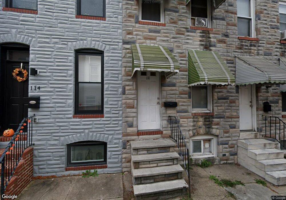
116 N Port St Baltimore, MD 21224
Patterson Place NeighborhoodEstimated Value: $172,000 - $229,983
Studio
1
Bath
768
Sq Ft
$262/Sq Ft
Est. Value
About This Home
This home is located at 116 N Port St, Baltimore, MD 21224 and is currently estimated at $200,992, approximately $261 per square foot. 116 N Port St is a home located in Baltimore City with nearby schools including Commodore John Rogers Elementary School, Booker T. Washington Middle School, and Paul Laurence Dunbar High School.
Ownership History
Date
Name
Owned For
Owner Type
Purchase Details
Closed on
Oct 30, 2025
Sold by
Ht Ten Llc and Ht Four Llc
Bought by
Dmv Capital Llc
Current Estimated Value
Purchase Details
Closed on
Aug 6, 2025
Sold by
Carr Ronald M and Carr Marilyn
Bought by
Ht Five Llc
Purchase Details
Closed on
Feb 23, 2023
Sold by
Highlandtown V Llc
Bought by
Delaware Limited Liability Company
Purchase Details
Closed on
Jul 25, 2000
Sold by
Hajimahalis Alec
Bought by
Patterson Park Community and Development Corp
Create a Home Valuation Report for This Property
The Home Valuation Report is an in-depth analysis detailing your home's value as well as a comparison with similar homes in the area
Home Values in the Area
Average Home Value in this Area
Purchase History
We collect this data history from publicly available records. To have your information removed, we recommend requesting removal directly through your county’s website.
| Date | Buyer | Sale Price | Title Company |
|---|---|---|---|
| Dmv Capital Llc | $320,000 | Old Republic National Title In | |
| Ht Five Llc | $1,200 | Commercial Title Company | |
| Ht Five Llc | $1,200 | Commercial Title Company | |
| Delaware Limited Liability Company | $1,521,676 | None Listed On Document | |
| Patterson Park Community | $12,000 | -- |
Source: Public Records
Tax History
| Year | Tax Paid | Tax Assessment Tax Assessment Total Assessment is a certain percentage of the fair market value that is determined by local assessors to be the total taxable value of land and additions on the property. | Land | Improvement |
|---|---|---|---|---|
| 2025 | $1,456 | $62,000 | $60,000 | $2,000 |
| 2024 | $1,456 | $62,000 | $60,000 | $2,000 |
| 2023 | $1,456 | $62,000 | $60,000 | $2,000 |
| 2022 | $1,463 | $62,000 | $60,000 | $2,000 |
| 2021 | $1,345 | $57,000 | $0 | $0 |
| 2020 | $1,227 | $63,333 | $0 | $0 |
| 2019 | $1,104 | $47,000 | $42,000 | $5,000 |
| 2018 | $1,337 | $56,667 | $0 | $0 |
| 2017 | $1,141 | $48,333 | $0 | $0 |
| 2016 | $2,549 | $40,000 | $0 | $0 |
| 2015 | $2,549 | $99,700 | $0 | $0 |
| 2014 | $2,549 | $99,700 | $0 | $0 |
Source: Public Records
Map
Nearby Homes
- 116 N Milton Ave
- 102 N Milton Ave
- 130 N Montford Ave
- 2410 E Fayette St
- 145 N Milton Ave
- 204 N Port St
- 2506 E Fairmount Ave
- 219 N Montford Ave
- 224 N Port St
- 129 N Rose St
- 10 N Milton Ave
- 23 N Bradford St
- 17 N Bradford St
- 220 N Montford Ave
- 2518 E Fairmount Ave
- 2328 E Baltimore St
- 135 N Luzerne Ave
- 40 N Patterson Park Ave
- 220 N Luzerne Ave
- 120 N Glover St
Your Personal Tour Guide
Ask me questions while you tour the home.