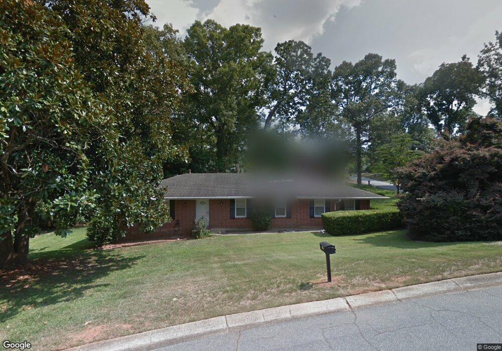
116 Oakdale Dr Warner Robins, GA 31088
Estimated Value: $143,000 - $170,000
3
Beds
2
Baths
1,363
Sq Ft
$115/Sq Ft
Est. Value
About This Home
This home is located at 116 Oakdale Dr, Warner Robins, GA 31088 and is currently estimated at $156,216, approximately $114 per square foot. 116 Oakdale Dr is a home located in Houston County with nearby schools including Shirley Hills Elementary School, Warner Robins Middle School, and Warner Robins High School.
Ownership History
Date
Name
Owned For
Owner Type
Purchase Details
Closed on
May 21, 2025
Sold by
Haire Tonge Kimberly and Scott Haire Scott
Bought by
Oasis Investments
Current Estimated Value
Purchase Details
Closed on
Jun 30, 2021
Sold by
Barkley Dorothy P and Barkley James O
Bought by
Barkley Dorothy P and Barkley James O
Purchase Details
Closed on
Mar 23, 2005
Sold by
Haire Dorothy P and Barkley Dorothy P
Bought by
Barkley Dorothy P and Barkley James O
Purchase Details
Closed on
Oct 28, 1982
Sold by
Haire Ronald Frank
Bought by
Haire Dorothy P
Purchase Details
Closed on
Mar 13, 1973
Sold by
Secretary Of Housing & Urban Dev
Bought by
Haire Ronald Frank
Purchase Details
Closed on
May 19, 1972
Sold by
Community Savings Bank
Bought by
Secretary Of Housing & Urban Dev
Purchase Details
Closed on
Dec 15, 1967
Sold by
Oliver William K
Bought by
Smith Roy S
Purchase Details
Closed on
Mar 10, 1967
Sold by
Killingsworth & Company
Bought by
Oliver William K
Purchase Details
Closed on
Aug 4, 1966
Sold by
Consolidated Land Dev Corp
Bought by
Killingsworth & Company
Purchase Details
Closed on
Nov 15, 1963
Bought by
Consolidated Land Dev Corp
Create a Home Valuation Report for This Property
The Home Valuation Report is an in-depth analysis detailing your home's value as well as a comparison with similar homes in the area
Home Values in the Area
Average Home Value in this Area
Purchase History
| Date | Buyer | Sale Price | Title Company |
|---|---|---|---|
| Oasis Investments | -- | None Listed On Document | |
| Oasis Investments | -- | None Listed On Document | |
| Barkley Dorothy P | -- | None Available | |
| Barkley Dorothy P | -- | None Available | |
| Haire Dorothy P | -- | -- | |
| Haire Ronald Frank | -- | -- | |
| Secretary Of Housing & Urban Dev | -- | -- | |
| Community Savings Bank | -- | -- | |
| Smith Roy S | -- | -- | |
| Oliver William K | -- | -- | |
| Killingsworth & Company | -- | -- | |
| Consolidated Land Dev Corp | -- | -- |
Source: Public Records
Tax History Compared to Growth
Tax History
| Year | Tax Paid | Tax Assessment Tax Assessment Total Assessment is a certain percentage of the fair market value that is determined by local assessors to be the total taxable value of land and additions on the property. | Land | Improvement |
|---|---|---|---|---|
| 2024 | $919 | $41,760 | $6,000 | $35,760 |
| 2023 | $707 | $35,080 | $6,000 | $29,080 |
| 2022 | $543 | $32,760 | $6,000 | $26,760 |
| 2021 | $434 | $27,920 | $4,800 | $23,120 |
| 2020 | $24 | $26,400 | $4,800 | $21,600 |
| 2019 | $401 | $26,400 | $4,800 | $21,600 |
| 2018 | $401 | $26,400 | $4,800 | $21,600 |
| 2017 | $401 | $26,400 | $4,800 | $21,600 |
| 2016 | $402 | $26,400 | $4,800 | $21,600 |
| 2015 | -- | $26,400 | $4,800 | $21,600 |
| 2014 | $70 | $31,040 | $4,800 | $26,240 |
| 2013 | $70 | $31,040 | $4,800 | $26,240 |
Source: Public Records
Map
Nearby Homes
- 108 Woodsdale Dr
- 103 Oakdale Dr
- 115 Glendale Ct
- 139 Rolling Woods Cir
- 1000 Corder Rd
- 1850 Russell Pkwy
- 0 Russell Pkwy Unit 10656199
- 103 Victor St
- 216 Self St
- 213 Self St
- 305 Tarrasa Dr
- 201 Belmont Dr
- 304 Laurie Ln
- 107 Via Eldorado Dr
- 118 Fox Glove Ct
- 119 Fox Glove Ct
- 25 & 26 Lot
- 100 Belmont Dr
- 1278 S Houston Lake Rd
- 100 Glenwood Ave Unit 701 S. Houston Lake
- 110 Sunnydale Dr
- 114 Oakdale Dr
- 109 Woodsdale Dr
- 111 Woodsdale Dr
- 109 Sunnydale Dr
- 111 Sunnydale Dr
- 107 Woodsdale Dr
- 113 Woodsdale Dr
- 107 Sunnydale Dr
- 113 Sunnydale Dr
- 112 Oakdale Dr
- 115 Oakdale Dr
- 105 Sunnydale Dr
- 102 Sunnydale Dr
- 105 Woodsdale Dr
- 115 Sunnydale Dr
- 112 Woodsdale Dr
- 103 Sunnydale Dr
- 110 Oakdale Dr
- 108 Trusty Trail