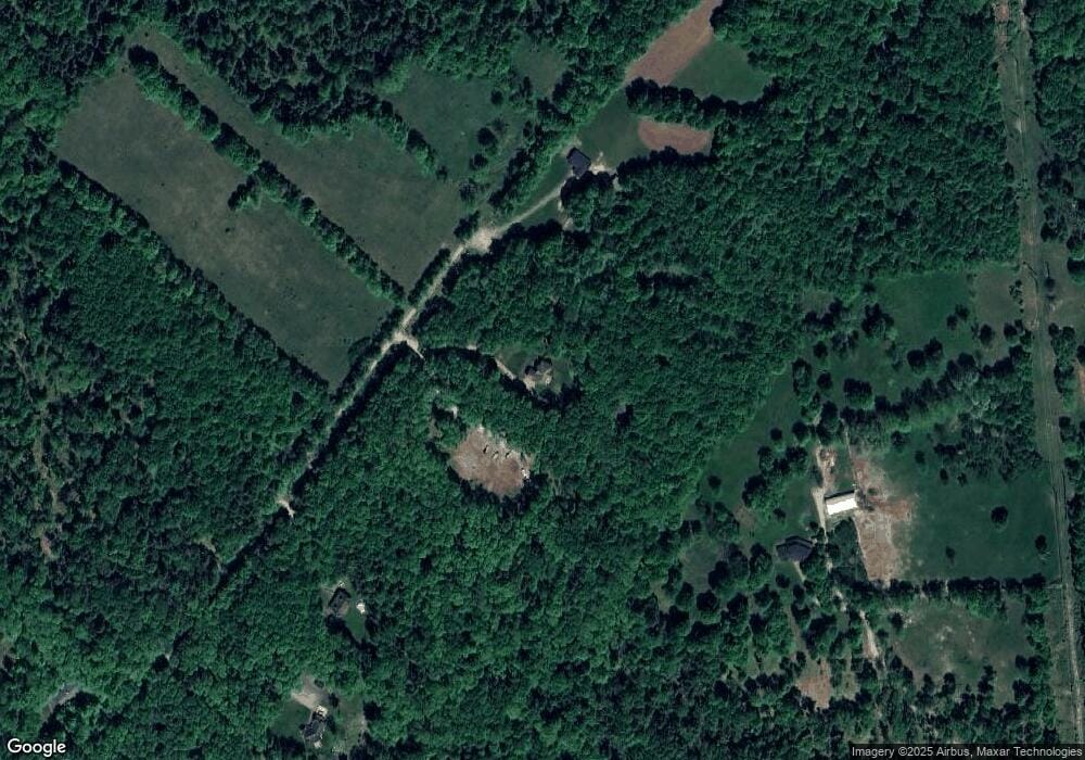
116 Phillips Rd Newfoundland, PA 18445
Estimated Value: $484,000 - $726,215
4
Beds
3
Baths
3,594
Sq Ft
$169/Sq Ft
Est. Value
About This Home
This home is located at 116 Phillips Rd, Newfoundland, PA 18445 and is currently estimated at $606,304, approximately $168 per square foot. 116 Phillips Rd is a home with nearby schools including Wallenpaupack Area High School.
Ownership History
Date
Name
Owned For
Owner Type
Purchase Details
Closed on
Mar 16, 2007
Sold by
Metzger Norman and Metzger Ellen
Bought by
Haynes Ashley D and Haynes Amy
Current Estimated Value
Home Financials for this Owner
Home Financials are based on the most recent Mortgage that was taken out on this home.
Original Mortgage
$60,802
Interest Rate
6.33%
Mortgage Type
Purchase Money Mortgage
Purchase Details
Closed on
Nov 22, 2005
Sold by
Nakielny Theodore and Nakielny Lurene
Bought by
Metzger Norman and Metzger Ellen
Create a Home Valuation Report for This Property
The Home Valuation Report is an in-depth analysis detailing your home's value as well as a comparison with similar homes in the area
Home Values in the Area
Average Home Value in this Area
Purchase History
| Date | Buyer | Sale Price | Title Company |
|---|---|---|---|
| Haynes Ashley D | $67,000 | First American Title Insuran | |
| Metzger Norman | $50,000 | None Available |
Source: Public Records
Mortgage History
| Date | Status | Borrower | Loan Amount |
|---|---|---|---|
| Closed | Haynes Ashley D | $60,802 |
Source: Public Records
Tax History
| Year | Tax Paid | Tax Assessment Tax Assessment Total Assessment is a certain percentage of the fair market value that is determined by local assessors to be the total taxable value of land and additions on the property. | Land | Improvement |
|---|---|---|---|---|
| 2025 | $7,187 | $497,100 | $83,500 | $413,600 |
| 2024 | $6,836 | $497,100 | $83,500 | $413,600 |
| 2023 | $9,610 | $497,100 | $83,500 | $413,600 |
| 2022 | $6,987 | $325,600 | $46,500 | $279,100 |
| 2021 | $6,929 | $325,600 | $46,500 | $279,100 |
| 2020 | $6,909 | $325,600 | $46,500 | $279,100 |
| 2019 | $6,481 | $325,600 | $46,500 | $279,100 |
| 2018 | $6,338 | $325,600 | $46,500 | $279,100 |
| 2017 | $1,468 | $325,600 | $46,500 | $279,100 |
| 2016 | $5,990 | $325,600 | $46,500 | $279,100 |
| 2014 | -- | $324,500 | $46,500 | $278,000 |
Source: Public Records
Map
Nearby Homes
- 0 Route 507 & I-84 Unit PWBPW254040
- 191 Pennsylvania 191
- Lot 15 Game Trail Dr
- 105 Forks Bridge Rd
- Lot 131 Sutton Place
- 56-63 Wellington Dr
- 109 Hazelton Dr
- Lot 1 Hazelton Dr
- Lot 4 Hazelton Dr
- 914 Main St
- 106 Brookview Ln
- 230 Hemlock Grove Rd
- 172 Granite Dr
- 115 Spruce St
- 100 S Granite Dr
- 117 Teak Dr
- 0 Marina Way Unit GSBSC260332
- 132 Spruce St
- 0 Evergreen Dr
- 111 S Knob Rd
- 114 Phillips Rd
- 0 Gilpin Rd Unit PWBPW241723
- 0 Gilpin Rd Unit PWB164427
- 0 Gilpin Rd Unit PWB164426
- 0 Gilpin Rd Unit PM-102158
- 0 Gilpin Rd
- 88 Phillips Rd
- 101 Gilpin Rd
- Lot 9 Phillips Rd
- 0 Phillips Rd
- 6 Phillips Rd
- Lot 3 Phillips Rd
- 2 Phillips Rd
- 68 Phillips Rd
- 141 Gilpin Rd
- 61 Phillips Rd
- 45 Long River Rd
- 70 Phillips Rd
- 46 Phillips Rd
- 165 Gilpin Rd
Your Personal Tour Guide
Ask me questions while you tour the home.
