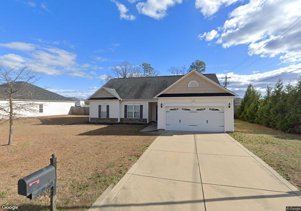
116 Pilot Ave Raeford, NC 28376
Estimated Value: $309,000 - $344,000
--
Bed
--
Bath
1,867
Sq Ft
$172/Sq Ft
Est. Value
About This Home
This home is located at 116 Pilot Ave, Raeford, NC 28376 and is currently estimated at $321,790, approximately $172 per square foot. 116 Pilot Ave is a home with nearby schools including Upchurch Elementary School, East Hoke Middle, and Hoke County High.
Ownership History
Date
Name
Owned For
Owner Type
Purchase Details
Closed on
Jun 20, 2013
Sold by
Cates Building Inc
Bought by
Robinson Justin and Robinson Tania
Current Estimated Value
Home Financials for this Owner
Home Financials are based on the most recent Mortgage that was taken out on this home.
Original Mortgage
$188,950
Outstanding Balance
$129,887
Interest Rate
2.75%
Mortgage Type
VA
Estimated Equity
$191,903
Create a Home Valuation Report for This Property
The Home Valuation Report is an in-depth analysis detailing your home's value as well as a comparison with similar homes in the area
Home Values in the Area
Average Home Value in this Area
Purchase History
| Date | Buyer | Sale Price | Title Company |
|---|---|---|---|
| Robinson Justin | $185,000 | None Available |
Source: Public Records
Mortgage History
| Date | Status | Borrower | Loan Amount |
|---|---|---|---|
| Open | Robinson Justin | $188,950 |
Source: Public Records
Tax History Compared to Growth
Tax History
| Year | Tax Paid | Tax Assessment Tax Assessment Total Assessment is a certain percentage of the fair market value that is determined by local assessors to be the total taxable value of land and additions on the property. | Land | Improvement |
|---|---|---|---|---|
| 2024 | $1,782 | $248,890 | $44,100 | $204,790 |
| 2023 | $1,782 | $248,890 | $44,100 | $204,790 |
| 2022 | $1,748 | $248,890 | $44,100 | $204,790 |
| 2021 | $1,295 | $188,190 | $40,000 | $148,190 |
| 2020 | $1,316 | $188,190 | $40,000 | $148,190 |
| 2019 | $1,316 | $188,190 | $40,000 | $148,190 |
| 2018 | $1,690 | $188,190 | $40,000 | $148,190 |
| 2017 | $1,690 | $188,190 | $40,000 | $148,190 |
| 2016 | $1,659 | $188,190 | $40,000 | $148,190 |
| 2015 | $1,659 | $188,190 | $40,000 | $148,190 |
| 2014 | $1,634 | $188,190 | $40,000 | $148,190 |
| 2013 | -- | $196,080 | $42,000 | $154,080 |
Source: Public Records
Map
Nearby Homes
- 132 Pilot Ave
- 117 Indigo Ave
- 117 Wexford St
- 150 Pilot Ave
- 114 Courtland Dr
- 114 Weston Woods St
- 114 Indigo Ave
- 133 Indigo Ave
- 131 Wexford St
- 130 Courtland Dr
- 130 Weston Woods St
- 130 Indigo Ave
- 297 Wedgefield Dr
- 147 Indigo Ave
- 147 Wexford St
- 331 Wedgefield Dr
- 271 Wedgefield Dr
- 142 Courtland Dr
- 146 Weston Woods St
- 117 Dr