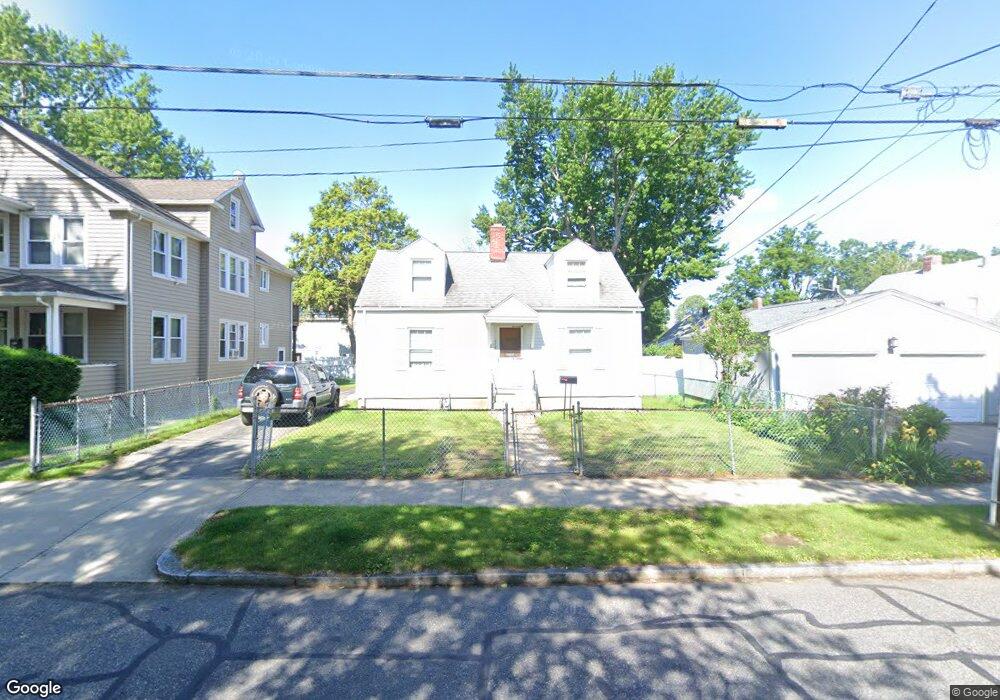
116 Powell Ave Springfield, MA 01118
East Forest Park NeighborhoodEstimated Value: $250,651 - $283,000
2
Beds
1
Bath
1,008
Sq Ft
$262/Sq Ft
Est. Value
About This Home
This home is located at 116 Powell Ave, Springfield, MA 01118 and is currently estimated at $263,663, approximately $261 per square foot. 116 Powell Ave is a home located in Hampden County with nearby schools including Frederick Harris Elementary School, M Marcus Kiley Middle, and Springfield High School of Science and Technology.
Ownership History
Date
Name
Owned For
Owner Type
Purchase Details
Closed on
Sep 13, 2024
Sold by
Decaro Giovanni S
Bought by
Decaro Anthony G and Decaro Roberto U
Current Estimated Value
Home Financials for this Owner
Home Financials are based on the most recent Mortgage that was taken out on this home.
Original Mortgage
$0
Interest Rate
6.46%
Mortgage Type
New Conventional
Purchase Details
Closed on
Oct 6, 2023
Sold by
Decaro Kathleen M Est and Hurley
Bought by
Decaro Anthony G and Decaro Giovanni S
Purchase Details
Closed on
Apr 26, 1991
Sold by
Mccormack Katherine
Bought by
Decaro Kathleen M and Decaro Ulderico
Create a Home Valuation Report for This Property
The Home Valuation Report is an in-depth analysis detailing your home's value as well as a comparison with similar homes in the area
Home Values in the Area
Average Home Value in this Area
Purchase History
| Date | Buyer | Sale Price | Title Company |
|---|---|---|---|
| Decaro Anthony G | -- | None Available | |
| Decaro Anthony G | -- | None Available | |
| Decaro Anthony G | -- | None Available | |
| Decaro Anthony G | -- | None Available | |
| Decaro Kathleen M | $88,900 | -- | |
| Decaro Kathleen M | $88,900 | -- |
Source: Public Records
Mortgage History
| Date | Status | Borrower | Loan Amount |
|---|---|---|---|
| Closed | Decaro Anthony G | $0 | |
| Previous Owner | Decaro Kathleen M | $72,000 | |
| Previous Owner | Decaro Kathleen M | $29,000 | |
| Previous Owner | Decaro Kathleen M | $80,000 |
Source: Public Records
Tax History
| Year | Tax Paid | Tax Assessment Tax Assessment Total Assessment is a certain percentage of the fair market value that is determined by local assessors to be the total taxable value of land and additions on the property. | Land | Improvement |
|---|---|---|---|---|
| 2025 | $3,334 | $212,600 | $45,200 | $167,400 |
| 2024 | $2,952 | $183,800 | $45,200 | $138,600 |
| 2023 | $3,069 | $180,000 | $43,100 | $136,900 |
| 2022 | $2,840 | $150,900 | $43,100 | $107,800 |
| 2021 | $2,514 | $133,000 | $39,200 | $93,800 |
| 2020 | $2,314 | $118,500 | $39,200 | $79,300 |
| 2019 | $2,263 | $115,000 | $39,200 | $75,800 |
| 2018 | $2,478 | $125,900 | $39,200 | $86,700 |
| 2017 | $2,306 | $117,300 | $39,200 | $78,100 |
| 2016 | $2,178 | $110,800 | $39,200 | $71,600 |
| 2015 | $2,109 | $107,200 | $39,200 | $68,000 |
Source: Public Records
Map
Nearby Homes
- 119 Powell Ave
- 116 Carr St
- 13 Bither St
- 1088 Sumner Ave
- 47 Hartford Terrace
- 29 Eddywood St
- 46 Hadley St
- 79 Roosevelt Ave
- 161 Dorset St
- 34 Castle St
- 19 Orpheum Ave
- 125 Manor Ct Unit 125
- 19 Manor Ct Unit 19
- 77 Dorset St
- 134 Eddywood St
- 46 Eckington St
- 26 Dwight Rd
- 206 Treetop Ave
- 38 Manchester Terrace
- 7 Ashbrook St
- 122 Powell Ave Unit 122 Powell Ave
- 120 Powell Ave Unit 122
- 227 Gifford St
- 233 Gifford St
- 111 Garland St
- 124 Powell Ave
- 223 Gifford St
- 115 Garland St
- 121 Garland St
- 219 Gifford St
- 115 Powell Ave
- 130 Powell Ave
- 109 Powell Ave
- 105 Powell Ave
- 125 Powell Ave
- 127 Garland St
- 136 Powell Ave
- 136 Powell Ave Unit 1
- 129 Powell Ave
- 234 Gifford St
Your Personal Tour Guide
Ask me questions while you tour the home.