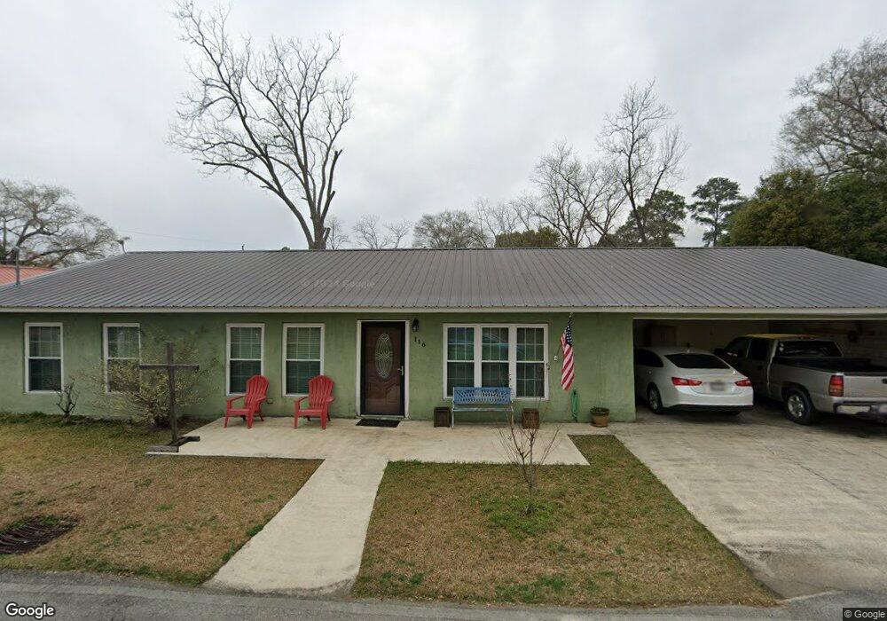
116 S Cowart Ave Glennville, GA 30427
Estimated Value: $145,275 - $223,000
--
Bed
--
Bath
1,764
Sq Ft
$102/Sq Ft
Est. Value
About This Home
This home is located at 116 S Cowart Ave, Glennville, GA 30427 and is currently estimated at $180,069, approximately $102 per square foot. 116 S Cowart Ave is a home with nearby schools including Tattnall County High School and Glennville Christian Academy.
Ownership History
Date
Name
Owned For
Owner Type
Purchase Details
Closed on
Oct 24, 2013
Sold by
Mann William H
Bought by
Mann Rachel R
Current Estimated Value
Home Financials for this Owner
Home Financials are based on the most recent Mortgage that was taken out on this home.
Original Mortgage
$75,000
Outstanding Balance
$18,620
Interest Rate
4.33%
Mortgage Type
New Conventional
Estimated Equity
$161,449
Purchase Details
Closed on
Nov 27, 2012
Sold by
Mann Nancy Delene
Bought by
Mann William H
Home Financials for this Owner
Home Financials are based on the most recent Mortgage that was taken out on this home.
Original Mortgage
$56,099
Interest Rate
3.44%
Mortgage Type
New Conventional
Create a Home Valuation Report for This Property
The Home Valuation Report is an in-depth analysis detailing your home's value as well as a comparison with similar homes in the area
Home Values in the Area
Average Home Value in this Area
Purchase History
| Date | Buyer | Sale Price | Title Company |
|---|---|---|---|
| Mann Rachel R | -- | -- | |
| Mann William H | -- | -- |
Source: Public Records
Mortgage History
| Date | Status | Borrower | Loan Amount |
|---|---|---|---|
| Open | Mann Rachel R | $75,000 | |
| Previous Owner | Mann William H | $56,099 |
Source: Public Records
Tax History Compared to Growth
Tax History
| Year | Tax Paid | Tax Assessment Tax Assessment Total Assessment is a certain percentage of the fair market value that is determined by local assessors to be the total taxable value of land and additions on the property. | Land | Improvement |
|---|---|---|---|---|
| 2025 | $1,221 | $48,360 | $1,320 | $47,040 |
| 2024 | $1,230 | $36,120 | $1,320 | $34,800 |
| 2023 | $589 | $36,120 | $1,320 | $34,800 |
| 2022 | $1,023 | $30,320 | $1,320 | $29,000 |
| 2021 | $953 | $28,960 | $1,320 | $27,640 |
| 2020 | $954 | $28,960 | $1,320 | $27,640 |
| 2019 | $820 | $24,520 | $1,000 | $23,520 |
| 2018 | $831 | $24,520 | $1,000 | $23,520 |
| 2017 | $624 | $24,520 | $1,000 | $23,520 |
| 2016 | $193 | $24,240 | $1,000 | $23,240 |
| 2015 | -- | $24,320 | $1,000 | $23,320 |
| 2014 | -- | $3,000 | $880 | $2,120 |
| 2013 | -- | $3,000 | $880 | $2,120 |
Source: Public Records
Map
Nearby Homes
- 305 S Baker St
- 404 S Baker St
- 306 S Tillman St
- 304 Morris St
- 413 Auburn Rd
- 803 E Barnard St
- 128 Fate Rd
- 203 Bull St
- 109 Lincoln Dr
- 601 Auburn Rd
- Tract 1 Simon St
- Tract 2 Simon St
- 400 W Mann St
- 402 W Mann St
- 302 N Church St
- 105 Widgeon Ln
- 706 Virginia Ave
- 708 Virginia Ave
- 655 N Caswell St
- 653 N Caswell St
- 316 Bolton St
- 314 Bolton St
- 312 Bolton St
- 110 S Cowart Ave
- 311 Bolton St
- 308 Bolton St
- 307 Bolton St
- 407 Bolton St
- 203 S Cowart Ave
- 114 S Herrington St
- 118 S Herrington St
- 306 Bolton St
- 111 S Baker St
- 109 S Baker St
- 202 S Herrington St
- 115 S Baker St
- 302 Bolton St
- 316 E Howard St
- 314 E Howard St
- 507 E Barnard St