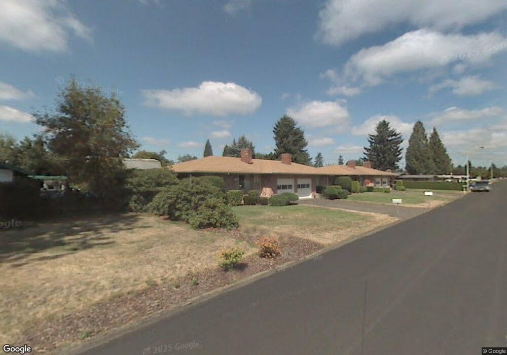
116 S Morrison Rd Vancouver, WA 98664
Vancouver Heights NeighborhoodEstimated Value: $495,000 - $667,131
4
Beds
2
Baths
1,626
Sq Ft
$365/Sq Ft
Est. Value
About This Home
This home is located at 116 S Morrison Rd, Vancouver, WA 98664 and is currently estimated at $592,783, approximately $364 per square foot. 116 S Morrison Rd is a home located in Clark County with nearby schools including George C. Marshall Elementary School, McLoughlin Middle School, and Fort Vancouver High School.
Ownership History
Date
Name
Owned For
Owner Type
Purchase Details
Closed on
Jul 16, 2025
Sold by
Pmcarr Properties Llc
Bought by
116 Morrison Llc
Current Estimated Value
Purchase Details
Closed on
Aug 11, 2023
Sold by
Carr Patricia M
Bought by
Pmcarr Properties Llc
Purchase Details
Closed on
Jul 15, 1998
Sold by
Plowman Paul A
Bought by
Carr Patricia M
Home Financials for this Owner
Home Financials are based on the most recent Mortgage that was taken out on this home.
Original Mortgage
$136,000
Interest Rate
7.01%
Create a Home Valuation Report for This Property
The Home Valuation Report is an in-depth analysis detailing your home's value as well as a comparison with similar homes in the area
Home Values in the Area
Average Home Value in this Area
Purchase History
| Date | Buyer | Sale Price | Title Company |
|---|---|---|---|
| 116 Morrison Llc | $600,000 | Old Republic Title | |
| Pmcarr Properties Llc | -- | None Listed On Document | |
| Carr Patricia M | $170,000 | First American Title Ins Co |
Source: Public Records
Mortgage History
| Date | Status | Borrower | Loan Amount |
|---|---|---|---|
| Previous Owner | Carr Patricia M | $136,000 |
Source: Public Records
Tax History Compared to Growth
Tax History
| Year | Tax Paid | Tax Assessment Tax Assessment Total Assessment is a certain percentage of the fair market value that is determined by local assessors to be the total taxable value of land and additions on the property. | Land | Improvement |
|---|---|---|---|---|
| 2025 | $6,164 | $662,654 | $189,700 | $472,954 |
| 2024 | $5,598 | $631,493 | $189,700 | $441,793 |
| 2023 | $5,488 | $598,821 | $189,700 | $409,121 |
| 2022 | $4,917 | $589,221 | $189,700 | $399,521 |
| 2021 | $4,560 | $491,782 | $162,500 | $329,282 |
| 2020 | $4,048 | $429,766 | $127,970 | $301,796 |
| 2019 | $3,702 | $395,285 | $117,433 | $277,852 |
| 2018 | $4,134 | $374,464 | $0 | $0 |
| 2017 | $3,715 | $347,211 | $0 | $0 |
| 2016 | $3,297 | $325,630 | $0 | $0 |
| 2015 | $2,895 | $276,130 | $0 | $0 |
| 2014 | -- | $229,210 | $0 | $0 |
| 2013 | -- | $195,163 | $0 | $0 |
Source: Public Records
Map
Nearby Homes
- 6906 Tennessee Ln
- 7012 Louisiana Dr
- 6804 Louisiana Dr
- 829 SE Morgan Rd
- 7010 Ohio Dr
- 700 Garrison Terrace
- 300 Baltimore Way
- 6901 SE Middle Way
- 8014 SE Middle Way
- 1115 SE Morgan Rd
- 6905 SE Evergreen Hwy
- 7506 SE Evergreen Hwy
- 8607 Mount Thielson Ave
- 8318 SE Middle Way
- 6704 Kansas St
- 1323 SE Columbia Crest Ct
- 1007 NE 82nd Ave
- 8405 NE 10th St
- 8015 SE Evergreen Hwy
- 6019 SE Riverside Dr
- 7310 Carolina Ln
- 110 S Morrison Rd
- 129 S Morrison Rd
- 115 S Knoxville Way
- 121 S Knoxville Way
- 109 S Knoxville Way
- 104 S Morrison Rd
- 119 S Garrison Rd
- 111 S Garrison Rd
- 103 S Knoxville Way
- 7412 Carolina Ln
- 102 N Morrison Rd
- 7405 Carolina Ln
- 105 S Garrison Rd
- 110 S Knoxville Way
- 116 S Knoxville Way
- 101 N Knoxville Way
- 102 S Knoxville Way
- 7210 Carolina Ln
- 116 S Fredericksburg Way