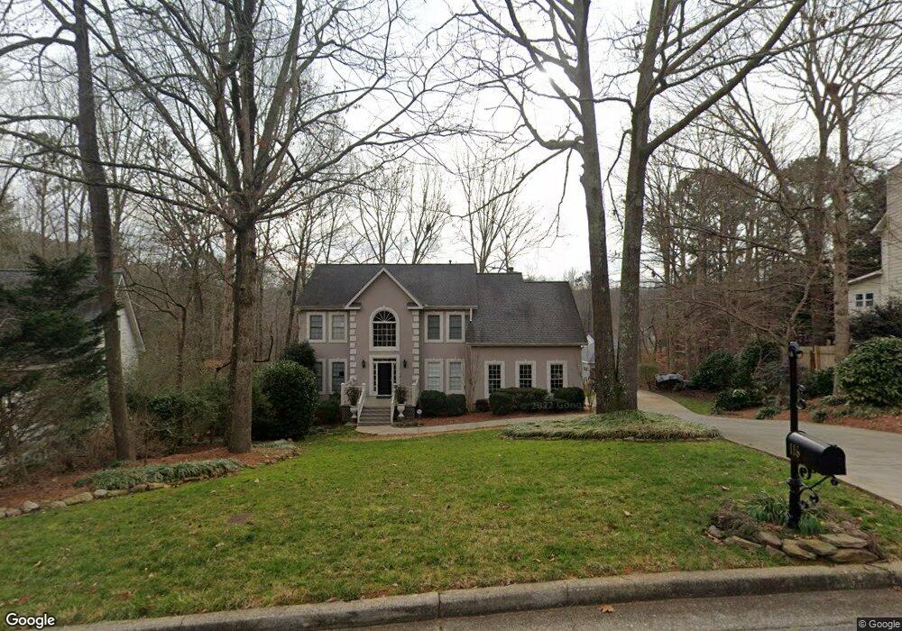
116 Saint Aurics Dr Unit 2 Suwanee, GA 30024
Estimated Value: $470,000 - $521,000
4
Beds
3
Baths
2,812
Sq Ft
$175/Sq Ft
Est. Value
About This Home
This home is located at 116 Saint Aurics Dr Unit 2, Suwanee, GA 30024 and is currently estimated at $491,735, approximately $174 per square foot. 116 Saint Aurics Dr Unit 2 is a home located in Gwinnett County with nearby schools including Walnut Grove Elementary School, Creekland Middle School, and Collins Hill High School.
Ownership History
Date
Name
Owned For
Owner Type
Purchase Details
Closed on
Apr 17, 2007
Sold by
Pulliam George R and Pulliam Kimberly A
Bought by
Miles Terence W
Current Estimated Value
Home Financials for this Owner
Home Financials are based on the most recent Mortgage that was taken out on this home.
Original Mortgage
$192,000
Outstanding Balance
$114,616
Interest Rate
6.1%
Mortgage Type
New Conventional
Estimated Equity
$377,119
Purchase Details
Closed on
Mar 28, 1996
Sold by
Duff Mark C Kathleen A
Bought by
Pulliam George R Kimberly
Create a Home Valuation Report for This Property
The Home Valuation Report is an in-depth analysis detailing your home's value as well as a comparison with similar homes in the area
Home Values in the Area
Average Home Value in this Area
Purchase History
| Date | Buyer | Sale Price | Title Company |
|---|---|---|---|
| Miles Terence W | $240,000 | -- | |
| Pulliam George R Kimberly | $184,900 | -- |
Source: Public Records
Mortgage History
| Date | Status | Borrower | Loan Amount |
|---|---|---|---|
| Open | Miles Terence W | $192,000 | |
| Closed | Pulliam George R Kimberly | $0 |
Source: Public Records
Tax History Compared to Growth
Tax History
| Year | Tax Paid | Tax Assessment Tax Assessment Total Assessment is a certain percentage of the fair market value that is determined by local assessors to be the total taxable value of land and additions on the property. | Land | Improvement |
|---|---|---|---|---|
| 2025 | $1,515 | $212,840 | $28,000 | $184,840 |
| 2024 | $1,494 | $198,960 | $34,000 | $164,960 |
| 2023 | $1,494 | $193,040 | $31,600 | $161,440 |
| 2022 | $5,106 | $177,640 | $29,200 | $148,440 |
| 2021 | $3,988 | $120,520 | $20,200 | $100,320 |
| 2020 | $4,016 | $120,520 | $20,200 | $100,320 |
| 2019 | $3,901 | $120,520 | $20,200 | $100,320 |
| 2018 | $3,863 | $118,480 | $17,200 | $101,280 |
| 2016 | $3,397 | $96,080 | $14,440 | $81,640 |
| 2015 | $3,100 | $83,640 | $12,400 | $71,240 |
| 2014 | -- | $83,640 | $12,400 | $71,240 |
Source: Public Records
Map
Nearby Homes
- 2370 Cape Courage Way
- 2140 Wildcat Cliffs Way
- 2167 Merrymount Dr
- 2061 Wildcat Cliffs Ln
- 2372 Merrymount Dr Unit 2
- 2265 Wildwood Lake Dr
- 205 Camden Creek Ct
- 2205 Parliament Dr
- 1924 Sidneys Cove
- 1839 Stonebrook Way
- 2155 Parliament Dr
- 1838 Prince Dr
- 1932 Riverton Dr
- 2067 York River Way
- 525 Provence Gate Ln
- 2050 Fortuna St
- 1908 Prince Dr
- 275 Rose Ivy Ct
- 232 Clarion Rd
- 1909 McLennon Ct
- 122 Saint Aurics Dr
- 110 Saint Aurics Dr Unit 2
- 2182 Little River Dr Unit 1
- 2172 Little River Dr
- 2192 Little River Dr
- 2145 Saint Thomas Way
- 111 Saint Aurics Dr
- 104 Saint Aurics Dr
- 2175 Saint Thomas Way Unit 1
- 2125 Saint Thomas Way
- 2175 St Thomas Way
- 2191 Little River Dr Unit 1
- 95 Saint Aurics Dr
- 98 Saint Aurics Dr
- 2105 Saint Thomas Way
- 2185 Saint Thomas Way Unit 1
- 2181 Little River Dr
- 0 Saint Thomas Way Unit 9057365
- 0 Saint Thomas Way Unit 3289728
- 2171 Little River Dr Unit 1