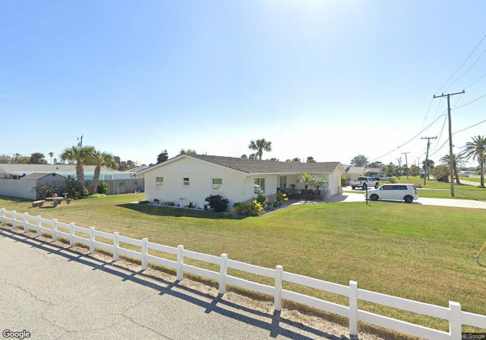
116 Simpson Ave Daytona Beach, FL 32118
Estimated Value: $372,000 - $493,000
3
Beds
2
Baths
1,385
Sq Ft
$314/Sq Ft
Est. Value
About This Home
This home is located at 116 Simpson Ave, Daytona Beach, FL 32118 and is currently estimated at $435,206, approximately $314 per square foot. 116 Simpson Ave is a home located in Volusia County with nearby schools including R.J. Longstreet Elementary School, Atlantic High School, and Silver Sands Middle School.
Ownership History
Date
Name
Owned For
Owner Type
Purchase Details
Closed on
Dec 19, 2012
Sold by
Shaffer Marjorie M
Bought by
Shaffer Thomas F
Current Estimated Value
Purchase Details
Closed on
Oct 17, 1994
Sold by
Shaffer John E and Shaffer Marjorie M
Bought by
Shaffer Marjorie M
Purchase Details
Closed on
May 15, 1985
Bought by
Shaffer Thomas F
Purchase Details
Closed on
Jul 15, 1980
Bought by
Shaffer Thomas F
Purchase Details
Closed on
Jan 15, 1973
Bought by
Shaffer Thomas F
Create a Home Valuation Report for This Property
The Home Valuation Report is an in-depth analysis detailing your home's value as well as a comparison with similar homes in the area
Home Values in the Area
Average Home Value in this Area
Purchase History
| Date | Buyer | Sale Price | Title Company |
|---|---|---|---|
| Shaffer Thomas F | -- | Attorney | |
| Shaffer Marjorie M | -- | -- | |
| Shaffer Thomas F | $55,000 | -- | |
| Shaffer Thomas F | $64,000 | -- | |
| Shaffer Thomas F | $8,000 | -- |
Source: Public Records
Tax History Compared to Growth
Tax History
| Year | Tax Paid | Tax Assessment Tax Assessment Total Assessment is a certain percentage of the fair market value that is determined by local assessors to be the total taxable value of land and additions on the property. | Land | Improvement |
|---|---|---|---|---|
| 2025 | $6,670 | $443,428 | $207,000 | $236,428 |
| 2024 | $6,670 | $447,776 | $207,000 | $240,776 |
| 2023 | $6,670 | $399,245 | $180,504 | $218,741 |
| 2022 | $6,133 | $350,967 | $130,410 | $220,557 |
| 2021 | $5,714 | $275,663 | $109,296 | $166,367 |
| 2020 | $5,262 | $252,784 | $108,468 | $144,316 |
| 2019 | $5,104 | $260,880 | $119,210 | $141,670 |
| 2018 | $4,664 | $227,392 | $81,900 | $145,492 |
| 2017 | $4,462 | $220,194 | $81,969 | $138,225 |
| 2016 | $4,158 | $194,526 | $0 | $0 |
| 2015 | $3,965 | $181,192 | $0 | $0 |
| 2014 | $3,597 | $164,928 | $0 | $0 |
Source: Public Records
Map
Nearby Homes
- 3315 S Atlantic Ave Unit 1605
- 3315 S Atlantic Ave Unit 1406
- 3315 S Atlantic Ave Unit 1005
- 3315 S Atlantic Ave Unit 806
- 3315 S Atlantic Ave Unit 1707
- 3315 S Atlantic Ave Unit 408
- 3315 S Atlantic Ave Unit 1108
- 3315 S Atlantic Ave Unit 1106
- 3255 S Atlantic Ave Unit 207
- 3255 S Atlantic Ave Unit 106
- 3311 S Atlantic Ave Unit 1504
- 3311 S Atlantic Ave Unit 602
- 3311 S Atlantic Ave Unit 604
- 3311 S Atlantic Ave Unit 304
- 3245 S Atlantic Ave Unit 208
- 0 S Peninsula Dr Unit MFRV4942972
- 0 S Peninsula Dr Unit MFRV4945559
- 0 S Peninsula Dr Unit 1219405
- 0 S Peninsula Dr
- 114 Simpson Ave
- 131 Dottie Ave
- 127 Dottie Ave
- 119 Dottie Ave
- 112 Simpson Ave
- 3261 Esperanza Ave
- 3302 S Atlantic Ave
- 117 Dottie Ave
- 3304 S Atlantic Ave
- 3262 Esperanza Ave
- 132 Dottie Ave
- 128 Dottie Ave
- 110 Simpson Ave
- 3306 S Atlantic Ave
- 124 Dottie Ave
- 3257 Esperanza Ave
- 120 Dottie Ave
- 115 Dottie Ave
- 3258 Esperanza Ave
- 3263 La Paloma Ave