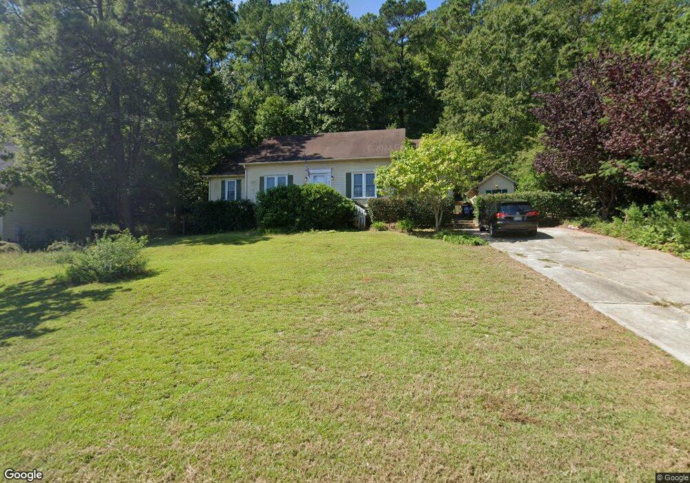
116 Thornhill Rd Columbia, SC 29212
Northwest Columbia NeighborhoodEstimated Value: $234,092 - $263,000
3
Beds
2
Baths
1,639
Sq Ft
$155/Sq Ft
Est. Value
About This Home
This home is located at 116 Thornhill Rd, Columbia, SC 29212 and is currently estimated at $254,773, approximately $155 per square foot. 116 Thornhill Rd is a home located in Lexington County with nearby schools including Irmo Middle, Irmo High, and Green Charter School Of The Midlands.
Ownership History
Date
Name
Owned For
Owner Type
Purchase Details
Closed on
Jan 22, 2016
Sold by
Conrex Residential Property Group 2013 1
Bought by
Conrex Residential Property Group 2013 4
Current Estimated Value
Home Financials for this Owner
Home Financials are based on the most recent Mortgage that was taken out on this home.
Original Mortgage
$25,770
Outstanding Balance
$20,516
Interest Rate
3.99%
Mortgage Type
Purchase Money Mortgage
Estimated Equity
$234,257
Purchase Details
Closed on
Nov 6, 2014
Sold by
Osborn David R and Osborn Peggy A
Bought by
Conrex Residential Property Group 2013-1
Create a Home Valuation Report for This Property
The Home Valuation Report is an in-depth analysis detailing your home's value as well as a comparison with similar homes in the area
Home Values in the Area
Average Home Value in this Area
Purchase History
| Date | Buyer | Sale Price | Title Company |
|---|---|---|---|
| Conrex Residential Property Group 2013 4 | -- | Attorney | |
| Conrex Residential Property Group 2013-1 | $120,000 | -- |
Source: Public Records
Mortgage History
| Date | Status | Borrower | Loan Amount |
|---|---|---|---|
| Open | Conrex Residential Property Group 2013 4 | $25,770 |
Source: Public Records
Tax History Compared to Growth
Tax History
| Year | Tax Paid | Tax Assessment Tax Assessment Total Assessment is a certain percentage of the fair market value that is determined by local assessors to be the total taxable value of land and additions on the property. | Land | Improvement |
|---|---|---|---|---|
| 2024 | $3,589 | $8,280 | $1,350 | $6,930 |
| 2023 | $3,589 | $8,139 | $1,800 | $6,339 |
| 2022 | $3,375 | $8,139 | $1,800 | $6,339 |
| 2020 | $3,426 | $8,139 | $1,800 | $6,339 |
| 2019 | $3,131 | $7,200 | $1,500 | $5,700 |
| 2018 | $2,982 | $7,200 | $1,500 | $5,700 |
| 2017 | $2,957 | $7,200 | $1,500 | $5,700 |
| 2016 | $2,940 | $7,200 | $1,500 | $5,700 |
| 2014 | $355 | $4,825 | $1,000 | $3,825 |
| 2013 | -- | $4,830 | $1,000 | $3,830 |
Source: Public Records
Map
Nearby Homes
- 110 Thornhill Rd
- 105 Thornhill Rd
- 265 Thornhill Rd
- 270 Danby Ct
- 219 Danby Ct
- 124 Fifeshire Dr
- 525 Smiths Market Rd
- 340 Wycombe Rd
- 215 Wilton Hill Rd
- 110 Bilton Rd
- 107 Fifeshire Dr
- 170 Cannon Dale Rd
- 124 Aldbury Rd
- 135 Ripley Station Rd
- 436 White Falls Dr
- 6 Lyme Bay
- 204 Cannon Dale Rd
- 105 Grice Ct
- 154 Lincoln Inn Rd
- 111 Rusty Barn Rd
- 114 Thornhill Rd
- 118 Thornhill Rd
- 122 Thornhill Rd
- 213 Stonsay Rd
- 112 Thornhill Rd
- 109 Thornhill Rd
- 126 Thornhill Rd
- 271 Thornhill Rd
- 273 Thornhill Rd
- 328 Berks Ct
- 209 Stonsay Rd
- 275 Thornhill Rd
- 107 Thornhill Rd
- 204 Stonsay Rd
- 324 Berks Ct
- 269 Thornhill Rd
- 200 Thornhill Rd
- 279 Thornhill Rd
- 320 Berks Ct
- 238 Danby Ct