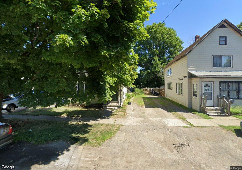
116 Townsend St Dunkirk, NY 14048
Estimated Value: $99,000 - $126,000
4
Beds
2
Baths
1,936
Sq Ft
$58/Sq Ft
Est. Value
About This Home
This home is located at 116 Townsend St, Dunkirk, NY 14048 and is currently estimated at $112,466, approximately $58 per square foot. 116 Townsend St is a home located in Chautauqua County with nearby schools including Dunkirk Intermediate School, Northern Chautauqua Catholic School, and Central Christian Academy.
Ownership History
Date
Name
Owned For
Owner Type
Purchase Details
Closed on
Oct 3, 2017
Sold by
Mancuso Debra A
Bought by
Hatala James
Current Estimated Value
Home Financials for this Owner
Home Financials are based on the most recent Mortgage that was taken out on this home.
Original Mortgage
$40,453
Outstanding Balance
$34,172
Interest Rate
4.25%
Mortgage Type
FHA
Estimated Equity
$78,294
Purchase Details
Closed on
Jun 22, 2011
Sold by
County Of Chautauqua
Bought by
Mancuso Debra
Purchase Details
Closed on
Jun 10, 2011
Sold by
Obrien Kevin
Bought by
County Of Chautauqua
Purchase Details
Closed on
Sep 13, 1996
Sold by
Estate Raczek Florence B
Bought by
O'Brien Kevin
Create a Home Valuation Report for This Property
The Home Valuation Report is an in-depth analysis detailing your home's value as well as a comparison with similar homes in the area
Home Values in the Area
Average Home Value in this Area
Purchase History
| Date | Buyer | Sale Price | Title Company |
|---|---|---|---|
| Hatala James | $41,200 | -- | |
| Mancuso Debra | $10,500 | -- | |
| County Of Chautauqua | $8,640 | -- | |
| O'Brien Kevin | $23,000 | -- |
Source: Public Records
Mortgage History
| Date | Status | Borrower | Loan Amount |
|---|---|---|---|
| Open | Hatala James | $40,453 |
Source: Public Records
Tax History
| Year | Tax Paid | Tax Assessment Tax Assessment Total Assessment is a certain percentage of the fair market value that is determined by local assessors to be the total taxable value of land and additions on the property. | Land | Improvement |
|---|---|---|---|---|
| 2024 | $1,550 | $38,500 | $2,000 | $36,500 |
| 2023 | $1,518 | $38,500 | $2,000 | $36,500 |
| 2022 | $1,336 | $38,500 | $2,000 | $36,500 |
| 2021 | $1,339 | $38,500 | $2,000 | $36,500 |
| 2020 | $1,328 | $38,500 | $2,000 | $36,500 |
| 2019 | $1,345 | $38,500 | $2,000 | $36,500 |
| 2018 | $1,345 | $38,500 | $2,000 | $36,500 |
| 2017 | $1,319 | $38,500 | $2,000 | $36,500 |
| 2016 | $1,283 | $38,500 | $2,000 | $36,500 |
| 2015 | -- | $38,500 | $2,000 | $36,500 |
| 2014 | -- | $38,500 | $2,000 | $36,500 |
Source: Public Records
Map
Nearby Homes
- 115 Nevins St
- 146 Hoyt St
- 236 Townsend St
- 250 Townsend St
- 129 E 2nd St
- 58 Ruggles St
- 140 S Martin St
- 245 Lake Shore Dr E
- 134 S Martin St
- 0 W Benton & Ruggles St Unit R1631836
- 172 S Margay St
- 101 King St
- 21 E Benton St
- 99 King St
- 120 S Ocelot St
- 26 N Ermine St
- 228 King St
- 103 E 7th St
- 447 Hoyt St
- 115 Lake Shore Dr E
- 118 Townsend St
- 112 Townsend St
- 120 Townsend St
- 421 S Roberts Rd
- 415 S Roberts Rd
- 413 S Roberts Rd
- 115 Townsend St
- 119 Townsend St
- 128 Townsend St
- 113 Townsend St
- 121 Townsend St
- 61 E Talcott St
- 407 S Roberts Rd
- 109 Townsend St
- 130 Townsend St
- 129 Townsend St
- 59 E Talcott St
- 437 S Roberts Rd
- 132 Townsend St
- 114 Nevins St
Your Personal Tour Guide
Ask me questions while you tour the home.