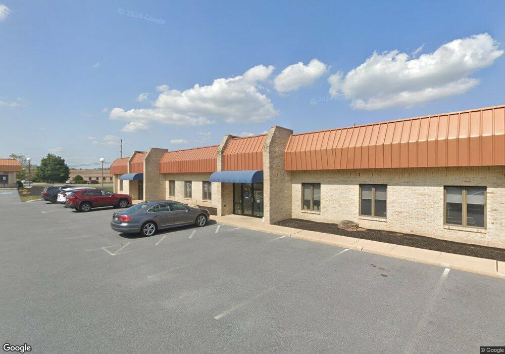
116 W Airport Rd Lititz, PA 17543
Kissel Hill NeighborhoodEstimated Value: $4,009,065
--
Bed
--
Bath
15,661
Sq Ft
$256/Sq Ft
Est. Value
About This Home
This home is located at 116 W Airport Rd, Lititz, PA 17543 and is currently estimated at $4,009,065, approximately $255 per square foot. 116 W Airport Rd is a home located in Lancaster County with nearby schools including Reidenbaugh Elementary School, Landis Run Intermediate School, and Manheim Township Middle School.
Ownership History
Date
Name
Owned For
Owner Type
Purchase Details
Closed on
Jun 1, 2015
Sold by
West Airport Road Partners Lp
Bought by
War Lp
Current Estimated Value
Purchase Details
Closed on
Apr 23, 2013
Sold by
War Properties Llc
Bought by
West Airport Road Partners Lp
Home Financials for this Owner
Home Financials are based on the most recent Mortgage that was taken out on this home.
Original Mortgage
$1,360,000
Interest Rate
3.64%
Mortgage Type
Future Advance Clause Open End Mortgage
Purchase Details
Closed on
Oct 20, 2006
Sold by
Estate Of Joanne K Myers and Myers J K
Bought by
Myers James W
Home Financials for this Owner
Home Financials are based on the most recent Mortgage that was taken out on this home.
Original Mortgage
$531,000
Interest Rate
6.49%
Mortgage Type
Commercial
Create a Home Valuation Report for This Property
The Home Valuation Report is an in-depth analysis detailing your home's value as well as a comparison with similar homes in the area
Home Values in the Area
Average Home Value in this Area
Purchase History
| Date | Buyer | Sale Price | Title Company |
|---|---|---|---|
| War Lp | $2,025,000 | None Available | |
| West Airport Road Partners Lp | $1,636,000 | None Available | |
| Myers James W | -- | None Available |
Source: Public Records
Mortgage History
| Date | Status | Borrower | Loan Amount |
|---|---|---|---|
| Previous Owner | West Airport Road Partners Lp | $1,360,000 | |
| Previous Owner | Myers James W | $531,000 |
Source: Public Records
Tax History Compared to Growth
Tax History
| Year | Tax Paid | Tax Assessment Tax Assessment Total Assessment is a certain percentage of the fair market value that is determined by local assessors to be the total taxable value of land and additions on the property. | Land | Improvement |
|---|---|---|---|---|
| 2025 | $31,634 | $1,462,000 | $235,800 | $1,226,200 |
| 2024 | $31,634 | $1,462,000 | $235,800 | $1,226,200 |
| 2023 | $30,809 | $1,462,000 | $235,800 | $1,226,200 |
| 2022 | $30,290 | $1,462,000 | $235,800 | $1,226,200 |
| 2021 | $29,614 | $1,462,000 | $235,800 | $1,226,200 |
| 2020 | $29,614 | $1,462,000 | $235,800 | $1,226,200 |
| 2019 | $29,326 | $1,462,000 | $235,800 | $1,226,200 |
| 2018 | $22,096 | $1,462,000 | $235,800 | $1,226,200 |
| 2017 | $27,889 | $1,096,000 | $122,500 | $973,500 |
| 2016 | $27,888 | $1,096,000 | $122,500 | $973,500 |
| 2015 | $7,009 | $1,096,000 | $122,500 | $973,500 |
| 2014 | $20,430 | $1,096,000 | $122,500 | $973,500 |
Source: Public Records
Map
Nearby Homes
- 327 Squire Ln
- 335 Royal Hunt Way
- 375 Royal Hunt Way
- 301 Fletcher Dr - Parkside Phase 5 Lot 36
- 294 Fletcher Dr - Parkside Phase 5 Lot 40
- 297 Fletcher Dr
- 113 Winter Hill Rd
- 428 Parkside Way
- 436 Parkside Way
- 449 Thatcher Ln
- 440 Parkside Way
- 105 Baneberry Ln Unit 55
- 101 Baneberry Ln
- 117 W Oregon Rd
- Winston Plan at Parkside
- Huntington Plan at Parkside
- Millbridge Plan at Parkside
- Danbury Plan at Parkside
- Breckenridge Plan at Parkside
- Magnolia Plan at Parkside
- 120 W Airport Rd
- 118 W Airport Rd
- 108 W Airport Rd
- 3 Falcon Ln
- 123 W Airport Rd
- 101 W Airport Rd
- 295 Squire Ln
- 291 Squire Ln
- 299 Squire Ln
- 131 W Airport Rd
- 100 W Airport Rd
- 303 Squire Ln
- 287 Squire Ln
- 307 Squire Ln
- 311 Squire Ln
- 283 Squire Ln
- 315 Squire Ln
- 329 Chandlers Way
- 288 Squire Ln
- 319 Squire Ln