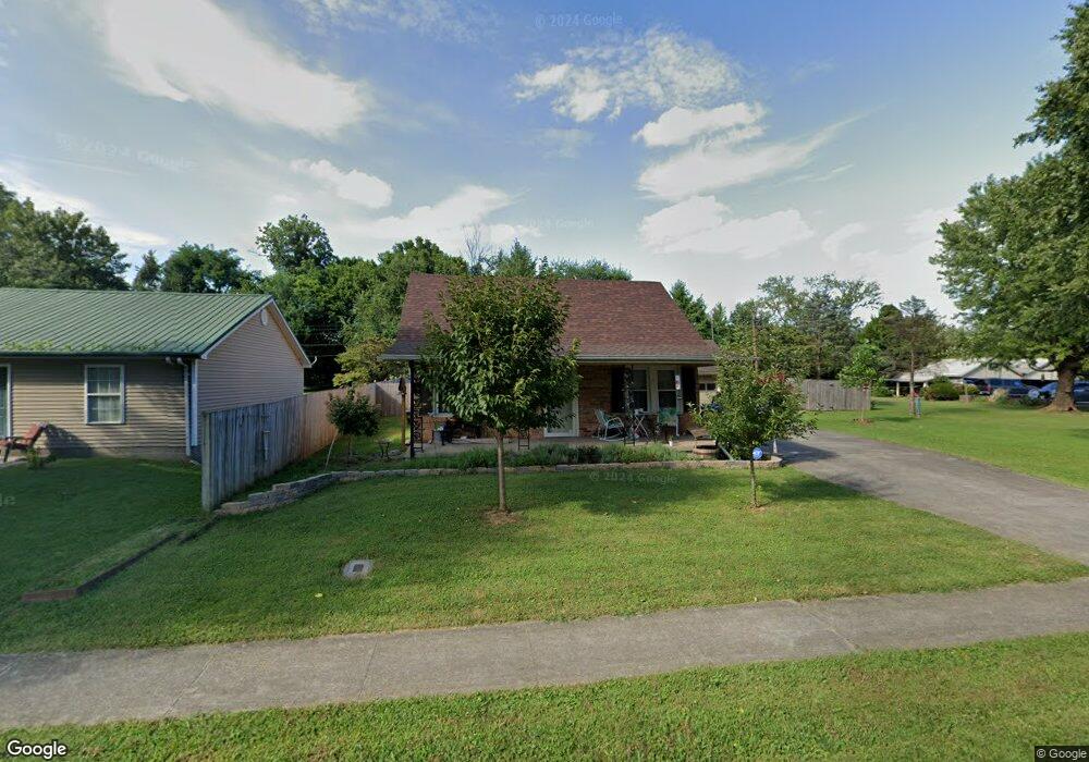
116 W Forrest Ave Bardstown, KY 40004
Estimated Value: $192,000 - $215,411
3
Beds
1
Bath
1,428
Sq Ft
$145/Sq Ft
Est. Value
About This Home
This home is located at 116 W Forrest Ave, Bardstown, KY 40004 and is currently estimated at $206,603, approximately $144 per square foot. 116 W Forrest Ave is a home located in Nelson County with nearby schools including Bardstown Elementary School, Bardstown Primary School, and Bardstown Middle School.
Ownership History
Date
Name
Owned For
Owner Type
Purchase Details
Closed on
Mar 26, 2021
Sold by
Simpson Joann and Harrell Sandra
Bought by
Greenwell Robert D and Turner Autumn C
Current Estimated Value
Home Financials for this Owner
Home Financials are based on the most recent Mortgage that was taken out on this home.
Original Mortgage
$161,616
Outstanding Balance
$145,278
Interest Rate
2.73%
Mortgage Type
New Conventional
Estimated Equity
$61,325
Purchase Details
Closed on
Apr 30, 2009
Sold by
Werner Brian I and Werner Jamie
Bought by
Harrell Mary Elizabeth
Create a Home Valuation Report for This Property
The Home Valuation Report is an in-depth analysis detailing your home's value as well as a comparison with similar homes in the area
Home Values in the Area
Average Home Value in this Area
Purchase History
| Date | Buyer | Sale Price | Title Company |
|---|---|---|---|
| Greenwell Robert D | $160,000 | None Available | |
| Harrell Mary Elizabeth | $76,000 | None Available |
Source: Public Records
Mortgage History
| Date | Status | Borrower | Loan Amount |
|---|---|---|---|
| Open | Greenwell Robert D | $161,616 |
Source: Public Records
Tax History Compared to Growth
Tax History
| Year | Tax Paid | Tax Assessment Tax Assessment Total Assessment is a certain percentage of the fair market value that is determined by local assessors to be the total taxable value of land and additions on the property. | Land | Improvement |
|---|---|---|---|---|
| 2024 | $542 | $160,000 | $0 | $0 |
| 2023 | $542 | $160,000 | $0 | $0 |
| 2022 | $556 | $160,000 | $160,000 | $0 |
| 2021 | $283 | $76,000 | $76,000 | $0 |
| 2020 | $282 | $76,000 | $76,000 | $0 |
| 2019 | $154 | $76,000 | $76,000 | $0 |
| 2018 | $161 | $76,000 | $76,000 | $0 |
| 2017 | $70 | $76,000 | $76,000 | $0 |
| 2016 | $434 | $76,000 | $76,000 | $0 |
| 2015 | $434 | $76,000 | $76,000 | $0 |
| 2014 | $434 | $76,000 | $76,000 | $0 |
| 2012 | $434 | $76,000 | $76,000 | $0 |
Source: Public Records
Map
Nearby Homes
- 728 Beechwood Ave
- 351 Campbell Alley
- 717 Moore Ave
- 110 E Daugherty Ave
- 607 Moore Ave
- 111 Hurstland Dr
- 123 Westwind Trail
- 522 N 4th St
- 926 Woods Run Rd
- 916 Woods Run Rd
- 914 Woods Run Rd
- 511 N 3rd St
- 1107 N 3rd St
- 104 Mckenna Way
- 124 Mcgowan Ave
- 114 Hillcrest Dr
- 134 Caldwell Ave
- Tract 3 Ag Division Kays Family Farm
- 158 Caldwell Ave
- 206 Riggs Blvd
- 110 W Forrest Ave
- 122 W Forrest Ave
- 122 W Forrest Ave
- 124 W Forrest Ave
- 108 W Forrest Ave
- 128 W Forrest Ave
- 113 W Forrest Ave
- 117 W Forrest Ave
- 111 W Forrest Ave
- 130 W Forrest Ave
- 119 W Forrest Ave
- 121 W Forrest Ave
- 132 W Forrest Ave
- 123 W Forrest Ave
- 125 W Forrest Ave
- 136 W Forrest Ave
- 115 W Halstead Ave
- 129 W Forrest Ave
- 131 W Forrest Ave
- 138 W Forrest Ave