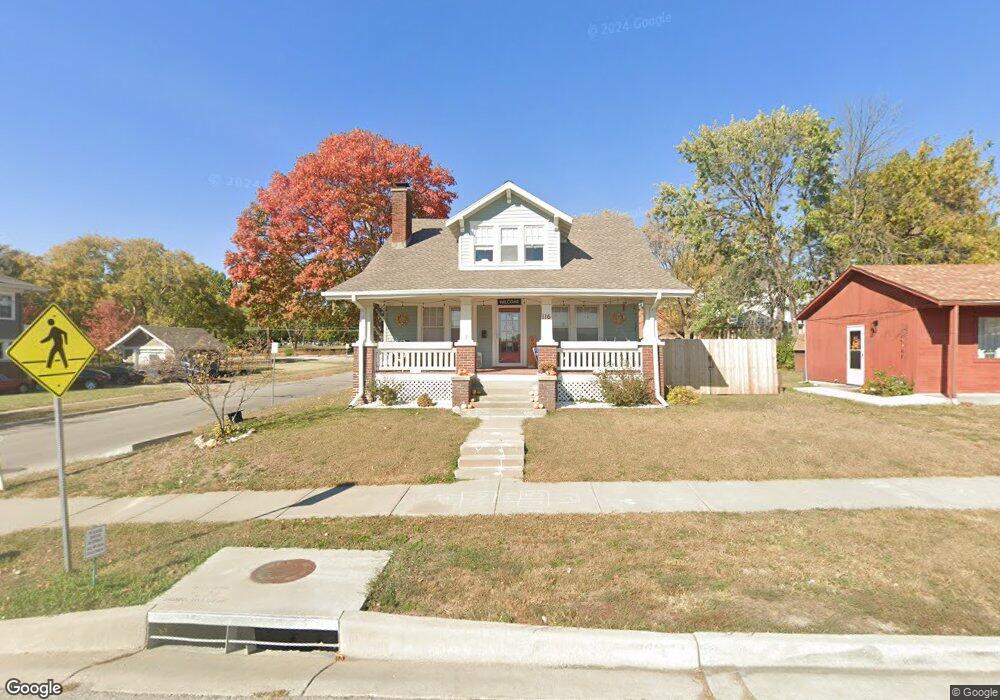
116 W Franklin St Liberty, MO 64068
Estimated Value: $141,007 - $424,000
Studio
--
Bath
--
Sq Ft
4,356
Sq Ft Lot Lot
About This Home
This home is located at 116 W Franklin St, Liberty, MO 64068 and is currently estimated at $329,252. 116 W Franklin St is a home located in Clay County with nearby schools including Franklin Elementary School, Heritage Middle School, and Liberty North High School.
Ownership History
Date
Name
Owned For
Owner Type
Purchase Details
Closed on
Dec 18, 2020
Sold by
Whitsitt Landon T and Whitsitt Jerilyn D
Bought by
Turner Jennifer
Current Estimated Value
Home Financials for this Owner
Home Financials are based on the most recent Mortgage that was taken out on this home.
Original Mortgage
$232,707
Outstanding Balance
$206,603
Interest Rate
2.8%
Mortgage Type
FHA
Estimated Equity
$122,649
Purchase Details
Closed on
Apr 30, 2007
Sold by
Derks Mary Sue
Bought by
Whitsitt Landon T and Whitsitt Jerilyn D
Home Financials for this Owner
Home Financials are based on the most recent Mortgage that was taken out on this home.
Original Mortgage
$123,675
Interest Rate
6.13%
Mortgage Type
Unknown
Create a Home Valuation Report for This Property
The Home Valuation Report is an in-depth analysis detailing your home's value as well as a comparison with similar homes in the area
Home Values in the Area
Average Home Value in this Area
Purchase History
We collect this data history from publicly available records. To have your information removed, we recommend requesting removal directly through your county’s website.
| Date | Buyer | Sale Price | Title Company |
|---|---|---|---|
| Turner Jennifer | -- | Stewart Title Co | |
| Whitsitt Landon T | -- | Integrity Land Title |
Source: Public Records
Mortgage History
We collect this data history from publicly available records. To have your information removed, we recommend requesting removal directly through your county’s website.
| Date | Status | Borrower | Loan Amount |
|---|---|---|---|
| Open | Turner Jennifer | $232,707 | |
| Previous Owner | Whitsitt Landon T | $123,675 | |
| Previous Owner | Whitsitt Landon T | $41,225 |
Source: Public Records
Tax History
| Year | Tax Paid | Tax Assessment Tax Assessment Total Assessment is a certain percentage of the fair market value that is determined by local assessors to be the total taxable value of land and additions on the property. | Land | Improvement |
|---|---|---|---|---|
| 2025 | $259 | $3,610 | -- | -- |
| 2024 | $278 | $3,610 | -- | -- |
| 2023 | $282 | $3,610 | $0 | $0 |
| 2022 | $200 | $2,530 | $0 | $0 |
| 2021 | $199 | $2,530 | $0 | $0 |
| 2020 | $212 | $2,530 | $0 | $0 |
| 2019 | $212 | $2,530 | $0 | $0 |
| 2018 | $216 | $2,530 | $0 | $0 |
| 2017 | $214 | $2,530 | $2,530 | $0 |
| 2016 | $214 | $2,530 | $2,530 | $0 |
| 2015 | $214 | $2,530 | $2,530 | $0 |
| 2014 | $215 | $2,530 | $2,530 | $0 |
Source: Public Records
Map
Nearby Homes
- 306 E Franklin St
- 439 Grover St
- 444 N Prairie St
- 416 E Franklin St
- 138 S Terrace Ave
- 220 Corbin St
- 508 N Morse Ave
- 406 E Arthur St
- 316 E Doniphan St
- 606 N Morse Ave
- 439 Ford St
- 730 W College St
- 619 N Gallatin St
- 400 W Murray St
- 203 N Ridge Ave
- 110 N Ridge Ave
- 400 S Missouri St
- 545 Jefferson Cir
- 225 Groom St
- 417 N Ridge Ave
- 116 W Franklin St
- 202 W Franklin St
- 108 N Gallatin St
- 116 N Gallatin St
- 205 W Franklin St
- 210 W Franklin St
- 14 N Prairie St
- 211 W Franklin St
- 124 N Gallatin St
- 104 W Kansas St
- 204 W Kansas St
- 221 W Franklin St
- 100 W Kansas St
- 222 W Franklin St
- 227 W Franklin St
- 218 W Kansas St
- 16 N Main St
- 201 W Mississippi St
- 106 N Main St
- 22 N Main St
Your Personal Tour Guide
Ask me questions while you tour the home.