Estimated Value: $172,000 - $239,000
5
Beds
3
Baths
2,000
Sq Ft
$107/Sq Ft
Est. Value
About This Home
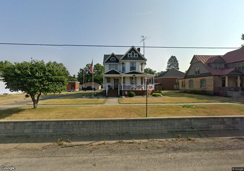
This home is located at 116 W State St, Colon, MI 49040 and is currently estimated at $214,993, approximately $107 per square foot. 116 W State St is a home located in St. Joseph County.
Ownership History
Date
Name
Owned For
Owner Type
Purchase Details
Closed on
Apr 7, 2006
Sold by
Baker Randall L and Baker Julie
Bought by
Baker Ernest J and Baker Sara L
Current Estimated Value
Home Financials for this Owner
Home Financials are based on the most recent Mortgage that was taken out on this home.
Original Mortgage
$154,850
Outstanding Balance
$89,602
Interest Rate
6.48%
Mortgage Type
Fannie Mae Freddie Mac
Estimated Equity
$125,391
Purchase Details
Closed on
Jun 27, 1997
Purchase Details
Closed on
Jan 1, 1901
Create a Home Valuation Report for This Property
The Home Valuation Report is an in-depth analysis detailing your home's value as well as a comparison with similar homes in the area
Purchase History
| Date | Buyer | Sale Price | Title Company |
|---|---|---|---|
| Baker Ernest J | $163,000 | None Available | |
| -- | -- | -- | |
| -- | -- | -- |
Source: Public Records
Mortgage History
| Date | Status | Borrower | Loan Amount |
|---|---|---|---|
| Open | Baker Ernest J | $154,850 |
Source: Public Records
Tax History
| Year | Tax Paid | Tax Assessment Tax Assessment Total Assessment is a certain percentage of the fair market value that is determined by local assessors to be the total taxable value of land and additions on the property. | Land | Improvement |
|---|---|---|---|---|
| 2025 | $1,108 | $90,100 | $8,400 | $81,700 |
| 2024 | $1,084 | $82,200 | $6,200 | $76,000 |
| 2023 | $1,181 | $75,700 | $6,200 | $69,500 |
| 2022 | $0 | $58,500 | $6,200 | $52,300 |
| 2021 | $964 | $54,800 | $6,200 | $48,600 |
| 2020 | $518 | $58,200 | $4,700 | $53,500 |
| 2019 | $397 | $48,200 | $4,700 | $43,500 |
| 2018 | $1,418 | $42,200 | $4,700 | $37,500 |
| 2017 | $1,384 | $43,200 | $43,200 | $0 |
| 2016 | -- | $42,100 | $42,100 | $0 |
| 2015 | -- | $40,700 | $0 | $0 |
| 2014 | -- | $41,600 | $41,600 | $0 |
| 2012 | -- | $33,500 | $33,500 | $0 |
Source: Public Records
Map
Nearby Homes
- 309 N Blackstone Ave
- 210 E South St
- 120 Palmer Ave
- 407 Barry St
- 161 Palmer Ave
- 622 Maple St
- VL Bowman St
- 917 Elm St
- 0 N Burr Oak Rd
- 448 Long Lake Rd
- 0 S Farrand Unit 25051538
- 31688 W Colon Rd
- 58954 Lakeshore Dr
- 30725 Orla Engle Rd
- 59178 Nora Dr
- 0 Coohon Rd
- 31908 Decker Rd
- 55637 Bennett Rd
- 1121 Heights Dr
- VL Heights Dr
- 128 S Saint Joseph St
- 111 Saint Joseph St
- 111 St Joseph St St
- 134 S Saint Joseph St
- 134 S Saint Joseph St
- 128 W Canal
- 131 S Saint Joseph St
- 131 S St Joseph St
- 131 S Street Joseph St
- 336 St Joseph St
- 108 W State St
- 108 W State St
- 128 W State St
- 116 E State St
- 106 E State St
- 105 E State St
- 215 W State St
- 86 Michigan 86
- 123 W Canal
- M Michigan 86
Your Personal Tour Guide
Ask me questions while you tour the home.