Estimated Value: $2,220,000 - $2,448,000
2
Beds
1
Bath
7,448
Sq Ft
$312/Sq Ft
Est. Value
About This Home
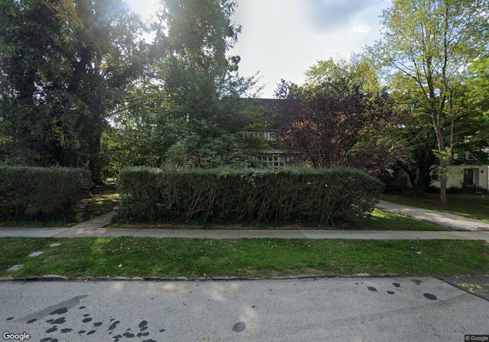
This home is located at 116 Walnut Ave, Wayne, PA 19087 and is currently estimated at $2,325,839, approximately $312 per square foot. 116 Walnut Ave is a home located in Delaware County with nearby schools including Wayne Elementary School, Radnor Middle School, and Radnor Senior High School.
Ownership History
Date
Name
Owned For
Owner Type
Purchase Details
Closed on
Jul 17, 2018
Sold by
Mcclain Pension Fund Llc
Bought by
114 Walnut Ave Partners Llc
Current Estimated Value
Home Financials for this Owner
Home Financials are based on the most recent Mortgage that was taken out on this home.
Original Mortgage
$1,425,000
Outstanding Balance
$1,232,386
Interest Rate
4.5%
Mortgage Type
Future Advance Clause Open End Mortgage
Estimated Equity
$1,093,453
Purchase Details
Closed on
May 16, 2018
Sold by
Mcclain Gary E
Bought by
Mcclain Pension Fund Llc
Purchase Details
Closed on
May 15, 2018
Sold by
Mcclain Gary E and Mcclain Christine F
Bought by
Mcclain Gary E
Purchase Details
Closed on
Mar 5, 1990
Sold by
Elmore Robert and Elmore Rachel
Bought by
Mcclain Gary E and Mcclain Christine F
Create a Home Valuation Report for This Property
The Home Valuation Report is an in-depth analysis detailing your home's value as well as a comparison with similar homes in the area
Home Values in the Area
Average Home Value in this Area
Purchase History
| Date | Buyer | Sale Price | Title Company |
|---|---|---|---|
| 114 Walnut Ave Partners Llc | $1,500,000 | None Available | |
| Mcclain Pension Fund Llc | -- | Accommodation | |
| Mcclain Gary E | -- | None Available | |
| Mcclain Gary E | $340,000 | -- |
Source: Public Records
Mortgage History
| Date | Status | Borrower | Loan Amount |
|---|---|---|---|
| Open | 114 Walnut Ave Partners Llc | $1,425,000 |
Source: Public Records
Tax History
| Year | Tax Paid | Tax Assessment Tax Assessment Total Assessment is a certain percentage of the fair market value that is determined by local assessors to be the total taxable value of land and additions on the property. | Land | Improvement |
|---|---|---|---|---|
| 2025 | $32,554 | $1,509,310 | $298,230 | $1,211,080 |
| 2024 | $30,516 | $1,509,310 | $298,230 | $1,211,080 |
| 2023 | $29,306 | $1,509,310 | $298,230 | $1,211,080 |
| 2022 | $28,986 | $1,509,310 | $298,230 | $1,211,080 |
| 2021 | $46,560 | $1,509,310 | $298,230 | $1,211,080 |
| 2020 | $18,752 | $539,050 | $161,390 | $377,660 |
| 2019 | $18,223 | $539,050 | $161,390 | $377,660 |
| 2018 | $17,866 | $539,050 | $0 | $0 |
| 2017 | $17,492 | $539,050 | $0 | $0 |
| 2016 | $2,958 | $539,050 | $0 | $0 |
| 2015 | $3,019 | $539,050 | $0 | $0 |
| 2014 | $3,019 | $539,050 | $0 | $0 |
Source: Public Records
Map
Nearby Homes
- 245 Willow Ave
- 50 Fariston Rd
- 415 Eagle Rd Unit 8
- 1052 Eagle Rd
- 317 E Beechtree Ln
- 444 Saint Davids Ave
- 3 Briar Rd
- 466 Saint Davids Ave
- 211 Deepdale Rd
- 421 Midland Ave
- 427 E Lancaster Ave Unit 1202
- 412 Fairview Dr
- 203 Church St
- 998 Upper Gulph Rd
- 966 Upper Gulph Rd
- 1 Private Way
- 658 Brooke Rd
- 93 Hillside Rd
- 1129 Brians Way
- 458 Huston Rd
- 116 Walnut Ave Unit 7
- 108 Walnut Ave
- 118 Walnut Ave
- 106 Walnut Ave
- 115 Poplar Ave
- 122 Walnut Ave
- 111 Poplar Ave
- 102 Walnut Ave
- 119 Poplar Ave
- 121 Poplar Ave
- 109 Poplar Ave
- 123 Poplar Ave
- 111 Walnut Ave
- 124 Walnut Ave
- 113 Walnut Ave
- 100 Walnut Ave
- 115 Walnut Ave
- 205 N Wayne Ave
- 125 Poplar Ave
- 119 Walnut Ave
Your Personal Tour Guide
Ask me questions while you tour the home.