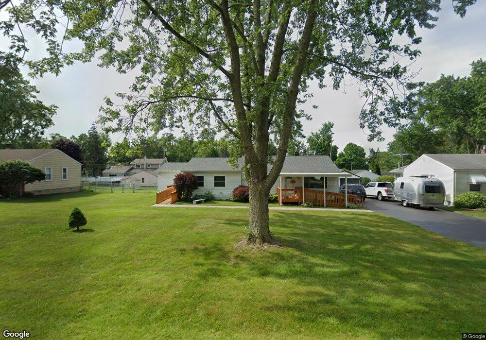
1160 Quinif Dr Walled Lake, MI 48390
Estimated Value: $333,000 - $469,000
3
Beds
3
Baths
1,871
Sq Ft
$199/Sq Ft
Est. Value
About This Home
This home is located at 1160 Quinif Dr, Walled Lake, MI 48390 and is currently estimated at $373,194, approximately $199 per square foot. 1160 Quinif Dr is a home located in Oakland County with nearby schools including Mary Helen Guest Elementary School, James R Geisler Middle School, and Walled Lake Central High School.
Ownership History
Date
Name
Owned For
Owner Type
Purchase Details
Closed on
Jun 20, 2016
Sold by
Steele Michael N
Bought by
Steele Joan D
Current Estimated Value
Home Financials for this Owner
Home Financials are based on the most recent Mortgage that was taken out on this home.
Original Mortgage
$115,000
Interest Rate
3.58%
Mortgage Type
New Conventional
Create a Home Valuation Report for This Property
The Home Valuation Report is an in-depth analysis detailing your home's value as well as a comparison with similar homes in the area
Home Values in the Area
Average Home Value in this Area
Purchase History
| Date | Buyer | Sale Price | Title Company |
|---|---|---|---|
| Steele Joan D | -- | Progressive Title Agency |
Source: Public Records
Mortgage History
| Date | Status | Borrower | Loan Amount |
|---|---|---|---|
| Closed | Steele Joan D | $115,000 |
Source: Public Records
Tax History Compared to Growth
Tax History
| Year | Tax Paid | Tax Assessment Tax Assessment Total Assessment is a certain percentage of the fair market value that is determined by local assessors to be the total taxable value of land and additions on the property. | Land | Improvement |
|---|---|---|---|---|
| 2024 | $3,057 | $165,810 | $0 | $0 |
| 2023 | $2,890 | $157,450 | $0 | $0 |
| 2022 | $2,839 | $148,290 | $0 | $0 |
| 2021 | $2,779 | $144,060 | $0 | $0 |
| 2020 | $2,683 | $140,290 | $0 | $0 |
| 2019 | $2,735 | $125,550 | $0 | $0 |
| 2018 | $2,717 | $106,220 | $0 | $0 |
| 2017 | $2,685 | $104,380 | $0 | $0 |
| 2016 | $1,986 | $96,820 | $0 | $0 |
| 2015 | -- | $76,880 | $0 | $0 |
| 2014 | -- | $53,430 | $0 | $0 |
| 2011 | -- | $50,820 | $0 | $0 |
Source: Public Records
Map
Nearby Homes
- 1128 Annjo St
- 1439 Shankin Dr
- 1687 Bolton St
- 1569 Dover Hill N
- 2038 Hidden Meadows Dr Unit 75
- 1747 Shankin Dr
- 2130 Park Place Dr
- 2144 Park Place Dr
- 2160 Newport Ct
- 1442 Sunset Dr
- 2159 Helmsford Dr
- 2145 Helmsford Dr
- 60750 N Pontiac Trail
- 2230 Briar Ridge
- 1904 Meadow Ridge Dr
- 275 Angola St
- 688 Wolverine Dr
- 770 Brushwood Dr
- 3101 Cameron Cir
- 2450 S Commerce Rd
- 1174 Quinif Dr
- 1180 Quinif Dr
- 1152 Quinif Dr
- 1165 N Eddie St Unit Bldg-Unit
- 1165 N Eddie St
- 1171 N Eddie St
- 1149 N Eddie St
- 1144 Quinif Dr
- 1159 Quinif Dr
- 1141 N Eddie St
- 1173 Quinif Dr
- 1185 N Eddie St
- 1136 Quinif Dr
- 1192 Quinif Dr
- 1179 Quinif Dr
- 1151 Quinif Dr
- 1135 Quinif Dr
- 1128 Quinif Dr
- 1189 N Eddie St
- 1160 N Eddie St