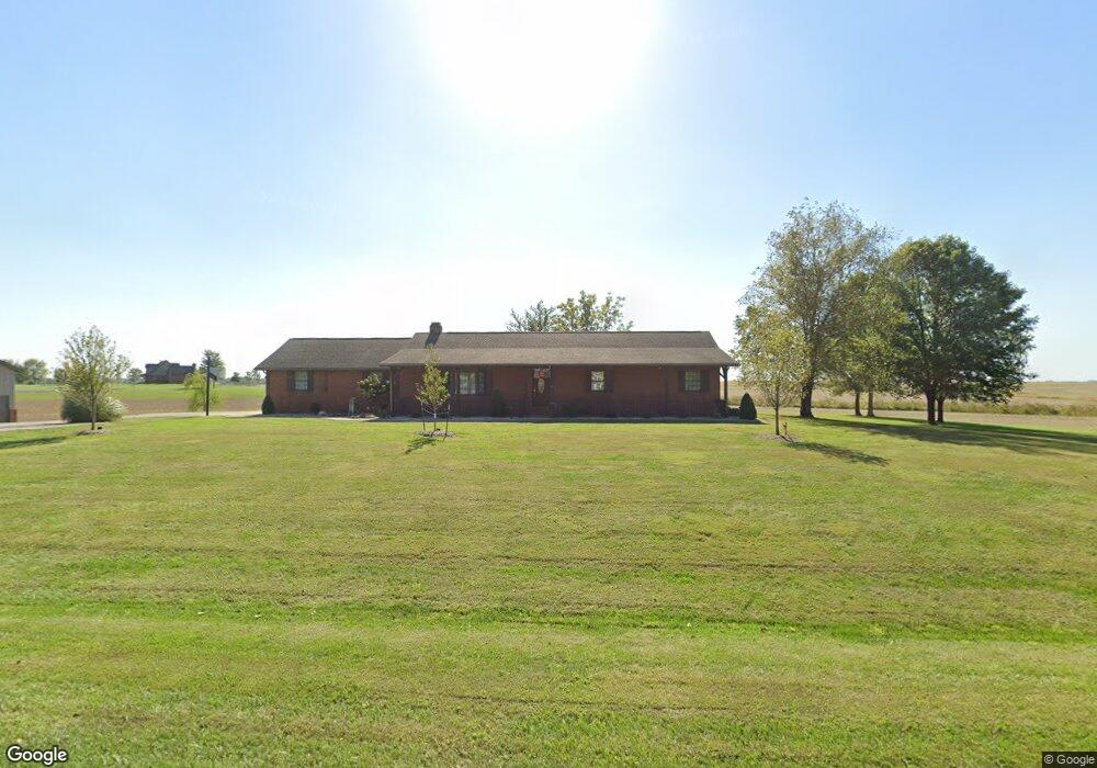
1160 State Route 177 New Baden, IL 62265
Estimated Value: $286,000 - $433,000
--
Bed
--
Bath
1,740
Sq Ft
$194/Sq Ft
Est. Value
About This Home
This home is located at 1160 State Route 177, New Baden, IL 62265 and is currently estimated at $336,724, approximately $193 per square foot. 1160 State Route 177 is a home located in Clinton County with nearby schools including Wesclin Middle School and Wesclin Sr High School.
Ownership History
Date
Name
Owned For
Owner Type
Purchase Details
Closed on
Mar 7, 2014
Sold by
Kehrer Staley Peggy
Bought by
Kehrer Dustin
Current Estimated Value
Home Financials for this Owner
Home Financials are based on the most recent Mortgage that was taken out on this home.
Original Mortgage
$225,000
Interest Rate
4.45%
Mortgage Type
Purchase Money Mortgage
Purchase Details
Closed on
Jul 8, 2013
Sold by
Kehrer Roger E
Bought by
Staley Peggy Kehrer and Kehrer Peggy A
Create a Home Valuation Report for This Property
The Home Valuation Report is an in-depth analysis detailing your home's value as well as a comparison with similar homes in the area
Home Values in the Area
Average Home Value in this Area
Purchase History
| Date | Buyer | Sale Price | Title Company |
|---|---|---|---|
| Kehrer Dustin | $250,000 | None Available | |
| Staley Peggy Kehrer | -- | None Available |
Source: Public Records
Mortgage History
| Date | Status | Borrower | Loan Amount |
|---|---|---|---|
| Closed | Kehrer Dustin | $225,000 |
Source: Public Records
Tax History Compared to Growth
Tax History
| Year | Tax Paid | Tax Assessment Tax Assessment Total Assessment is a certain percentage of the fair market value that is determined by local assessors to be the total taxable value of land and additions on the property. | Land | Improvement |
|---|---|---|---|---|
| 2024 | $4,306 | $77,120 | $11,340 | $65,780 |
| 2023 | $4,306 | $73,450 | $10,800 | $62,650 |
| 2022 | $4,187 | $69,290 | $10,190 | $59,100 |
| 2021 | $3,886 | $67,270 | $9,890 | $57,380 |
| 2020 | $3,752 | $63,460 | $9,330 | $54,130 |
| 2019 | $3,732 | $63,460 | $9,330 | $54,130 |
| 2018 | $3,784 | $60,801 | $8,930 | $51,871 |
| 2017 | $3,768 | $59,030 | $8,670 | $50,360 |
| 2016 | $3,748 | $59,030 | $8,670 | $50,360 |
| 2015 | $3,349 | $59,030 | $8,670 | $50,360 |
| 2013 | $3,349 | $62,590 | $8,670 | $53,920 |
Source: Public Records
Map
Nearby Homes
- 4810 Airport Rd
- 228 Walnut
- 244 Walnut
- 308 W Indiana St
- 111 E Poos Dr
- 91 Weatherholt Dr
- 204 W Poos Dr
- 10971 Platinum Ln
- 5929 Highbanks Rd
- 51 S Brockschmidt Rd
- 414 Turquoise Ct
- 847 Topaz Ct
- 841 Topaz Ct
- 108 E Main St
- 633 Moorland Cir
- 3 W Patterson St
- 25 W Oak St
- 57 W Patterson St
- 118 W Green St
- 38 Cheryl Dr