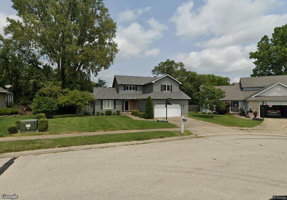
1160 W Pineview Ct Decatur, IL 62526
Sims-Woodridge NeighborhoodEstimated Value: $253,000 - $301,000
3
Beds
3
Baths
3,236
Sq Ft
$86/Sq Ft
Est. Value
About This Home
This home is located at 1160 W Pineview Ct, Decatur, IL 62526 and is currently estimated at $277,606, approximately $85 per square foot. 1160 W Pineview Ct is a home located in Macon County with nearby schools including Warrensburg-Latham Elementary School, Warrensburg-Latham Middle School, and Warrensburg-Latham High School.
Ownership History
Date
Name
Owned For
Owner Type
Purchase Details
Closed on
Oct 14, 2014
Sold by
Kirby Aaron M and Kirby Marhsa
Bought by
Neisslie Jeffrey and Neisslie Sara
Current Estimated Value
Home Financials for this Owner
Home Financials are based on the most recent Mortgage that was taken out on this home.
Original Mortgage
$171,830
Outstanding Balance
$130,608
Interest Rate
3.87%
Mortgage Type
FHA
Estimated Equity
$146,998
Purchase Details
Closed on
Feb 29, 2008
Sold by
Schwake Rita A
Bought by
Kirby Aaron M
Purchase Details
Closed on
Oct 1, 1994
Create a Home Valuation Report for This Property
The Home Valuation Report is an in-depth analysis detailing your home's value as well as a comparison with similar homes in the area
Home Values in the Area
Average Home Value in this Area
Purchase History
| Date | Buyer | Sale Price | Title Company |
|---|---|---|---|
| Neisslie Jeffrey | $175,000 | None Available | |
| Kirby Aaron M | $155,000 | None Available | |
| -- | $120,800 | -- |
Source: Public Records
Mortgage History
| Date | Status | Borrower | Loan Amount |
|---|---|---|---|
| Open | Neisslie Jeffrey | $171,830 |
Source: Public Records
Tax History Compared to Growth
Tax History
| Year | Tax Paid | Tax Assessment Tax Assessment Total Assessment is a certain percentage of the fair market value that is determined by local assessors to be the total taxable value of land and additions on the property. | Land | Improvement |
|---|---|---|---|---|
| 2024 | $7,087 | $79,742 | $10,925 | $68,817 |
| 2023 | $6,576 | $73,306 | $10,043 | $63,263 |
| 2022 | $6,208 | $67,988 | $9,314 | $58,674 |
| 2021 | $5,950 | $63,573 | $8,709 | $54,864 |
| 2020 | $5,248 | $57,045 | $7,815 | $49,230 |
| 2019 | $5,248 | $57,045 | $7,815 | $49,230 |
| 2018 | $5,219 | $57,453 | $7,871 | $49,582 |
| 2017 | $5,223 | $57,196 | $7,836 | $49,360 |
| 2016 | $5,292 | $57,334 | $7,855 | $49,479 |
| 2015 | $5,156 | $56,654 | $7,762 | $48,892 |
| 2014 | $4,714 | $56,654 | $7,762 | $48,892 |
| 2013 | $4,838 | $56,654 | $7,762 | $48,892 |
Source: Public Records
Map
Nearby Homes
- 3707 N Woodridge Dr
- 1225 W Pineview Ct
- 1110 Woodridge Ct
- 3981 N Northbrook Dr
- 821 W Karen Dr
- 933 W Frank Dr
- 1474 Meadowview Dr
- 880 W Frank Dr
- 810 Sarah Dr
- 612 W Karen Dr
- 1110 W Ash Ave
- 3333 N University Ave
- 22 Grays Ln
- 3321 N Oakland Ave
- 4074 Sheffield Ct
- 3235 N Susan Dr
- 416 Southampton Dr
- 1823 Cooper Dr
- 3103 N Oakland Ave
- 365 W Ash Ave
- 1110 W Pineview Ct
- 1227 W Mound Rd
- 1161 W Pineview Ct
- 1131 W Pineview Ct
- 1202 W Pineview Ct
- 1205 W Pineview Ct
- 3720 N Woodridge Dr
- 1136 W Mound Rd
- 1140 W Sugar Pine Ct
- 1120 W Sugar Pine Ct
- 1150 W Sugar Pine Ct
- 1212 W Pineview Ct
- 1170 W Sugar Pine Ct
- 1110 W Sugar Pine Ct
- 1222 W Pineview Ct
- 1220 W Mound Rd
- 1215 W Pineview Ct
- 1181 W Sugar Pine Ct
- 3685 N Woodridge Dr
- 1171 W Sugar Pine Ct