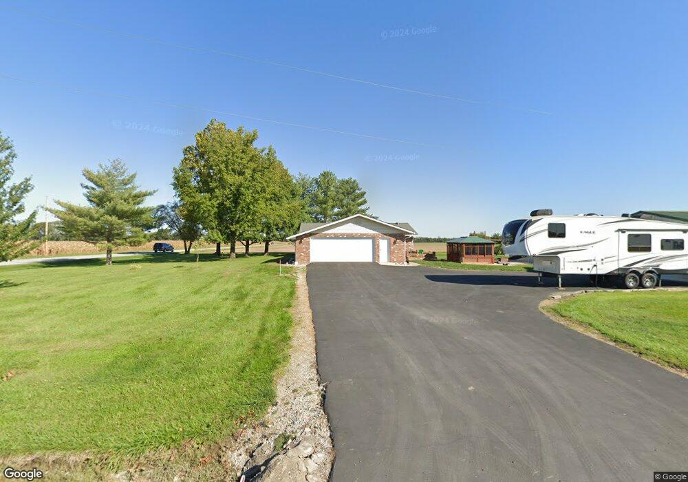
11601 Coal Mine Rd Lenzburg, IL 62255
Estimated Value: $196,772 - $260,000
--
Bed
--
Bath
1,890
Sq Ft
$119/Sq Ft
Est. Value
About This Home
This home is located at 11601 Coal Mine Rd, Lenzburg, IL 62255 and is currently estimated at $225,443, approximately $119 per square foot. 11601 Coal Mine Rd is a home located in St. Clair County with nearby schools including Marissa Elementary School and Marissa Jr & Sr High School.
Ownership History
Date
Name
Owned For
Owner Type
Purchase Details
Closed on
May 23, 2003
Sold by
Bollmeier Linda Sue Marie
Bought by
Luebbers Thomas and Luebbers Sharon
Current Estimated Value
Home Financials for this Owner
Home Financials are based on the most recent Mortgage that was taken out on this home.
Original Mortgage
$88,200
Interest Rate
5.9%
Mortgage Type
Purchase Money Mortgage
Create a Home Valuation Report for This Property
The Home Valuation Report is an in-depth analysis detailing your home's value as well as a comparison with similar homes in the area
Home Values in the Area
Average Home Value in this Area
Purchase History
| Date | Buyer | Sale Price | Title Company |
|---|---|---|---|
| Luebbers Thomas | $142,500 | Chicago Title |
Source: Public Records
Mortgage History
| Date | Status | Borrower | Loan Amount |
|---|---|---|---|
| Closed | Luebbers Thomas | $88,200 | |
| Closed | Luebbers Thomas | $10,400 |
Source: Public Records
Tax History Compared to Growth
Tax History
| Year | Tax Paid | Tax Assessment Tax Assessment Total Assessment is a certain percentage of the fair market value that is determined by local assessors to be the total taxable value of land and additions on the property. | Land | Improvement |
|---|---|---|---|---|
| 2024 | $4,042 | $64,883 | $3,005 | $61,878 |
| 2023 | $3,346 | $54,446 | $2,710 | $51,736 |
| 2022 | $3,616 | $53,893 | $2,428 | $51,465 |
| 2021 | $3,607 | $51,348 | $2,259 | $49,089 |
| 2020 | $3,599 | $52,786 | $2,248 | $50,538 |
| 2019 | $3,492 | $50,071 | $2,072 | $47,999 |
| 2018 | $4,363 | $51,413 | $2,070 | $49,343 |
| 2017 | $2,186 | $50,470 | $1,985 | $48,485 |
| 2016 | $4,327 | $51,108 | $1,965 | $49,143 |
| 2014 | $2,027 | $51,121 | $1,903 | $49,218 |
| 2013 | $3,594 | $53,044 | $1,965 | $51,079 |
Source: Public Records
Map
Nearby Homes
- 000 Darmstadt Rd
- 2770 Washington County Line Rd
- 2430 Beckmann Rd
- 735 Buss St
- 882 Edward St
- 964 Kleefeld Ln
- 632 Wiese Ln
- 624 Hailie St
- 620 Kate Ct
- 616 Kate Ct
- 612 Kate Ct
- 644 Hailie St
- 608 Kate Ct
- 1007 Jean Marie St
- 1008 Jean Marie St
- 1019 Saint Peter Ave
- 639 Hailie St
- 627 Hailie St
- 631 Hailie St
- 604 Kate Ct
- 11609 Coal Mine Rd
- 11542 New Athens Darmstadt Rd
- 11530 New Athens Darmstadt Rd
- 11520 Church St
- 11516 New Athens Darmstadt Rd
- 11516 New Athens Darmstadt Rd
- 11522 Mill St
- 11703 Coal Mine Rd
- 11512 New Athens Darmstadt Rd
- 11515 Mill St
- 11515 Mill St
- 11511 Mill St
- 11511 Mill St
- 11507 Church St
- 11508 Mill St
- 11503 New Athens Darmstadt Rd
- 11500 Church St
- 2730 Polk St
- 2720 Polk St
- 2720 Polk St